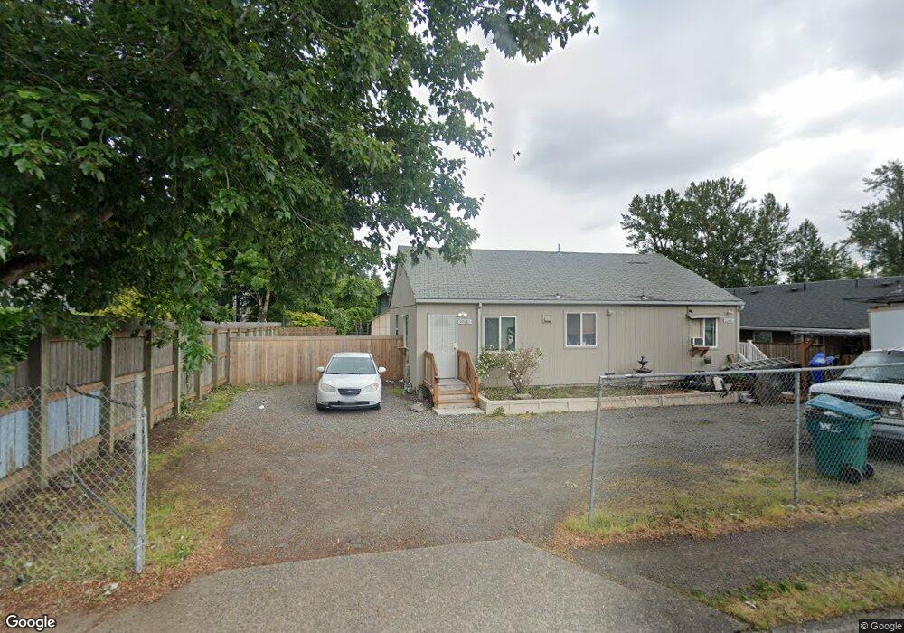
20481 SE Stark St Unit 20491 Gresham, OR 97030
North Central NeighborhoodEstimated Value: $316,000 - $428,000
2
Beds
2
Baths
1,200
Sq Ft
$295/Sq Ft
Est. Value
About This Home
This home is located at 20481 SE Stark St Unit 20491, Gresham, OR 97030 and is currently estimated at $353,434, approximately $294 per square foot. 20481 SE Stark St Unit 20491 is a home located in Multnomah County with nearby schools including North Gresham Elementary School, Clear Creek Middle School, and Gresham High School.
Ownership History
Date
Name
Owned For
Owner Type
Purchase Details
Closed on
Dec 6, 1995
Sold by
Johansen Michael K and Grieve Brenda Lee
Bought by
Herman James E
Current Estimated Value
Home Financials for this Owner
Home Financials are based on the most recent Mortgage that was taken out on this home.
Original Mortgage
$89,900
Outstanding Balance
$1,243
Interest Rate
7.48%
Mortgage Type
FHA
Estimated Equity
$352,191
Create a Home Valuation Report for This Property
The Home Valuation Report is an in-depth analysis detailing your home's value as well as a comparison with similar homes in the area
Home Values in the Area
Average Home Value in this Area
Purchase History
| Date | Buyer | Sale Price | Title Company |
|---|---|---|---|
| Herman James E | $64,500 | Ticor Title Insurance |
Source: Public Records
Mortgage History
| Date | Status | Borrower | Loan Amount |
|---|---|---|---|
| Open | Herman James E | $89,900 |
Source: Public Records
Tax History
| Year | Tax Paid | Tax Assessment Tax Assessment Total Assessment is a certain percentage of the fair market value that is determined by local assessors to be the total taxable value of land and additions on the property. | Land | Improvement |
|---|---|---|---|---|
| 2025 | $2,359 | $115,920 | -- | -- |
| 2024 | $2,258 | $112,550 | -- | -- |
| 2023 | $2,058 | $109,280 | $0 | $0 |
| 2022 | $2,000 | $106,100 | $0 | $0 |
| 2021 | $1,950 | $103,010 | $0 | $0 |
| 2020 | $1,834 | $100,010 | $0 | $0 |
| 2019 | $1,786 | $97,100 | $0 | $0 |
| 2018 | $1,703 | $94,280 | $0 | $0 |
| 2017 | $1,634 | $91,540 | $0 | $0 |
| 2016 | $1,441 | $88,880 | $0 | $0 |
| 2015 | $1,410 | $86,300 | $0 | $0 |
| 2014 | $1,376 | $83,790 | $0 | $0 |
Source: Public Records
Map
Nearby Homes
- 21016 SE Stark St Unit 69
- 1026 SE 209th Ave
- 21001 SE Yamhill St
- 1208 SE 209th Ave
- 19776 SE Stark St Unit 147
- 21400 SE Stark St Unit 2
- 131 NE 201st Ave
- 209 SE 214th Ave
- 0 SE Burnside St
- 2013 NW Bella Vista Dr
- 805 SE 197th Ave
- 132 SE 214th Ave
- 920 SE 214th Ave
- 21525 SE Oak St
- 1711 NW 19th St
- 19765 NE Everett Ln
- 0 NE 202nd Ave
- 1758 NW 18th Ct
- 249 NE 191st Ave
- 1387 NW Riverview Ave Unit 14B
- 421 SE 205th Place Unit 425
- 411 SE 205th Place Unit 419
- 506 SE 204th Place
- 505 SE 205th Ave Unit 507
- 514 SE 204th Place
- 514 SE 204th Place Unit 23
- 401 SE 205th Place Unit 405
- 426 SE 205th Place Unit 428
- 410 SE 205th Place Unit 412
- 412 SE 205th Place
- 532 SE 204th Place
- 502 SE 205th Ave Unit 508
- 521 SE 205th Ave Unit 525
- 333 SE 205th Place Unit 339
- 546 SE 204th Place
- 404 SE 205th Place Unit 406
- 503 SE 204th Place
- 552 SE 204th Place
- 517 SE 204th Place
- 530 SE 205th Ave
Your Personal Tour Guide
Ask me questions while you tour the home.