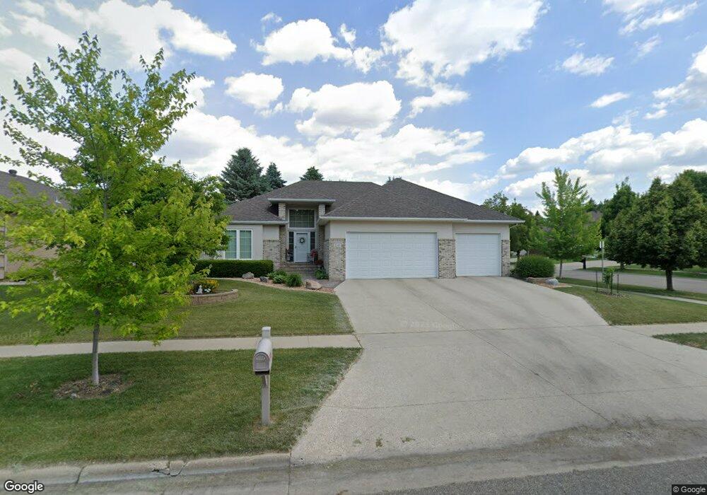
2049 5th St E West Fargo, ND 58078
Charleswood NeighborhoodEstimated Value: $647,000 - $719,703
4
Beds
3
Baths
3,788
Sq Ft
$180/Sq Ft
Est. Value
About This Home
This home is located at 2049 5th St E, West Fargo, ND 58078 and is currently estimated at $683,352, approximately $180 per square foot. 2049 5th St E is a home located in Cass County with nearby schools including South Elementary School, Cheney Middle School, and West Fargo High School.
Ownership History
Date
Name
Owned For
Owner Type
Purchase Details
Closed on
Jan 19, 2017
Sold by
Boyle Thomas J and Boyle Nancy A
Bought by
Schmidt Patrick L and Schmidt Cheryl M
Current Estimated Value
Create a Home Valuation Report for This Property
The Home Valuation Report is an in-depth analysis detailing your home's value as well as a comparison with similar homes in the area
Home Values in the Area
Average Home Value in this Area
Purchase History
| Date | Buyer | Sale Price | Title Company |
|---|---|---|---|
| Schmidt Patrick L | $470,000 | Northern Title Co |
Source: Public Records
Tax History Compared to Growth
Tax History
| Year | Tax Paid | Tax Assessment Tax Assessment Total Assessment is a certain percentage of the fair market value that is determined by local assessors to be the total taxable value of land and additions on the property. | Land | Improvement |
|---|---|---|---|---|
| 2024 | $7,280 | $278,800 | $40,400 | $238,400 |
| 2023 | $7,389 | $262,450 | $40,400 | $222,050 |
| 2022 | $7,503 | $255,400 | $40,400 | $215,000 |
| 2021 | $7,075 | $231,700 | $36,150 | $195,550 |
| 2020 | $6,646 | $223,400 | $36,150 | $187,250 |
| 2019 | $6,373 | $220,200 | $36,150 | $184,050 |
| 2018 | $6,059 | $218,400 | $36,150 | $182,250 |
| 2017 | $7,239 | $218,400 | $36,150 | $182,250 |
| 2016 | $6,670 | $213,200 | $36,150 | $177,050 |
| 2015 | $6,759 | $192,700 | $17,500 | $175,200 |
| 2014 | $6,583 | $180,100 | $17,500 | $162,600 |
| 2013 | $6,519 | $172,350 | $17,500 | $154,850 |
Source: Public Records
Map
Nearby Homes
- 2041 5 St E
- 2041 5th St E
- 2048 Ruxton Ct
- 2033 5th St E
- 2040 Ruxton Ct
- 517 20 1 2 Ave E
- 517 20 1/2 Ave E
- 509 20 1 2 Ave E
- 509 20 1/2 Ave E
- 2032 Ruxton Ct
- 525 20 1/2 Ave E
- 2042 5th St E
- 2034 5th St E
- 2050 5th St E
- 2025 5th St E
- 533 20 1/2 Ave E
- 2024 Ruxton Ct
- 2058 5th St E
- 607 20 1 2 Ave E
- 2017 5th St E