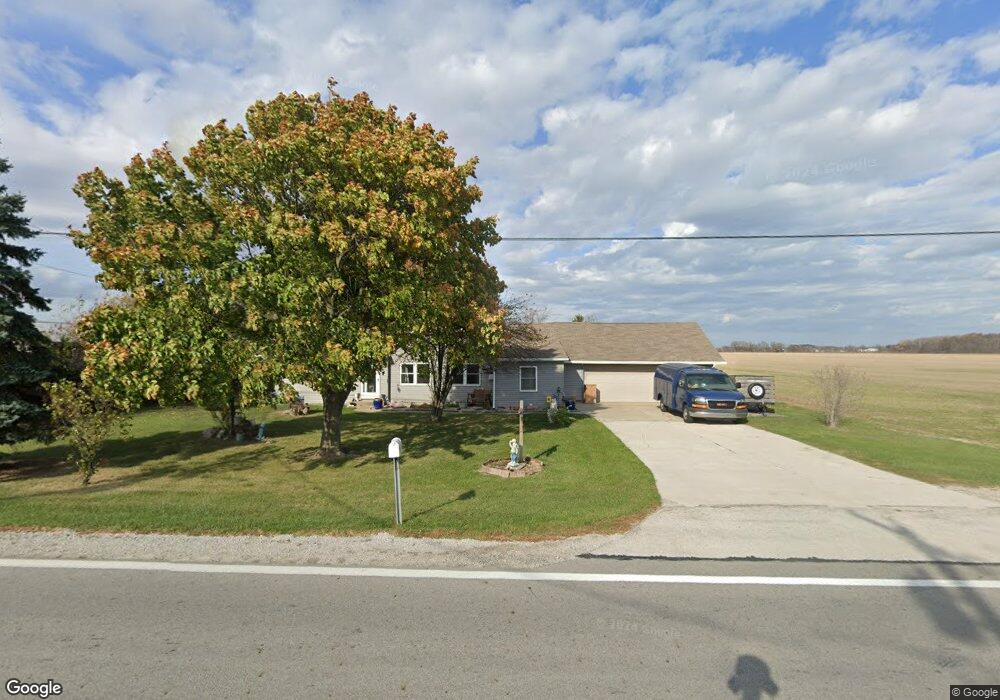
20495 W State Route 579 Curtice, OH 43412
Estimated Value: $226,923 - $307,000
3
Beds
2
Baths
1,669
Sq Ft
$156/Sq Ft
Est. Value
About This Home
This home is located at 20495 W State Route 579, Curtice, OH 43412 and is currently estimated at $260,231, approximately $155 per square foot. 20495 W State Route 579 is a home located in Ottawa County with nearby schools including Genoa Elementary School.
Ownership History
Date
Name
Owned For
Owner Type
Purchase Details
Closed on
Apr 17, 2019
Sold by
W S O S Community Action Commission Inc
Bought by
Sawyer David L and Sawyer Teresa L
Current Estimated Value
Purchase Details
Closed on
Oct 18, 2012
Sold by
New Falls Corporation
Bought by
W S O S Community Action Commission Inc
Purchase Details
Closed on
May 20, 2009
Sold by
New Falls Corporation
Bought by
Sawyer David
Home Financials for this Owner
Home Financials are based on the most recent Mortgage that was taken out on this home.
Original Mortgage
$40,000
Interest Rate
8%
Mortgage Type
Seller Take Back
Purchase Details
Closed on
Jan 15, 2008
Sold by
Schlievert Leona V
Bought by
New Falls Corp
Create a Home Valuation Report for This Property
The Home Valuation Report is an in-depth analysis detailing your home's value as well as a comparison with similar homes in the area
Home Values in the Area
Average Home Value in this Area
Purchase History
| Date | Buyer | Sale Price | Title Company |
|---|---|---|---|
| Sawyer David L | $51,500 | None Available | |
| W S O S Community Action Commission Inc | $41,736 | Attorney | |
| Sawyer David | $40,000 | None Available | |
| New Falls Corp | $40,000 | None Available |
Source: Public Records
Mortgage History
| Date | Status | Borrower | Loan Amount |
|---|---|---|---|
| Previous Owner | Sawyer David | $40,000 |
Source: Public Records
Tax History Compared to Growth
Tax History
| Year | Tax Paid | Tax Assessment Tax Assessment Total Assessment is a certain percentage of the fair market value that is determined by local assessors to be the total taxable value of land and additions on the property. | Land | Improvement |
|---|---|---|---|---|
| 2024 | $1,900 | $52,637 | $13,178 | $39,459 |
| 2023 | $1,900 | $56,851 | $11,459 | $45,392 |
| 2022 | $1,902 | $37,142 | $11,459 | $25,683 |
| 2021 | $1,653 | $36,580 | $11,460 | $25,120 |
| 2020 | $1,257 | $26,460 | $7,900 | $18,560 |
| 2019 | $1,248 | $26,460 | $7,900 | $18,560 |
| 2018 | $1,205 | $26,530 | $7,900 | $18,630 |
| 2017 | $1,140 | $23,750 | $7,190 | $16,560 |
| 2016 | $1,144 | $23,750 | $7,190 | $16,560 |
| 2015 | $1,151 | $23,750 | $7,190 | $16,560 |
| 2014 | $514 | $22,920 | $7,190 | $15,730 |
| 2013 | $478 | $10,620 | $7,190 | $3,430 |
Source: Public Records
Map
Nearby Homes
- 21224 W Toledo St
- 0 W Walbridge Rd
- Track 1 W Walbridge Rd
- 19367 W Walbridge Rd
- 6927 N Wildacre Rd
- 7105 N Elliston Trowbridge Rd
- 445 S Yondota Rd
- 7330 Jerusalem Rd
- 725 Donovan Rd
- 9015 Seaman Rd
- 24181 W James Ridge Rd
- 1861 N Opfer-Lentz Rd
- 0 N Graytown Rd
- 6645 Seaman Rd
- 23105 W Edgefield Dr
- 1615 N Thyre Dr
- 1031 N Cousino Rd
- 23225 Ohio 51
- 23430 State Route 51 W
- 5300 Williston Rd
- 20421 W State Route 579
- 20561 W State Route 579
- 20371 W State Route 579
- 20617 W State Route 579
- 20363 W State Route 579
- 20651 W Sr 579
- 20703 Ohio 579
- 20353 W State Route 579
- 20729 W Sr 579
- 20249 W State Route 579
- 20751 W Sr 579
- 20211 W State Route 579
- 20775 W State Route 579
- 20191 W State Route 579
- 20860 W Toledo St
- 20770 Yale St
- 20117 W State Route 579
- 20370 W Sr 579
- 20370 Oh-579
- 5640 N Oakwood Ln