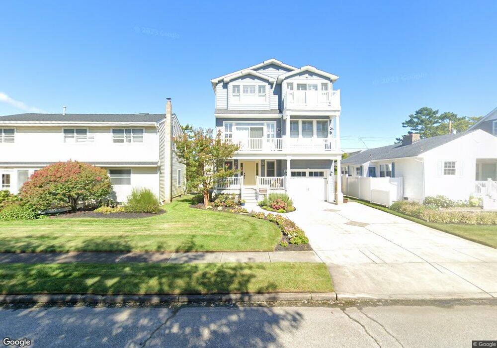
205 18th St S Brigantine, NJ 08203
Estimated Value: $1,400,366 - $1,672,000
Studio
--
Bath
3,326
Sq Ft
$462/Sq Ft
Est. Value
About This Home
This home is located at 205 18th St S, Brigantine, NJ 08203 and is currently estimated at $1,537,842, approximately $462 per square foot. 205 18th St S is a home located in Atlantic County with nearby schools including Brigantine Elementary School and New Hope Christian Academy/Robinson Small Learning Center.
Ownership History
Date
Name
Owned For
Owner Type
Purchase Details
Closed on
Nov 20, 2007
Sold by
Mullin Kevin E
Bought by
Craig Anthony G and Craig Deborah L
Current Estimated Value
Home Financials for this Owner
Home Financials are based on the most recent Mortgage that was taken out on this home.
Original Mortgage
$610,000
Outstanding Balance
$398,492
Interest Rate
6.27%
Mortgage Type
Construction
Estimated Equity
$1,139,350
Purchase Details
Closed on
Jan 31, 2006
Sold by
Alderfer Josephine
Bought by
Kevin Mullin
Purchase Details
Closed on
Dec 21, 1993
Sold by
Wetzel Bernard W
Bought by
Alderfer Kenneth and Alderfer Josephine
Purchase Details
Closed on
Sep 13, 1988
Sold by
Wetzel Bernard W
Bought by
Wetzel Bernard W
Create a Home Valuation Report for This Property
The Home Valuation Report is an in-depth analysis detailing your home's value as well as a comparison with similar homes in the area
Home Values in the Area
Average Home Value in this Area
Purchase History
| Date | Buyer | Sale Price | Title Company |
|---|---|---|---|
| Craig Anthony G | $370,000 | Commonwealth Land Title Insu | |
| Kevin Mullin | $412,500 | -- | |
| Alderfer Kenneth | $93,000 | -- | |
| Wetzel Bernard W | -- | -- |
Source: Public Records
Mortgage History
| Date | Status | Borrower | Loan Amount |
|---|---|---|---|
| Open | Craig Anthony G | $610,000 |
Source: Public Records
Tax History
| Year | Tax Paid | Tax Assessment Tax Assessment Total Assessment is a certain percentage of the fair market value that is determined by local assessors to be the total taxable value of land and additions on the property. | Land | Improvement |
|---|---|---|---|---|
| 2025 | $14,371 | $764,400 | $268,400 | $496,000 |
| 2024 | $14,371 | $764,400 | $268,400 | $496,000 |
Source: Public Records
Map
Nearby Homes
- 1600 W Brigantine Ave
- 1904 W Brigantine Ave
- 301 20th St S
- 1306 Bayshore Ave
- 201 23rd St S
- 103 24th St S
- 106 24th St S
- 1000 W Brigantine Ave Unit 4
- 900 W Brigantine Ave
- 2502 Ocean Ave
- 150 9th St S
- 250 8th St S
- 222 8th St S
- 800 W Brigantine Ave Unit 217
- 713 W Brigantine Ave
- 403 28th St S
- 600 W Brigantine Ave Unit 112
- 159 Sheridan Square
- 468 W Shore Dr
- 321 6th St S Unit 2
Your Personal Tour Guide
Ask me questions while you tour the home.