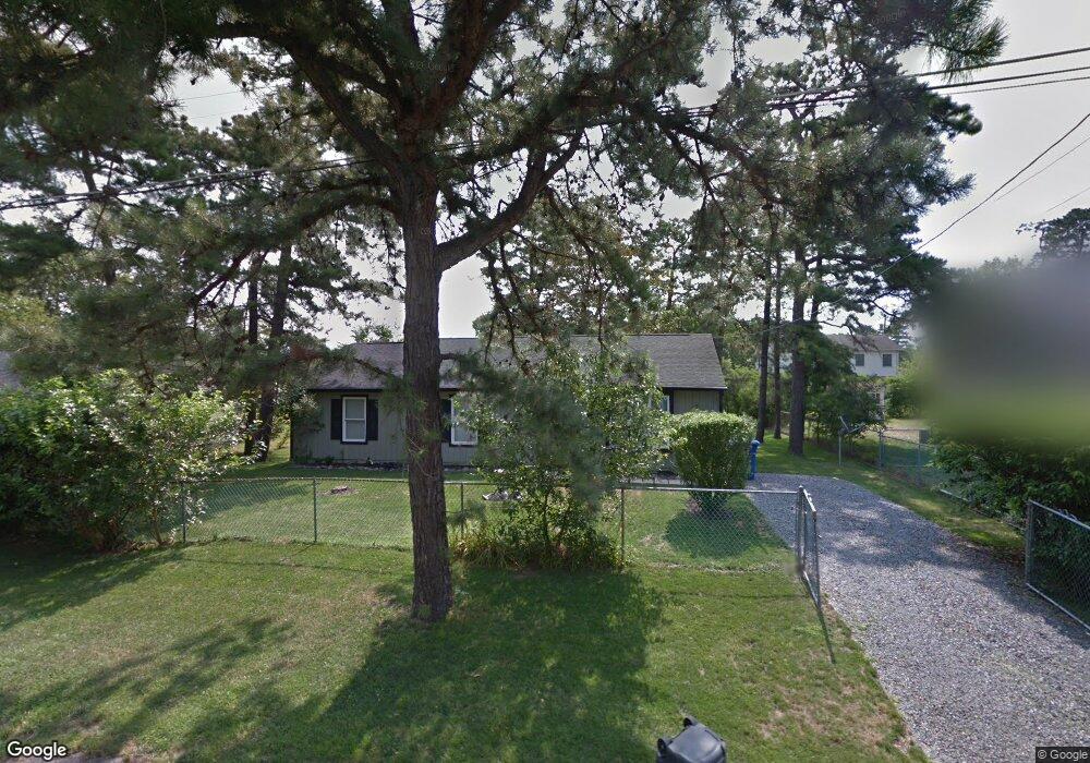
205 Apache Trail Browns Mills, NJ 08015
Estimated Value: $274,000 - $340,000
3
Beds
1
Bath
1,248
Sq Ft
$247/Sq Ft
Est. Value
About This Home
This home is located at 205 Apache Trail, Browns Mills, NJ 08015 and is currently estimated at $308,508, approximately $247 per square foot. 205 Apache Trail is a home located in Burlington County.
Ownership History
Date
Name
Owned For
Owner Type
Purchase Details
Closed on
May 29, 2009
Sold by
Bloinarz Gregory
Bought by
Williams Dennis A
Current Estimated Value
Home Financials for this Owner
Home Financials are based on the most recent Mortgage that was taken out on this home.
Original Mortgage
$141,988
Interest Rate
5.31%
Mortgage Type
VA
Purchase Details
Closed on
Nov 15, 2002
Sold by
Thinnabut Pornpan
Bought by
Bloinarz Frank J
Home Financials for this Owner
Home Financials are based on the most recent Mortgage that was taken out on this home.
Original Mortgage
$79,829
Interest Rate
6.18%
Mortgage Type
FHA
Create a Home Valuation Report for This Property
The Home Valuation Report is an in-depth analysis detailing your home's value as well as a comparison with similar homes in the area
Home Values in the Area
Average Home Value in this Area
Purchase History
| Date | Buyer | Sale Price | Title Company |
|---|---|---|---|
| Williams Dennis A | $139,000 | Foundation Title | |
| Bloinarz Frank J | $80,500 | Congress Title |
Source: Public Records
Mortgage History
| Date | Status | Borrower | Loan Amount |
|---|---|---|---|
| Previous Owner | Williams Dennis A | $141,988 | |
| Previous Owner | Bloinarz Frank J | $79,829 |
Source: Public Records
Tax History Compared to Growth
Tax History
| Year | Tax Paid | Tax Assessment Tax Assessment Total Assessment is a certain percentage of the fair market value that is determined by local assessors to be the total taxable value of land and additions on the property. | Land | Improvement |
|---|---|---|---|---|
| 2025 | $4,432 | $144,600 | $37,800 | $106,800 |
| 2024 | $4,159 | $144,600 | $37,800 | $106,800 |
| 2023 | $4,159 | $144,600 | $37,800 | $106,800 |
| 2022 | $3,849 | $144,600 | $37,800 | $106,800 |
| 2021 | $3,692 | $144,600 | $37,800 | $106,800 |
| 2020 | $3,553 | $144,600 | $37,800 | $106,800 |
| 2019 | $3,402 | $144,600 | $37,800 | $106,800 |
| 2018 | $3,287 | $144,600 | $37,800 | $106,800 |
| 2017 | $3,219 | $144,600 | $37,800 | $106,800 |
| 2016 | $3,207 | $85,800 | $22,300 | $63,500 |
| 2015 | $3,181 | $85,800 | $22,300 | $63,500 |
| 2014 | $3,042 | $85,800 | $22,300 | $63,500 |
Source: Public Records
Map
Nearby Homes
- 306 Apache Trail
- 315 Algonquin Trail
- 208 Wichita Trail
- 304 Spring Lake Blvd
- 310 Piute Trail
- 304 Mohawk Trail
- 219 Chippewa Trail
- 224 Cherokee Dr
- 1714 Red Feather Trail
- 419 Chippewa Trail
- 13 Muskogean Trail
- 77 Sepulga Dr
- 22 Maricopa Trail
- 2 Kiowa Trail
- 111 Huckleberry Ln
- 1 S Branch Dr
- 764 Lakehurst Rd
- 505 Wisconsin Trail
- 304 Otter Ave
- 307 Colorado Trail
- 207 Apache Trail
- 203 Apache Trail
- 204 Blackfoot Trail
- 202 Blackfoot Trail
- 206 Blackfoot Trail
- 209 Apache Trail
- 202 Apache Trail
- 206 Apache Trail
- 106 Cherokee Dr
- 108 Cherokee Dr
- 705 Red Feather Trail
- 104 Cherokee Dr
- 200 Blackfoot Trail
- 205 Blackfoot Trail
- 205 Algonquin Trail
- 703 Red Feather Trail
- 102 Cherokee Dr
- 203 Blackfoot Trail
- 203 Algonquin Trail