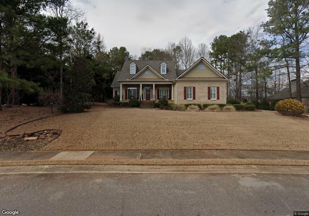
205 Ashbrook Way Athens, GA 30605
Estimated Value: $502,305 - $557,000
5
Beds
3
Baths
2,682
Sq Ft
$194/Sq Ft
Est. Value
About This Home
This home is located at 205 Ashbrook Way, Athens, GA 30605 and is currently estimated at $519,576, approximately $193 per square foot. 205 Ashbrook Way is a home located in Clarke County with nearby schools including Barnett Shoals Elementary School, Hilsman Middle School, and Cedar Shoals High School.
Ownership History
Date
Name
Owned For
Owner Type
Purchase Details
Closed on
Aug 18, 2008
Sold by
Alishio Jaime
Bought by
Shane Craig L and Shane Amy
Current Estimated Value
Home Financials for this Owner
Home Financials are based on the most recent Mortgage that was taken out on this home.
Original Mortgage
$290,700
Outstanding Balance
$188,866
Interest Rate
6.21%
Mortgage Type
New Conventional
Estimated Equity
$330,710
Purchase Details
Closed on
May 13, 2005
Sold by
Michael J Ross Constructio
Bought by
Alishio Jaime
Home Financials for this Owner
Home Financials are based on the most recent Mortgage that was taken out on this home.
Original Mortgage
$229,600
Interest Rate
5.8%
Mortgage Type
New Conventional
Purchase Details
Closed on
Oct 29, 2003
Sold by
Ashton Place Partnership
Bought by
Michael J Ross Construction Inc
Create a Home Valuation Report for This Property
The Home Valuation Report is an in-depth analysis detailing your home's value as well as a comparison with similar homes in the area
Home Values in the Area
Average Home Value in this Area
Purchase History
| Date | Buyer | Sale Price | Title Company |
|---|---|---|---|
| Shane Craig L | $306,000 | -- | |
| Alishio Jaime | $287,000 | -- | |
| Michael J Ross Construction Inc | $35,000 | -- |
Source: Public Records
Mortgage History
| Date | Status | Borrower | Loan Amount |
|---|---|---|---|
| Open | Shane Craig L | $290,700 | |
| Previous Owner | Alishio Jaime | $229,600 |
Source: Public Records
Tax History Compared to Growth
Tax History
| Year | Tax Paid | Tax Assessment Tax Assessment Total Assessment is a certain percentage of the fair market value that is determined by local assessors to be the total taxable value of land and additions on the property. | Land | Improvement |
|---|---|---|---|---|
| 2025 | $5,726 | $205,867 | $23,000 | $182,867 |
| 2024 | $5,726 | $191,846 | $20,700 | $171,146 |
| 2023 | $5,496 | $173,142 | $20,700 | $152,442 |
| 2022 | $4,646 | $155,653 | $20,700 | $134,953 |
| 2021 | $4,289 | $137,268 | $20,700 | $116,568 |
| 2020 | $4,010 | $128,996 | $20,700 | $108,296 |
| 2019 | $3,801 | $121,947 | $20,700 | $101,247 |
| 2018 | $3,730 | $119,857 | $20,700 | $99,157 |
| 2017 | $3,389 | $109,830 | $20,700 | $89,130 |
| 2016 | $3,423 | $110,820 | $20,700 | $90,120 |
| 2015 | $3,462 | $111,810 | $20,700 | $91,110 |
| 2014 | $3,271 | $106,029 | $20,700 | $85,329 |
Source: Public Records
Map
Nearby Homes
- 324 Ashbrook Ln
- Lot 14 Ashbrook Way
- Lot 32 Ashbrook Way
- Lot 13 Ashbrook Way
- 140 Ashbrook Dr
- 320 Ashbrook Ln
- 144 Ashbrook Dr
- 202 Ashbrook Way
- 316 Ashbrook Ln
- 0 Ashbrook Ln Unit CM402727
- Lot 52 Lindmar Ct
- Lot 53 Lindmar Ct
- 206 Ashbrook Way
- 210 Ashbrook Way
- Lot 20 Ashbrook Ln
- Lot 10D Ashbrook Ln
- Lot 27 Ashbrook Ln
- Lot 26 Ashbrook Ln
- Lot 31 Ashbrook Ln
- Lot 10 Ashbrook Ln