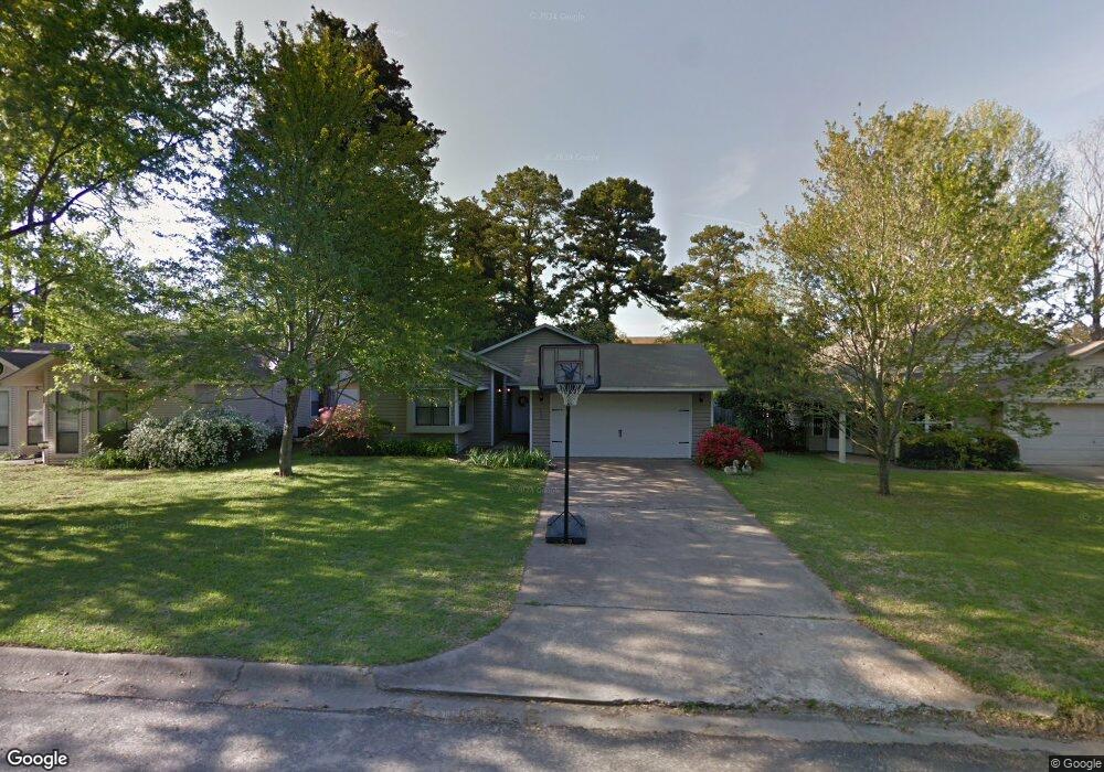
205 Austin Cir Russellville, AR 72801
Estimated Value: $121,498 - $144,000
3
Beds
2
Baths
1,232
Sq Ft
$110/Sq Ft
Est. Value
About This Home
This home is located at 205 Austin Cir, Russellville, AR 72801 and is currently estimated at $135,875, approximately $110 per square foot. 205 Austin Cir is a home located in Pope County with nearby schools including Dwight Elementary School, Russellville Upper Elementary School, and Russellville Junior High School.
Ownership History
Date
Name
Owned For
Owner Type
Purchase Details
Closed on
Dec 12, 2016
Sold by
S & V Investment Llc
Bought by
Downes Julie C
Current Estimated Value
Purchase Details
Closed on
Jun 9, 2011
Sold by
Hott Watterson Rachel and Watterson John
Bought by
Downes Julie C
Home Financials for this Owner
Home Financials are based on the most recent Mortgage that was taken out on this home.
Original Mortgage
$99,901
Interest Rate
4.25%
Mortgage Type
FHA
Purchase Details
Closed on
Feb 25, 2008
Sold by
Not Provided
Bought by
Hott Rachel L
Home Financials for this Owner
Home Financials are based on the most recent Mortgage that was taken out on this home.
Original Mortgage
$103,020
Interest Rate
5.47%
Create a Home Valuation Report for This Property
The Home Valuation Report is an in-depth analysis detailing your home's value as well as a comparison with similar homes in the area
Home Values in the Area
Average Home Value in this Area
Purchase History
| Date | Buyer | Sale Price | Title Company |
|---|---|---|---|
| Downes Julie C | $45,500 | None Available | |
| Downes Julie C | -- | Heritage Title And Closing C | |
| Hott Rachel L | $98,000 | -- | |
| Hott Rachel L | -- | -- |
Source: Public Records
Mortgage History
| Date | Status | Borrower | Loan Amount |
|---|---|---|---|
| Previous Owner | Hott Rachel L | $99,901 | |
| Previous Owner | Hott Rachel L | $103,020 | |
| Previous Owner | Hott Rachel L | $1,000 |
Source: Public Records
Tax History Compared to Growth
Tax History
| Year | Tax Paid | Tax Assessment Tax Assessment Total Assessment is a certain percentage of the fair market value that is determined by local assessors to be the total taxable value of land and additions on the property. | Land | Improvement |
|---|---|---|---|---|
| 2024 | $878 | $19,160 | $1,800 | $17,360 |
| 2023 | $841 | $19,160 | $1,800 | $17,360 |
| 2022 | $425 | $19,160 | $1,800 | $17,360 |
| 2021 | $389 | $19,160 | $1,800 | $17,360 |
| 2020 | $353 | $15,880 | $1,800 | $14,080 |
| 2019 | $359 | $15,880 | $1,800 | $14,080 |
| 2018 | $383 | $15,880 | $1,800 | $14,080 |
| 2017 | $732 | $15,880 | $1,800 | $14,080 |
| 2016 | $383 | $15,880 | $1,800 | $14,080 |
| 2015 | $735 | $16,220 | $1,800 | $14,420 |
| 2014 | $398 | $16,220 | $1,800 | $14,420 |
Source: Public Records
Map
Nearby Homes
- 4509 W Main St
- 1214 Hilltop Dr
- 110 Evergreen Estates Dr
- 12 Live Oak Ln
- 211 Hickory Hills Dr
- 14 Water Oak Ln
- 418 N Fairbanks Ave
- 603 Marina Rd
- 413 N Fairbanks Ave
- 107 Sunset Dr
- 400 N Fairbanks Ave
- 116 Skyline Dr Unit 4
- 3320 Riverview Rd
- 3302 Riverview Rd
- 306 Osage Ct
- 213 N Shore Dr
- 2606 W C Ct Unit 5
- 2606 W C Ct
- 214 N Shore Dr
- 118 Damascus Rd