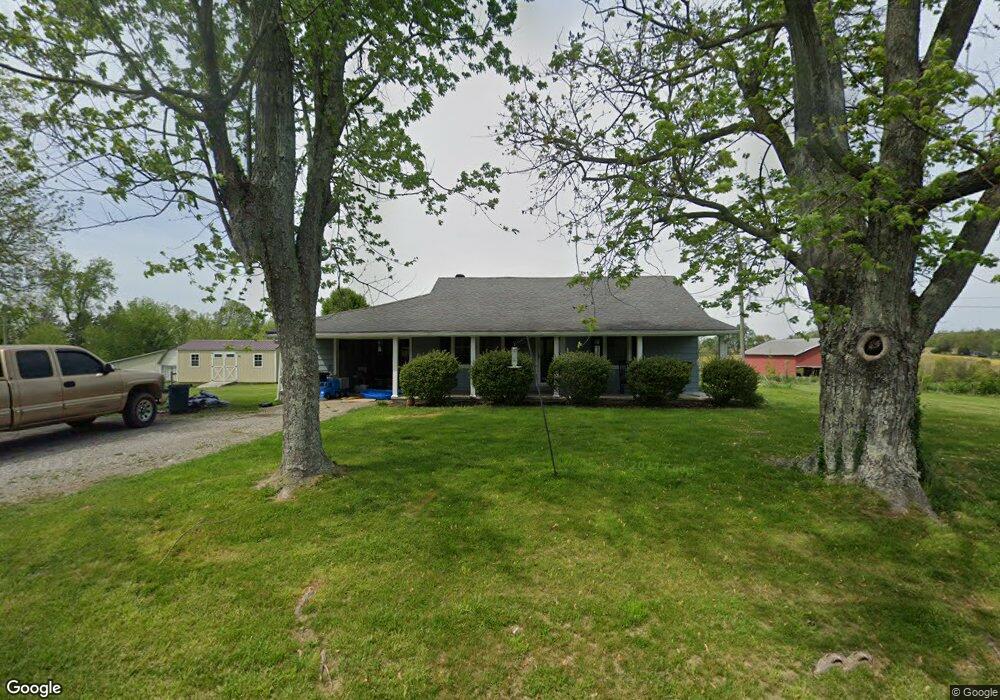
205 Black Rd Campbellsville, KY 42718
Estimated Value: $122,000 - $210,000
3
Beds
1
Bath
1,680
Sq Ft
$92/Sq Ft
Est. Value
About This Home
This home is located at 205 Black Rd, Campbellsville, KY 42718 and is currently estimated at $155,090, approximately $92 per square foot. 205 Black Rd is a home located in Taylor County with nearby schools including Taylor County Elementary School, Taylor County Middle School, and Taylor County High School.
Ownership History
Date
Name
Owned For
Owner Type
Purchase Details
Closed on
Sep 9, 2020
Sold by
Bartman Investments Llc
Bought by
Bartman Heather B
Current Estimated Value
Purchase Details
Closed on
Nov 12, 2015
Sold by
Bartman Elizabeth Y
Bought by
Bartman Investments Llc
Home Financials for this Owner
Home Financials are based on the most recent Mortgage that was taken out on this home.
Original Mortgage
$60,000
Interest Rate
3.1%
Mortgage Type
Purchase Money Mortgage
Create a Home Valuation Report for This Property
The Home Valuation Report is an in-depth analysis detailing your home's value as well as a comparison with similar homes in the area
Home Values in the Area
Average Home Value in this Area
Purchase History
| Date | Buyer | Sale Price | Title Company |
|---|---|---|---|
| Bartman Heather B | $75,000 | None Available | |
| Bartman Investments Llc | $75,000 | None Available |
Source: Public Records
Mortgage History
| Date | Status | Borrower | Loan Amount |
|---|---|---|---|
| Previous Owner | Bartman Investments Llc | $60,000 |
Source: Public Records
Tax History Compared to Growth
Tax History
| Year | Tax Paid | Tax Assessment Tax Assessment Total Assessment is a certain percentage of the fair market value that is determined by local assessors to be the total taxable value of land and additions on the property. | Land | Improvement |
|---|---|---|---|---|
| 2025 | $726 | $75,000 | $0 | $0 |
| 2024 | $736 | $75,000 | $0 | $0 |
| 2023 | $762 | $75,000 | $0 | $0 |
| 2022 | $774 | $75,000 | $0 | $0 |
| 2021 | $771 | $75,000 | $0 | $0 |
| 2020 | $789 | $75,000 | $0 | $0 |
| 2019 | $790 | $75,000 | $0 | $0 |
| 2018 | $776 | $75,000 | $0 | $0 |
| 2017 | $759 | $75,000 | $0 | $0 |
| 2016 | $741 | $75,000 | $0 | $0 |
| 2015 | $476 | $48,400 | $0 | $0 |
| 2014 | $466 | $48,400 | $0 | $0 |
| 2012 | -- | $48,400 | $0 | $0 |
Source: Public Records
Map
Nearby Homes
- 0 Greenleaf Dr
- 453 Greenleaf Dr
- 139 Sassy Ct
- 147 Sassy Ct
- 173 Natures Way
- 1780 Shiloh Rd
- 354 Wildwood Way
- 648 W Main St
- 0 Plantation Dr
- 1850 New Columbia Rd
- 00 New Columbia Rd Unit Lot 2 (2.669 ac.)
- 0 New Columbia Rd Unit HK25004781
- 3 Hodgenville Rd
- 5 Hodgenville Rd
- 1805 Hodgenville Rd
- 106 Sherwood Park
- Lot 24 Canterbury Way
- 101 Sherwood Park
- 0 Trace Fork Rd Unit HK24003110
- 113 Yorkshire Place