Estimated Value: $289,000 - $323,000
3
Beds
2
Baths
1,629
Sq Ft
$184/Sq Ft
Est. Value
About This Home
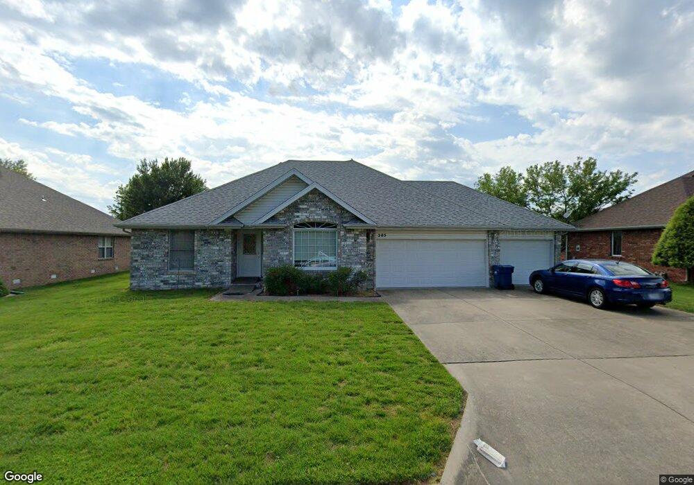
This home is located at 205 Bluebird Ln, Nixa, MO 65714 and is currently estimated at $300,337, approximately $184 per square foot. 205 Bluebird Ln is a home located in Christian County with nearby schools including Espy Elementary School, Nixa Junior High School, and Nicholas A. Inman Intermediate School.
Ownership History
Date
Name
Owned For
Owner Type
Purchase Details
Closed on
Aug 4, 2015
Sold by
Myrick Darlene and Myrick Steve
Bought by
Grover Larry G
Current Estimated Value
Home Financials for this Owner
Home Financials are based on the most recent Mortgage that was taken out on this home.
Original Mortgage
$158,163
Outstanding Balance
$123,157
Interest Rate
4.06%
Mortgage Type
New Conventional
Estimated Equity
$177,180
Purchase Details
Closed on
Oct 4, 2012
Sold by
Defeo Dana C
Bought by
Defeo Dana C and The Dana C Defeo Trust
Purchase Details
Closed on
May 10, 2011
Sold by
Defeo Dana Craig
Bought by
Defeo Dana C and Dana C Defeo Trust
Create a Home Valuation Report for This Property
The Home Valuation Report is an in-depth analysis detailing your home's value as well as a comparison with similar homes in the area
Home Values in the Area
Average Home Value in this Area
Purchase History
| Date | Buyer | Sale Price | Title Company |
|---|---|---|---|
| Grover Larry G | -- | Ozark Abstract & Title | |
| Defeo Dana C | -- | Choice Escrow & Land Title L | |
| Defeo Dana C | -- | None Available | |
| Defeo Dana C | -- | None Available |
Source: Public Records
Mortgage History
| Date | Status | Borrower | Loan Amount |
|---|---|---|---|
| Open | Grover Larry G | $158,163 |
Source: Public Records
Tax History
| Year | Tax Paid | Tax Assessment Tax Assessment Total Assessment is a certain percentage of the fair market value that is determined by local assessors to be the total taxable value of land and additions on the property. | Land | Improvement |
|---|---|---|---|---|
| 2025 | $1,827 | $31,140 | -- | -- |
| 2024 | $1,827 | $29,320 | -- | -- |
| 2023 | $1,827 | $29,320 | $0 | $0 |
| 2022 | $1,699 | $27,230 | $0 | $0 |
| 2021 | $1,700 | $27,230 | $0 | $0 |
| 2020 | $1,498 | $22,900 | $0 | $0 |
| 2019 | $1,498 | $22,900 | $0 | $0 |
| 2018 | $1,395 | $22,900 | $0 | $0 |
| 2017 | $1,395 | $22,900 | $0 | $0 |
| 2016 | $1,374 | $22,900 | $0 | $0 |
| 2015 | $1,376 | $22,900 | $22,900 | $0 |
| 2014 | $1,340 | $22,860 | $0 | $0 |
| 2013 | $13 | $22,860 | $0 | $0 |
| 2011 | $13 | $45,720 | $0 | $0 |
Source: Public Records
Map
Nearby Homes
- 711 Robinwood Ln
- 805 W Briarwood Ln
- 713 Morning Glory Dr
- 000 (Tbd) Highway 160 (14 8 Acres) St
- 000 West St
- 1334 W Mount Vernon St
- 403 S Bryant St
- 912 Wesley Ave
- Sw Corner Highway 160 & St S
- 207 W Park St
- 902 Foxwood Dr
- 1209 W Mount Vernon St
- 108 W Walnut St
- 102 W Bennett St
- 1205 W Yellowstone St
- 601 S Gregg Rd
- 907 Northview Dr
- 307 N Prospect St
- 308 N Prospect St
- 410 N Prospect St
- 205 N Bluebird Ln
- 203 N Bluebird Ln
- 207 N Bluebird Ln
- 208 N Bluebird Ln
- 706 Robinwood Ln
- 201 N Bluebird Ln
- 701 W Robinwood Ln
- 707 W Osage Dr
- 210 N Bluebird Ln
- 206 Bluebird Ln
- 204 Bluebird Ln
- 703 Robinwood Ln
- 708 Robinwood Ln
- 212 N Bluebird Ln
- 705 Robinwood Ln
- 709 Osage Dr
- 202 Bluebird Ln
- 707 W Robinwood Ln
- 707 Robinwood Ln
- 706 Osage Dr
Your Personal Tour Guide
Ask me questions while you tour the home.