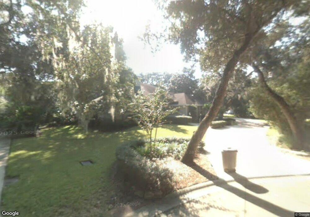
205 Bluebird Ln Saint Augustine, FL 32080
Estimated Value: $836,000 - $964,000
Studio
--
Bath
2,188
Sq Ft
$414/Sq Ft
Est. Value
About This Home
This home is located at 205 Bluebird Ln, Saint Augustine, FL 32080 and is currently estimated at $905,885, approximately $414 per square foot. 205 Bluebird Ln is a home located in St. Johns County with nearby schools including R.B. Hunt Elementary School, Sebastian Middle School, and St. Augustine High School.
Ownership History
Date
Name
Owned For
Owner Type
Purchase Details
Closed on
Jan 19, 2021
Sold by
Leslie John C and Leslie Patricia A
Bought by
Leslie John C and Leslie Patricia A
Current Estimated Value
Home Financials for this Owner
Home Financials are based on the most recent Mortgage that was taken out on this home.
Original Mortgage
$357,150
Outstanding Balance
$318,138
Interest Rate
2.6%
Mortgage Type
VA
Estimated Equity
$587,747
Purchase Details
Closed on
Dec 6, 2016
Sold by
Leslie John C and Leslie Patricia A
Bought by
Leslie John C and Leslie Patricia A
Home Financials for this Owner
Home Financials are based on the most recent Mortgage that was taken out on this home.
Original Mortgage
$372,999
Interest Rate
3.57%
Mortgage Type
VA
Purchase Details
Closed on
Dec 1, 2016
Bought by
Leslie Living Trust D:3-25-200
Home Financials for this Owner
Home Financials are based on the most recent Mortgage that was taken out on this home.
Original Mortgage
$372,999
Interest Rate
3.57%
Mortgage Type
VA
Purchase Details
Closed on
May 11, 2013
Sold by
Leslie John C and Leslie Patricia A
Bought by
Leslie John C and Leslie Patricia A
Home Financials for this Owner
Home Financials are based on the most recent Mortgage that was taken out on this home.
Original Mortgage
$354,725
Interest Rate
3.37%
Mortgage Type
VA
Purchase Details
Closed on
Sep 20, 2012
Sold by
Leslie John C and Leslie Patricia A
Bought by
Leslie John C and Leslie Patricia A
Home Financials for this Owner
Home Financials are based on the most recent Mortgage that was taken out on this home.
Original Mortgage
$354,050
Interest Rate
3.64%
Mortgage Type
VA
Purchase Details
Closed on
Sep 12, 2012
Sold by
Leslie John C and Leslie Patricia A
Bought by
Leslie John C and Leslie Patricia A
Home Financials for this Owner
Home Financials are based on the most recent Mortgage that was taken out on this home.
Original Mortgage
$354,050
Interest Rate
3.64%
Mortgage Type
VA
Purchase Details
Closed on
Mar 25, 2008
Sold by
Leslie John C and Leslie Patricia A
Bought by
Leslie John C and Leslie Patricia A
Create a Home Valuation Report for This Property
The Home Valuation Report is an in-depth analysis detailing your home's value as well as a comparison with similar homes in the area
Home Values in the Area
Average Home Value in this Area
Purchase History
| Date | Buyer | Sale Price | Title Company |
|---|---|---|---|
| Leslie John C | -- | Accommodation | |
| Leslie John C | -- | Accommodation | |
| Leslie John C | -- | Title Source Inc | |
| Leslie John C | -- | Title Source Inc | |
| Leslie Living Trust D:3-25-200 | $100 | -- | |
| Leslie John C | -- | Title Source | |
| Leslie John C | -- | Title Source | |
| Leslie John C | -- | Title Source Inc | |
| Leslie John C | -- | Title Source Inc | |
| Leslie John C | -- | Attorney |
Source: Public Records
Mortgage History
| Date | Status | Borrower | Loan Amount |
|---|---|---|---|
| Open | Leslie John C | $357,150 | |
| Closed | Leslie John C | $372,999 | |
| Previous Owner | Leslie John C | $354,725 | |
| Previous Owner | Leslie John C | $354,050 |
Source: Public Records
Tax History
| Year | Tax Paid | Tax Assessment Tax Assessment Total Assessment is a certain percentage of the fair market value that is determined by local assessors to be the total taxable value of land and additions on the property. | Land | Improvement |
|---|---|---|---|---|
| 2025 | $3,634 | $330,125 | -- | -- |
| 2024 | $3,634 | $320,821 | -- | -- |
| 2023 | $3,634 | $311,477 | $0 | $0 |
| 2022 | $3,573 | $302,405 | $0 | $0 |
| 2021 | $3,517 | $293,597 | $0 | $0 |
| 2020 | $3,360 | $289,543 | $0 | $0 |
| 2019 | $3,283 | $283,033 | $0 | $0 |
| 2018 | $3,244 | $277,756 | $0 | $0 |
| 2017 | $3,613 | $272,043 | $0 | $0 |
| 2016 | $3,597 | $274,441 | $0 | $0 |
| 2015 | $3,640 | $272,534 | $0 | $0 |
| 2014 | $3,567 | $270,371 | $0 | $0 |
Source: Public Records
Map
Nearby Homes
- 320 Redwing Ln
- 200 Bluebird Ln
- 209 Bluebird Ln
- 316 Redwing Ln
- 324 Redwing Ln
- 204 Bluebird Ln
- 120 Ridgeway Rd
- 138 Ridgeway Rd
- 138 Ridgeway Rd
- 138 Ridgeway Rd Unit LOT 11
- 208 Bluebird Ln
- 110 Ridgeway Rd
- 110 Ridgeway Rd Unit LOT 13
- 213 Bluebird Ln
- 156 Ridgeway Rd
- 312 Redwing Ln
- 170 Ridgeway Rd
- 106 Ridgeway Rd
- 212 Bluebird Ln
- 328 Redwing Ln
Your Personal Tour Guide
Ask me questions while you tour the home.