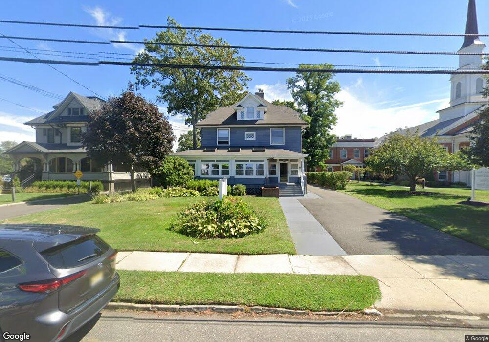
205 Broad St Unit B Red Bank, NJ 07701
Estimated Value: $1,009,000 - $1,071,326
--
Bed
--
Bath
3,840
Sq Ft
$271/Sq Ft
Est. Value
About This Home
This home is located at 205 Broad St Unit B, Red Bank, NJ 07701 and is currently estimated at $1,040,163, approximately $270 per square foot. 205 Broad St Unit B is a home located in Monmouth County with nearby schools including Red Bank Primary School, Red Bank Middle School, and Red Bank Reg High School.
Ownership History
Date
Name
Owned For
Owner Type
Purchase Details
Closed on
Oct 3, 2023
Sold by
Herrick Karen E
Bought by
205 Broad Street Llc
Current Estimated Value
Home Financials for this Owner
Home Financials are based on the most recent Mortgage that was taken out on this home.
Original Mortgage
$810,000
Outstanding Balance
$794,072
Interest Rate
7.12%
Mortgage Type
New Conventional
Estimated Equity
$246,091
Purchase Details
Closed on
Feb 15, 1995
Sold by
Stout Nancy
Bought by
Big Brook Devt
Create a Home Valuation Report for This Property
The Home Valuation Report is an in-depth analysis detailing your home's value as well as a comparison with similar homes in the area
Home Values in the Area
Average Home Value in this Area
Purchase History
| Date | Buyer | Sale Price | Title Company |
|---|---|---|---|
| 205 Broad Street Llc | $900,000 | American Land Title | |
| 205 Broad Street Llc | $900,000 | American Land Title | |
| Big Brook Devt | $135,000 | -- |
Source: Public Records
Mortgage History
| Date | Status | Borrower | Loan Amount |
|---|---|---|---|
| Open | 205 Broad Street Llc | $810,000 | |
| Closed | 205 Broad Street Llc | $810,000 |
Source: Public Records
Tax History Compared to Growth
Tax History
| Year | Tax Paid | Tax Assessment Tax Assessment Total Assessment is a certain percentage of the fair market value that is determined by local assessors to be the total taxable value of land and additions on the property. | Land | Improvement |
|---|---|---|---|---|
| 2025 | $16,774 | $951,200 | $483,500 | $467,700 |
| 2024 | $16,501 | $888,000 | $433,500 | $454,500 |
| 2023 | $16,501 | $863,500 | $513,500 | $350,000 |
| 2022 | $17,021 | $822,100 | $513,500 | $308,600 |
| 2021 | $17,021 | $760,900 | $466,800 | $294,100 |
| 2020 | $17,222 | $758,000 | $466,800 | $291,200 |
| 2019 | $16,642 | $752,700 | $466,800 | $285,900 |
| 2018 | $16,105 | $736,400 | $466,800 | $269,600 |
| 2017 | $15,525 | $735,800 | $466,800 | $269,000 |
| 2016 | $15,394 | $730,600 | $466,800 | $263,800 |
| 2015 | $15,904 | $782,300 | $600,200 | $182,100 |
| 2014 | $14,965 | $782,300 | $600,200 | $182,100 |
Source: Public Records
Map
Nearby Homes
- 17 Leroy Place Unit 3B
- 17 Leroy Place Unit 1C
- 44 Waverly Place
- 27 Irving Place
- 205 Maple Ave
- 137 E Bergen Place
- 82 Linden Place
- 26 Pinckney Rd Unit C
- 23 Wallace St Unit 207
- 42 Chestnut St
- 232 S Pearl St
- 253 Pearl St S
- 123 Manor Dr
- 82 Manor Dr Unit 803
- 3 Cedar Crossing
- 65 Manor Dr
- 24 Cedar Crossing
- 23 Cedar Crossing
- 4 Boat Club Ct Unit 3E
- 24 River St
- 199 Broad St
- 195 Broad St
- 219 Broad St
- 191 Broad St
- 206 Broad St
- 214 Broad St
- 214 Broad St Unit 5
- 214 Broad St Unit 1
- 214 Broad St Unit 2
- 214 Broad St Unit B
- 214 Broad St Unit 3-4
- 214 Broad St Unit 3
- 210 Broad St Unit 3 suites + Wait room
- 210 Broad St Unit B1-2
- 210 Broad St Unit B4
- 210 Broad St Unit B5
- 210 Broad St Unit B3
- 210 Broad St Unit B1-3
- 210 Broad St Unit 1B
- 210 Broad St Unit 1A