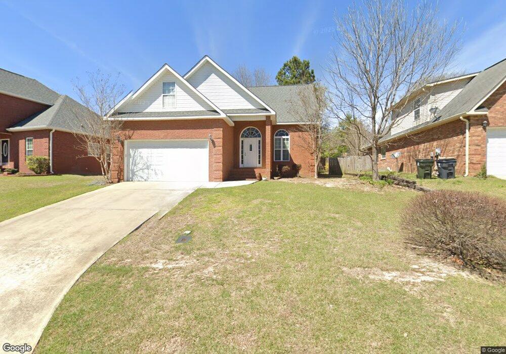
205 Cart Path Way Bonaire, GA 31005
Estimated Value: $251,000 - $274,000
4
Beds
3
Baths
1,827
Sq Ft
$142/Sq Ft
Est. Value
About This Home
This home is located at 205 Cart Path Way, Bonaire, GA 31005 and is currently estimated at $259,455, approximately $142 per square foot. 205 Cart Path Way is a home located in Houston County with nearby schools including Russell Elementary School, Huntington Middle School, and Warner Robins High School.
Ownership History
Date
Name
Owned For
Owner Type
Purchase Details
Closed on
Jun 23, 2006
Sold by
Kirby Construction Inc
Bought by
Cummings Kristina M and Cummings Kevin J
Current Estimated Value
Home Financials for this Owner
Home Financials are based on the most recent Mortgage that was taken out on this home.
Original Mortgage
$131,280
Outstanding Balance
$77,182
Interest Rate
6.57%
Mortgage Type
New Conventional
Estimated Equity
$182,273
Purchase Details
Closed on
Feb 24, 2004
Sold by
Asbell Max B
Bought by
Kirby Construction Inc
Create a Home Valuation Report for This Property
The Home Valuation Report is an in-depth analysis detailing your home's value as well as a comparison with similar homes in the area
Home Values in the Area
Average Home Value in this Area
Purchase History
| Date | Buyer | Sale Price | Title Company |
|---|---|---|---|
| Cummings Kristina M | $164,100 | None Available | |
| Kirby Construction Inc | $15,000 | -- |
Source: Public Records
Mortgage History
| Date | Status | Borrower | Loan Amount |
|---|---|---|---|
| Open | Cummings Kristina M | $131,280 | |
| Closed | Cummings Kristina M | $32,820 |
Source: Public Records
Tax History Compared to Growth
Tax History
| Year | Tax Paid | Tax Assessment Tax Assessment Total Assessment is a certain percentage of the fair market value that is determined by local assessors to be the total taxable value of land and additions on the property. | Land | Improvement |
|---|---|---|---|---|
| 2024 | $2,799 | $85,520 | $8,000 | $77,520 |
| 2023 | $2,364 | $71,680 | $6,200 | $65,480 |
| 2022 | $1,552 | $67,520 | $6,200 | $61,320 |
| 2021 | $1,369 | $59,200 | $6,200 | $53,000 |
| 2020 | $1,242 | $53,480 | $6,200 | $47,280 |
| 2019 | $1,242 | $53,480 | $6,200 | $47,280 |
| 2018 | $1,242 | $53,480 | $6,200 | $47,280 |
| 2017 | $1,244 | $53,480 | $6,200 | $47,280 |
| 2016 | $1,246 | $53,480 | $6,200 | $47,280 |
| 2015 | -- | $53,480 | $6,200 | $47,280 |
| 2014 | $596 | $53,480 | $6,200 | $47,280 |
| 2013 | $596 | $60,440 | $6,200 | $54,240 |
Source: Public Records
Map
Nearby Homes
- 106 Mulligan Ct
- 106 Countrywood Trail
- 105 Fernwood Dr
- 307 Fleming Dr
- 300 Summer Hill Place
- 104 Old Perry Rd
- 100 Pebblebrook E
- 207 Summer Hill Place
- 51 Play Golf Dr
- 507 Wexford Cir
- 422 Wexford Cir
- LOT 25 & 26 Plantation Dr
- 111 Raintree Dr
- 330 Hidden Creek Cir
- 116 Timber Mill Ct
- 206 Picketts Mill Ct
- 214 Picketts Mill Ct
- 107 Julee Emilyn Dr
- 105 International Blvd
- 211 Edgarton Way
- 207 Cart Path Way
- 203 Cart Path Way
- 102 Birdie Dr
- 104 Birdie Dr
- 201 Cart Path Way
- 106 Birdie Dr
- 211 Cart Path Way
- 108 Birdie Dr
- 206 Cart Path Way
- 0 Birdie Dr Unit 7572141
- 213 Cart Path Way
- 105 Cart Path Way
- 204 Cart Path Way
- 103 Birdie Dr
- 110 Birdie Dr
- 105 Birdie Dr
- 215 Cart Path Way
- 107 Birdie Dr
- 202 Cart Path Way
- 210 Cart Path Way