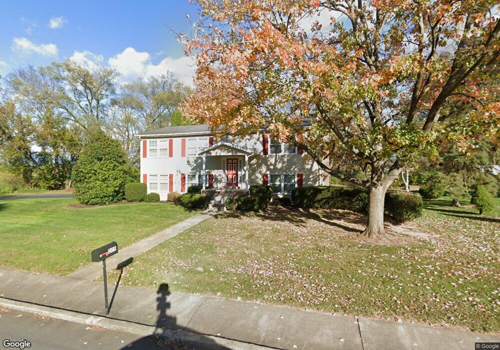
205 Craig Ln Carlisle, PA 17013
Estimated Value: $316,947 - $353,000
3
Beds
2
Baths
1,944
Sq Ft
$172/Sq Ft
Est. Value
About This Home
This home is located at 205 Craig Ln, Carlisle, PA 17013 and is currently estimated at $334,737, approximately $172 per square foot. 205 Craig Ln is a home located in Cumberland County with nearby schools including Bellaire Elementary School, Wilson Middle School, and Carlisle Area High School.
Ownership History
Date
Name
Owned For
Owner Type
Purchase Details
Closed on
Feb 11, 2025
Sold by
Grace Baptist Church
Bought by
Grace Baptist Church
Current Estimated Value
Purchase Details
Closed on
Nov 16, 2016
Sold by
Campbell David and Campbell Mairi
Bought by
Grace Baptist Church
Purchase Details
Closed on
Jul 15, 2011
Sold by
Grace Baptist Church
Bought by
Campbell David
Create a Home Valuation Report for This Property
The Home Valuation Report is an in-depth analysis detailing your home's value as well as a comparison with similar homes in the area
Home Values in the Area
Average Home Value in this Area
Purchase History
| Date | Buyer | Sale Price | Title Company |
|---|---|---|---|
| Grace Baptist Church | -- | None Listed On Document | |
| Grace Baptist Church | $182,500 | Attorney | |
| Campbell David | $138,000 | -- |
Source: Public Records
Tax History Compared to Growth
Tax History
| Year | Tax Paid | Tax Assessment Tax Assessment Total Assessment is a certain percentage of the fair market value that is determined by local assessors to be the total taxable value of land and additions on the property. | Land | Improvement |
|---|---|---|---|---|
| 2025 | $4,392 | $186,500 | $42,200 | $144,300 |
| 2024 | $4,266 | $186,500 | $42,200 | $144,300 |
| 2023 | $4,071 | $186,500 | $42,200 | $144,300 |
| 2022 | $4,013 | $186,500 | $42,200 | $144,300 |
| 2021 | $3,955 | $186,500 | $42,200 | $144,300 |
| 2020 | $3,872 | $186,500 | $42,200 | $144,300 |
| 2019 | $3,791 | $186,500 | $42,200 | $144,300 |
| 2018 | $3,710 | $186,500 | $42,200 | $144,300 |
| 2017 | $3,636 | $186,500 | $42,200 | $144,300 |
| 2016 | -- | $186,500 | $42,200 | $144,300 |
| 2015 | -- | $186,500 | $42,200 | $144,300 |
| 2014 | -- | $186,500 | $42,200 | $144,300 |
Source: Public Records
Map
Nearby Homes
- 61 Bennington Way
- 912 Forbes Rd
- 670 W Louther St
- 13 Shillington Ln
- 944 W North St
- 34 Donegal Dr
- 232 Cherry St
- 0 Cherry St
- 1339 Georgetown Cir
- 2 Bennington Way
- 10 Cheltenham Ln
- 12 Cheltenham Ln
- 404 W Penn St
- 51 Bennington Way
- Carter Plan at Grange - Single Family
- Corby Plan at Grange - Single Family
- Arundel Plan at Grange - Single Family
- Royston Plan at Grange - Single Family
- Elgin Plan at Grange - Single Family
- Anders Plan at Grange - Single Family