Estimated Value: $156,000 - $181,000
About This Home
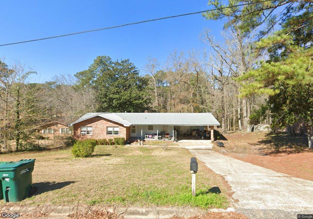
This home is located at 205 Deerpath St, Ozark, AL 36360 and is currently estimated at $167,041, approximately $87 per square foot. 205 Deerpath St is a home located in Dale County with nearby schools including Lisenby Primary School, Mixon Intermediate School, and D. A. Smith Middle School.
Ownership History
We collect this data history from publicly available records. To have your information removed, we recommend requesting removal directly through your county’s website.
Purchase Details
Home Financials for this Owner
Home Financials are based on the most recent Mortgage that was taken out on this home.Purchase Details
Purchase History
We collect this data history from publicly available records. To have your information removed, we recommend requesting removal directly through your county’s website.
| Date | Buyer | Sale Price | Title Company |
|---|---|---|---|
| $130,000 | None Available | ||
| -- | -- |
Mortgage History
We collect this data history from publicly available records. To have your information removed, we recommend requesting removal directly through your county’s website.
| Date | Status | Borrower | Loan Amount |
|---|---|---|---|
| Open | $130,000 |
Tax History
We collect this data history from publicly available records. To have your information removed, we recommend requesting removal directly through your county’s website.
| Year | Tax Paid | Tax Assessment Tax Assessment Total Assessment is a certain percentage of the fair market value that is determined by local assessors to be the total taxable value of land and additions on the property. | Land | Improvement |
|---|---|---|---|---|
| 2025 | $891 | $17,640 | $320 | $17,320 |
| 2024 | $891 | $16,500 | $540 | $15,960 |
| 2023 | $833 | $15,280 | $540 | $14,740 |
| 2022 | $944 | $18,700 | $7,700 | $11,000 |
| 2021 | $879 | $17,400 | $1,060 | $16,340 |
| 2020 | $937 | $18,560 | $1,060 | $17,500 |
| 2019 | $937 | $18,560 | $1,060 | $17,500 |
| 2018 | $880 | $17,420 | $1,060 | $16,360 |
| 2017 | $134 | $2,660 | $1,060 | $1,600 |
| 2016 | $129 | $2,560 | $1,060 | $1,500 |
| 2015 | $129 | $2,560 | $1,060 | $1,500 |
| 2014 | $128 | $2,540 | $1,060 | $1,480 |
| 2013 | $127 | $2,540 | $1,060 | $1,480 |
Map
- 153 Berkshire Dr
- 1110 S Union Ave
- Lot 4 Spruce Ln
- 599 Parker Hills Dr
- 359 Spruce Ln
- LOT 2 Sandy Hills Ct
- 358 Spruce Ln
- 13.35 Acres U S 231
- 1.5 Acres U S 231
- 4.3 Acres U S 231
- 370 Spruce Ln
- 759 Pine Ave
- 1.144 Acres S Highway 231
- 167 Oakdale Dr
- 262 Cherry Ln
- 196 Chestnut Dr
- 0000 Magnolia St
- 138 Charles St
- 876 Camilla Ave
- 0 Dogwood Cir
- 241 Deerpath St
- 221 Deerpath St
- 242 Deerpath St
- 242 Deerpath St
- 261 Deerpath St
- 199 Deerpath St
- 202 Deerpath St
- 179 Berkshire Dr
- 196 Deerpath St
- 174 Briarcliff Rd
- 398 Deese Rd
- 110 Deerpath St
- 105 Deerpath St
- 102 Deerpath St
- 166 Deerpath St
- 418 Deese Rd
- 190 Briarcliff Rd
- 178 Berkshire Dr
- 123 Berkshire Dr
- 148 Berkshire Dr
Ask me questions while you tour the home.