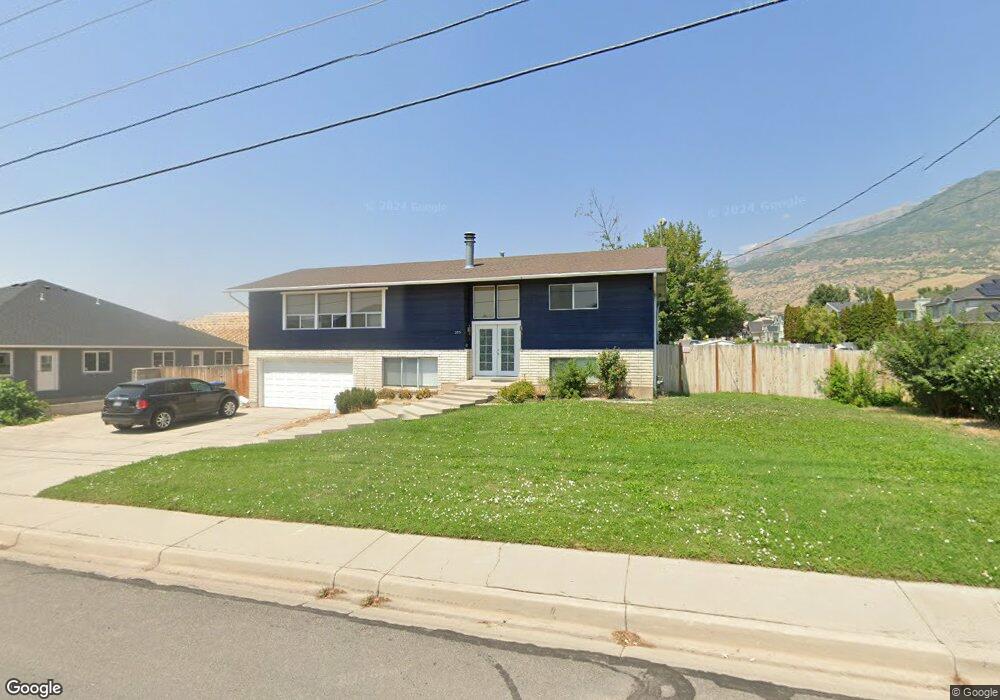
205 E 1600 N Orem, UT 84057
Northridge NeighborhoodEstimated Value: $512,000 - $564,755
5
Beds
2
Baths
2,352
Sq Ft
$227/Sq Ft
Est. Value
About This Home
This home is located at 205 E 1600 N, Orem, UT 84057 and is currently estimated at $534,252, approximately $227 per square foot. 205 E 1600 N is a home located in Utah County with nearby schools including Northridge Elementary School, Oak Canyon Junior High School, and Timpanogos High School.
Ownership History
Date
Name
Owned For
Owner Type
Purchase Details
Closed on
Oct 20, 2021
Sold by
Hp Utah I Llc
Bought by
Sfr Borrower 2021-2 Llc and Hpa Texas Sub 2018-1 Llc
Current Estimated Value
Purchase Details
Closed on
Jul 28, 2021
Sold by
Ferrin Leonard and Marrs Constance
Bought by
Hp Utah I Llc
Purchase Details
Closed on
Aug 21, 2017
Sold by
Ferrin Leonard and Marrs Constance
Bought by
Ferrin Leonard and Marrs Constance
Home Financials for this Owner
Home Financials are based on the most recent Mortgage that was taken out on this home.
Original Mortgage
$9,580
Interest Rate
3.96%
Mortgage Type
Purchase Money Mortgage
Purchase Details
Closed on
Aug 18, 2017
Sold by
Dw Baxter Properties Llc
Bought by
Ferrin Leonard and Marrs Constance M
Home Financials for this Owner
Home Financials are based on the most recent Mortgage that was taken out on this home.
Original Mortgage
$9,580
Interest Rate
3.96%
Mortgage Type
Purchase Money Mortgage
Purchase Details
Closed on
Jun 1, 2016
Sold by
Crosby Renee O and The Renee Crosby Family Trust
Bought by
Baster David W and The Baxter Family Trust
Purchase Details
Closed on
Jul 12, 2005
Sold by
Crosby Renee O
Bought by
Crosby Renee O and Renee Crosby Family Trust
Home Financials for this Owner
Home Financials are based on the most recent Mortgage that was taken out on this home.
Original Mortgage
$20,000
Interest Rate
5.55%
Mortgage Type
New Conventional
Purchase Details
Closed on
Aug 26, 2003
Sold by
Crosby Renee O and Renee Crosby Family Trust
Bought by
Crosby Renee O and Renee Crosby Family Trust
Purchase Details
Closed on
Jul 29, 2003
Sold by
Crosby Herschell S and Crosby Renee O
Bought by
Crosby Renee O
Purchase Details
Closed on
May 19, 2003
Sold by
Crosby Renee O and Crosby Family Trust
Bought by
Crosby Renee O and Renee Crosby Family Trust
Purchase Details
Closed on
Oct 21, 2002
Sold by
Crosby Renee Orvin and Kae Rennette
Bought by
Crosby Renee O and Crosby Family Trust
Purchase Details
Closed on
Sep 20, 2002
Sold by
Crosby Herschel Spurlock and Crosby Renee O
Bought by
Crosby Renee Orvin and Kae Rennette
Create a Home Valuation Report for This Property
The Home Valuation Report is an in-depth analysis detailing your home's value as well as a comparison with similar homes in the area
Home Values in the Area
Average Home Value in this Area
Purchase History
| Date | Buyer | Sale Price | Title Company |
|---|---|---|---|
| Sfr Borrower 2021-2 Llc | -- | Stewart Title | |
| Hp Utah I Llc | -- | Metro National Title | |
| Ferrin Leonard | -- | Utah First Title Ins Agency | |
| Ferrin Leonard | -- | Inwest Title | |
| Baster David W | -- | Southern Utah Title | |
| Crosby Renee O | -- | Horizon Title Insurance | |
| Crosby Renee O | -- | Horizon Title Insurance | |
| Crosby Renee O | -- | -- | |
| Crosby Renee O | -- | -- | |
| Crosby Renee O | -- | -- | |
| Crosby Renee O | -- | -- | |
| Crosby Renee Orvin | -- | -- |
Source: Public Records
Mortgage History
| Date | Status | Borrower | Loan Amount |
|---|---|---|---|
| Previous Owner | Ferrin Leonard | $9,580 | |
| Previous Owner | Ferrin Leonard | $268,742 | |
| Previous Owner | Crosby Renee O | $20,000 |
Source: Public Records
Tax History
| Year | Tax Paid | Tax Assessment Tax Assessment Total Assessment is a certain percentage of the fair market value that is determined by local assessors to be the total taxable value of land and additions on the property. | Land | Improvement |
|---|---|---|---|---|
| 2025 | $2,154 | $275,055 | -- | -- |
| 2024 | $2,154 | $263,450 | $0 | $0 |
| 2023 | $2,035 | $267,410 | $0 | $0 |
| 2022 | $2,064 | $262,790 | $0 | $0 |
| 2021 | $1,792 | $345,600 | $156,400 | $189,200 |
| 2020 | $1,639 | $310,600 | $125,100 | $185,500 |
| 2019 | $1,453 | $286,400 | $125,100 | $161,300 |
| 2018 | $1,481 | $278,800 | $118,000 | $160,800 |
| 2017 | $1,375 | $138,710 | $0 | $0 |
| 2016 | $805 | $132,330 | $0 | $0 |
| 2015 | $1,473 | $129,580 | $0 | $0 |
| 2014 | $1,465 | $128,260 | $0 | $0 |
Source: Public Records
Map
Nearby Homes
- 1636 N 160 E
- 1638 N 160 E
- 363 E 1395 N Unit 22
- 1480 N 430 E
- 1371 N 330 E Unit 8
- 540 E Quail Rd
- 49 W 1880 N
- 723 E 1450 N Unit 25
- 1744 N 280 W
- 1566 N 275 West St Unit 1
- 1548 N 275 West St Unit 2
- 1547 N 275 West St Unit 5
- 372 E 1165 N
- 287 W 1380 N
- 695 E 1870 N
- 332 W Amiron Way Unit D
- 110 S 1320 E
- 1643 N Mountain Oaks Dr
- 713 E 1450 N Unit 23
- 1461 N Amiron Way Unit B
Your Personal Tour Guide
Ask me questions while you tour the home.