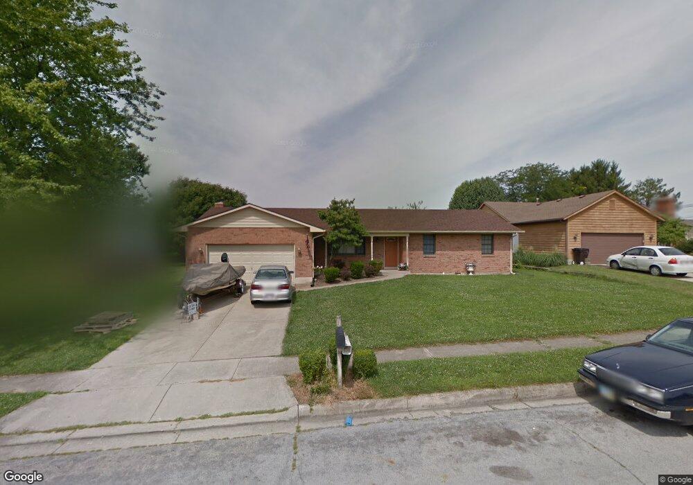
205 E Ellis Dr Waynesville, OH 45068
Wayne Township NeighborhoodEstimated Value: $325,173 - $364,000
3
Beds
2
Baths
1,719
Sq Ft
$201/Sq Ft
Est. Value
About This Home
This home is located at 205 E Ellis Dr, Waynesville, OH 45068 and is currently estimated at $345,543, approximately $201 per square foot. 205 E Ellis Dr is a home located in Warren County with nearby schools including Waynesville Elementary School, Waynesville Middle School, and Waynesville High School.
Ownership History
Date
Name
Owned For
Owner Type
Purchase Details
Closed on
Feb 28, 2006
Sold by
West Anne
Bought by
Agee Bryan D and Agee Jacqueline S
Current Estimated Value
Home Financials for this Owner
Home Financials are based on the most recent Mortgage that was taken out on this home.
Original Mortgage
$122,400
Interest Rate
6.2%
Mortgage Type
Fannie Mae Freddie Mac
Purchase Details
Closed on
Oct 23, 2002
Sold by
Mclaughlin Jerald
Bought by
West Anne
Home Financials for this Owner
Home Financials are based on the most recent Mortgage that was taken out on this home.
Original Mortgage
$60,500
Interest Rate
6.29%
Mortgage Type
New Conventional
Purchase Details
Closed on
May 1, 1987
Sold by
Lucas Robert H and Lucas Charlo
Bought by
Mclaughlin and Mclaughlin Jerald
Purchase Details
Closed on
Dec 15, 1981
Sold by
Waynesville Development &
Purchase Details
Closed on
Aug 4, 1978
Sold by
Waynesville Development I
Create a Home Valuation Report for This Property
The Home Valuation Report is an in-depth analysis detailing your home's value as well as a comparison with similar homes in the area
Home Values in the Area
Average Home Value in this Area
Purchase History
| Date | Buyer | Sale Price | Title Company |
|---|---|---|---|
| Agee Bryan D | $153,000 | Aspen Title Agency Inc | |
| West Anne | $144,000 | -- | |
| Mclaughlin | $11,700 | -- | |
| -- | -- | -- | |
| -- | -- | -- |
Source: Public Records
Mortgage History
| Date | Status | Borrower | Loan Amount |
|---|---|---|---|
| Previous Owner | Agee Bryan D | $122,400 | |
| Previous Owner | West Anne | $60,500 |
Source: Public Records
Tax History Compared to Growth
Tax History
| Year | Tax Paid | Tax Assessment Tax Assessment Total Assessment is a certain percentage of the fair market value that is determined by local assessors to be the total taxable value of land and additions on the property. | Land | Improvement |
|---|---|---|---|---|
| 2024 | $3,811 | $87,160 | $21,000 | $66,160 |
| 2023 | $3,342 | $66,311 | $12,915 | $53,396 |
| 2022 | $3,277 | $66,311 | $12,915 | $53,396 |
| 2021 | $3,156 | $66,311 | $12,915 | $53,396 |
| 2020 | $2,988 | $53,911 | $10,500 | $43,411 |
| 2019 | $2,989 | $53,911 | $10,500 | $43,411 |
| 2018 | $2,990 | $53,911 | $10,500 | $43,411 |
| 2017 | $3,173 | $53,400 | $10,675 | $42,725 |
| 2016 | $2,983 | $53,400 | $10,675 | $42,725 |
| 2015 | $2,988 | $53,400 | $10,675 | $42,725 |
| 2014 | $2,955 | $49,900 | $9,980 | $39,930 |
| 2013 | $2,950 | $52,530 | $10,500 | $42,030 |
Source: Public Records
Map
Nearby Homes
- 60 E Ellis Dr
- 1036 Bayberry Dr
- 1106 Brookfield Dr Unit 1106
- 1198 Lytle Rd
- 460 Miami St
- 53 S 4th St
- 363 Victoria Place
- 350 Somerset Ln
- 196 S 3rd St
- 155 S Main St
- 1 Cumberland Ct
- 0 Ohio 73 Unit 944080
- 401 Wilkerson Ln
- 437 N Main St
- 7219 N Route 42
- 7219 U S 42
- 7219 N Us Rt 42
- 4752 E Lower Springboro Rd
- 3950 E State Route 73
- 4 Corwin Rd
- 195 E Ellis Dr
- 225 E Ellis Dr
- 194 W Ellis Dr
- 185 E Ellis Dr
- 184 W Ellis Dr
- 0 St Rt 73 Unit 1573632
- 0 St Rt 73 Unit 758508
- 0 Old Route 73 Unit 412492
- 111 St Rte 73
- 1 Old Route 73
- 111 St Rte 73
- 0 St Rt 73 Unit 1437115
- 0 St Rt 73 Unit 1457672
- 0 St Rt 73 Unit 1494691
- 0 St Rt 73 Unit 4 1806908
- 0 St Rt 73 Unit 3 1806897
- 0 St Rt 73 Unit 2 1806893
- 0 St Rt 73 Unit 1 1806880
- 0 St Rt 73 Unit 1806908
- 0 St Rt 73 Unit 1806897