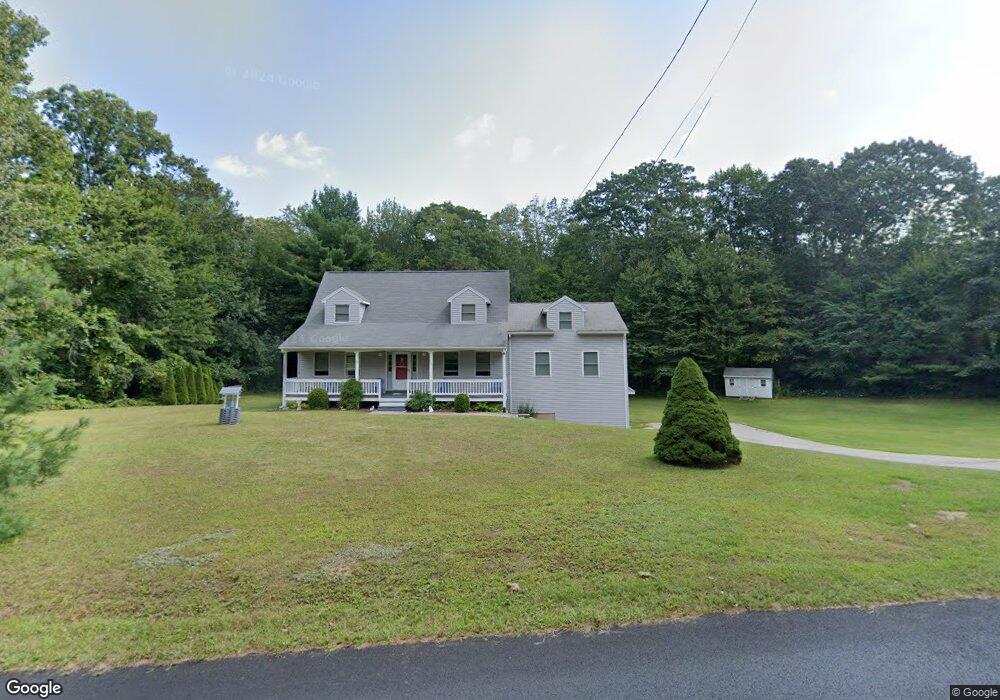
205 Freeman Rd Charlton, MA 01507
Estimated Value: $500,903 - $551,000
3
Beds
3
Baths
1,992
Sq Ft
$263/Sq Ft
Est. Value
About This Home
This home is located at 205 Freeman Rd, Charlton, MA 01507 and is currently estimated at $523,226, approximately $262 per square foot. 205 Freeman Rd is a home located in Worcester County with nearby schools including Shepherd Hill Regional High School and ViewPoint Christian Academy.
Ownership History
Date
Name
Owned For
Owner Type
Purchase Details
Closed on
Feb 4, 2016
Sold by
Gelineau John T and Gelineau Tracy M
Bought by
Gelineau Ft and Gelineau
Current Estimated Value
Purchase Details
Closed on
Jul 16, 1999
Sold by
Gatto Neila and Gatto Patricia A
Bought by
Gelnieau John T and Gelineau Tracy M
Home Financials for this Owner
Home Financials are based on the most recent Mortgage that was taken out on this home.
Original Mortgage
$75,000
Interest Rate
7.39%
Mortgage Type
Purchase Money Mortgage
Purchase Details
Closed on
Feb 8, 1994
Sold by
Burlingame Jeffrey
Bought by
Gatto Neil A and Gatto Patricia
Home Financials for this Owner
Home Financials are based on the most recent Mortgage that was taken out on this home.
Original Mortgage
$120,150
Interest Rate
7.12%
Mortgage Type
Purchase Money Mortgage
Create a Home Valuation Report for This Property
The Home Valuation Report is an in-depth analysis detailing your home's value as well as a comparison with similar homes in the area
Home Values in the Area
Average Home Value in this Area
Purchase History
| Date | Buyer | Sale Price | Title Company |
|---|---|---|---|
| Gelineau Ft | -- | -- | |
| Gelineau Ft | -- | -- | |
| Gelnieau John T | $155,000 | -- | |
| Gelnieau John T | $155,000 | -- | |
| Gatto Neil A | $126,500 | -- | |
| Gatto Neil A | $126,500 | -- |
Source: Public Records
Mortgage History
| Date | Status | Borrower | Loan Amount |
|---|---|---|---|
| Previous Owner | Gatto Neil A | $57,500 | |
| Previous Owner | Gatto Neil A | $75,000 | |
| Previous Owner | Gatto Neil A | $120,150 |
Source: Public Records
Tax History
| Year | Tax Paid | Tax Assessment Tax Assessment Total Assessment is a certain percentage of the fair market value that is determined by local assessors to be the total taxable value of land and additions on the property. | Land | Improvement |
|---|---|---|---|---|
| 2025 | $4,535 | $407,500 | $90,100 | $317,400 |
| 2024 | $4,408 | $388,700 | $90,100 | $298,600 |
| 2023 | $4,255 | $349,600 | $87,100 | $262,500 |
| 2022 | $4,198 | $315,900 | $79,300 | $236,600 |
| 2021 | $3,949 | $263,100 | $75,100 | $188,000 |
| 2020 | $3,886 | $260,100 | $72,100 | $188,000 |
| 2019 | $3,842 | $260,100 | $72,100 | $188,000 |
| 2018 | $3,511 | $260,100 | $72,100 | $188,000 |
| 2017 | $3,401 | $241,200 | $66,100 | $175,100 |
| 2016 | $3,324 | $241,200 | $66,100 | $175,100 |
| 2015 | $3,237 | $241,200 | $66,100 | $175,100 |
| 2014 | $2,943 | $232,500 | $68,700 | $163,800 |
Source: Public Records
Map
Nearby Homes
- 0 Freeman Rd Unit 73369281
- 2 Lelandville Rd
- 3 Lelandville Rd
- L2 Partridge Hill Rd
- L3 Partridge Hill Rd
- 2 Potter Village Rd
- 91 Burlingame Rd
- 0 Blood Rd
- 7 King Rd
- 58 Lelandville Rd
- 60 Saundersdale Rd
- 164 Oxford Rd
- 8 Wamsutta Ridge Rd
- 7 L Stevens Rd Unit B
- 9 L Stevens Rd Unit B
- 9 L Stevens Rd Unit A
- 82 Prince Rd
- 25 N Main St Unit A
- 8 Northside Rd
- 0 Old Southbridge Rd
- 199 Freeman Rd
- 209 Freeman Rd
- 0 Haggerty Rd
- 202 Freeman Rd
- 211 Freeman Rd
- 193 Freeman Rd
- 214 Freeman Rd
- 0 Ramshorn Rd
- 3 Ramshorn Rd Unit 6
- Lot 1 Ramshorn Rd
- 200 Freeman Rd
- 200A Freeman Rd
- 2 Haggerty Rd
- Lot 6.3 Ramshorn Rd
- 131 Number 6 Schoolhouse Rd
- 5 Ramshorn Rd
- 5 Ramshorn Rd
- 5 Ramshorn Rd
- 119 Number 6 Schoolhouse Rd
- 6 Haggerty Rd
Your Personal Tour Guide
Ask me questions while you tour the home.