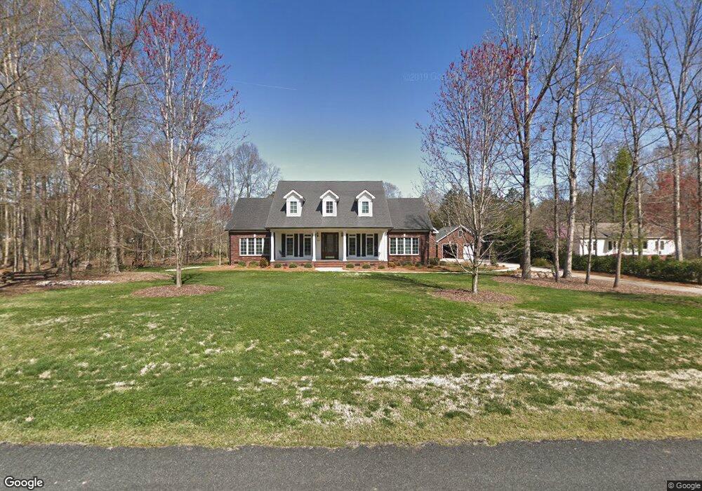
205 Frontier Cir China Grove, NC 28023
Estimated Value: $477,000 - $640,340
--
Bed
4
Baths
3,135
Sq Ft
$188/Sq Ft
Est. Value
About This Home
This home is located at 205 Frontier Cir, China Grove, NC 28023 and is currently estimated at $588,335, approximately $187 per square foot. 205 Frontier Cir is a home located in Rowan County with nearby schools including China Grove Elementary School, China Grove Middle School, and Jesse C Carson High School.
Ownership History
Date
Name
Owned For
Owner Type
Purchase Details
Closed on
Feb 24, 2004
Sold by
Fannie Mae
Bought by
Thomas Barry D and Thomas Carolyn C
Current Estimated Value
Home Financials for this Owner
Home Financials are based on the most recent Mortgage that was taken out on this home.
Original Mortgage
$160,000
Outstanding Balance
$71,253
Interest Rate
5%
Mortgage Type
Purchase Money Mortgage
Estimated Equity
$517,082
Purchase Details
Closed on
Nov 10, 2003
Sold by
Smith George F and Smith Elizabeth D
Bought by
Federal National Mortgage Association
Create a Home Valuation Report for This Property
The Home Valuation Report is an in-depth analysis detailing your home's value as well as a comparison with similar homes in the area
Home Values in the Area
Average Home Value in this Area
Purchase History
| Date | Buyer | Sale Price | Title Company |
|---|---|---|---|
| Thomas Barry D | -- | -- | |
| Federal National Mortgage Association | -- | -- |
Source: Public Records
Mortgage History
| Date | Status | Borrower | Loan Amount |
|---|---|---|---|
| Open | Thomas Barry D | $160,000 |
Source: Public Records
Tax History Compared to Growth
Tax History
| Year | Tax Paid | Tax Assessment Tax Assessment Total Assessment is a certain percentage of the fair market value that is determined by local assessors to be the total taxable value of land and additions on the property. | Land | Improvement |
|---|---|---|---|---|
| 2025 | $3,900 | $582,157 | $40,000 | $542,157 |
| 2024 | $3,900 | $582,157 | $40,000 | $542,157 |
| 2023 | $3,900 | $582,157 | $40,000 | $542,157 |
| 2022 | $2,974 | $397,918 | $32,500 | $365,418 |
| 2021 | $2,953 | $397,918 | $32,500 | $365,418 |
| 2020 | $2,953 | $397,918 | $32,500 | $365,418 |
| 2019 | $2,953 | $397,918 | $32,500 | $365,418 |
| 2018 | $2,495 | $339,070 | $32,500 | $306,570 |
| 2017 | $2,495 | $339,070 | $32,500 | $306,570 |
| 2016 | $2,495 | $339,070 | $32,500 | $306,570 |
| 2015 | $2,533 | $339,070 | $32,500 | $306,570 |
| 2014 | $2,451 | $344,189 | $32,500 | $311,689 |
Source: Public Records
Map
Nearby Homes
- 850 and 830 E Nc 152 Hwy E
- 1925 Mount Hope Church Rd
- 220 Yost Town Rd
- 1660 Lentz Rd
- 145 Ketchie Estates Rd
- 1352 Eva Ln
- 175 Ketchie Estates Rd
- 1335 Brookwood Dr
- 235 Madison Rd
- 1365 Safrit Rd
- TA3000 Plan at Kensington
- Hudson Plan at Kensington
- Devin Plan at Kensington
- Bayside Plan at Kensington
- TA4000 Plan at Kensington
- Kipling Plan at Kensington
- Declan Plan at Kensington
- Montcrest Plan at Kensington
- Jasper Plan at Kensington
- Gideon Plan at Kensington
- 207 Frontier Cir
- 203 Frontier Cir
- 209 Frontier Cir
- 204 Frontier Cir
- 202 Frontier Cir
- 206 Frontier Cir
- 525 Rock Ln
- 301 Frontier Cir
- 113 Frontier Cir
- 204 Timberfield Trail
- 302 Frontier Cir
- 206 Timberfield Trail
- 605 Rock Ln
- 111 Frontier Cir
- 0000 Rock Ln
- 208 Timberfield Trail
- 202 Timberfield Trail
- 104 Frontier Cir
- 109 Frontier Cir
- 304 Frontier Cir