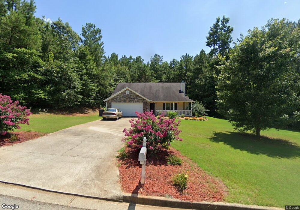
205 Hamilton Dr Mansfield, GA 30055
Jasper County NeighborhoodEstimated Value: $278,665 - $372,000
Studio
2
Baths
1,740
Sq Ft
$188/Sq Ft
Est. Value
About This Home
This home is located at 205 Hamilton Dr, Mansfield, GA 30055 and is currently estimated at $326,416, approximately $187 per square foot. 205 Hamilton Dr is a home located in Jasper County with nearby schools including Jasper County Primary School, Washington Park Elementary School, and Jasper County Middle School.
Ownership History
Date
Name
Owned For
Owner Type
Purchase Details
Closed on
Jan 4, 2005
Sold by
Southern Horizon Realty Gr
Bought by
Leslie Barbara G and Leslie David R
Current Estimated Value
Home Financials for this Owner
Home Financials are based on the most recent Mortgage that was taken out on this home.
Original Mortgage
$133,269
Outstanding Balance
$63,904
Interest Rate
5.61%
Mortgage Type
FHA
Estimated Equity
$262,512
Purchase Details
Closed on
Jul 8, 2004
Sold by
Jones Estates Llc
Bought by
Southern Horizon Realty Group Llc
Create a Home Valuation Report for This Property
The Home Valuation Report is an in-depth analysis detailing your home's value as well as a comparison with similar homes in the area
Home Values in the Area
Average Home Value in this Area
Purchase History
| Date | Buyer | Sale Price | Title Company |
|---|---|---|---|
| Leslie Barbara G | $134,329 | -- | |
| Southern Horizon Realty Group Llc | $20,000 | -- |
Source: Public Records
Mortgage History
| Date | Status | Borrower | Loan Amount |
|---|---|---|---|
| Open | Leslie Barbara G | $133,269 |
Source: Public Records
Tax History
| Year | Tax Paid | Tax Assessment Tax Assessment Total Assessment is a certain percentage of the fair market value that is determined by local assessors to be the total taxable value of land and additions on the property. | Land | Improvement |
|---|---|---|---|---|
| 2025 | $2,461 | $107,880 | $13,600 | $94,280 |
| 2024 | $2,690 | $104,760 | $13,600 | $91,160 |
| 2023 | $2,497 | $97,160 | $12,000 | $85,160 |
| 2022 | $2,484 | $89,960 | $4,800 | $85,160 |
| 2021 | $2,056 | $67,680 | $3,600 | $64,080 |
| 2020 | $2,014 | $63,880 | $3,600 | $60,280 |
| 2019 | $1,956 | $59,880 | $2,000 | $57,880 |
| 2018 | $1,734 | $52,720 | $2,000 | $50,720 |
| 2017 | $1,681 | $50,320 | $2,000 | $48,320 |
| 2016 | $1,445 | $43,160 | $2,000 | $41,160 |
| 2015 | $1,355 | $38,920 | $2,000 | $36,920 |
| 2014 | $1,196 | $34,640 | $2,000 | $32,640 |
Source: Public Records
Map
Nearby Homes
- 1360 Stag Run Dr
- 52 Armstrong Dr Unit 83
- 62 Armstrong Dr Unit 84
- 72 Armstrong Dr Unit 85
- 768 Stag Run Dr
- 82 Armstrong Dr Unit 86
- 1042 Stag Run Dr
- 92 Armstrong Dr Unit 87
- 122 Armstrong Dr Unit 90
- 102 Armstrong Dr Unit 88
- 132 Armstrong Dr Unit 91
- 112 Armstrong Dr Unit 89
- 31 Sourwood Dr
- 206 Bear Creek Point
- 2.8 AC Bear Creek Point
- 4752 County Line Rd
- 376 Doe Ln
- 867 Bear Creek Point
- LOTS 48,49,50 Doe Ln
- 660 Doe Ln
- 243 Hamilton Dr
- 259 Hamilton Dr
- 218 Hamilton Dr
- 299 Hamilton Dr
- 4114 County Line Rd
- 1427 Stag Run Dr
- 1428 Stag Run Dr
- 25 Lance Ct
- 37 Lance Ct
- 290 Hamilton Dr
- 15 Lance Ct
- 1398 Stag Run Dr
- 308 Hamilton Dr
- 1379 Stag Run Dr
- 0 Lance Ct Unit M166436
- 0 Lance Ct Unit 20055073
- 0 Bennett Ln Unit 31 LOTS 7387290
- 868 Stag Run Dr
- 1380 Stag Run Dr
- 868 Stag Run Dr
Your Personal Tour Guide
Ask me questions while you tour the home.