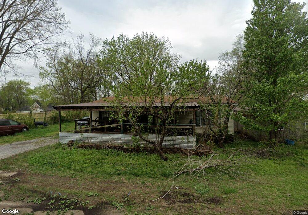
205 Hickory St Prairie Grove, AR 72753
Estimated Value: $134,000 - $230,000
3
Beds
2
Baths
1,120
Sq Ft
$168/Sq Ft
Est. Value
About This Home
This home is located at 205 Hickory St, Prairie Grove, AR 72753 and is currently estimated at $188,246, approximately $168 per square foot. 205 Hickory St is a home located in Washington County with nearby schools including Prairie Grove Elementary School, Prairie Grove Middle School, and Prairie Grove Junior High School.
Ownership History
Date
Name
Owned For
Owner Type
Purchase Details
Closed on
May 5, 2023
Sold by
Commissioner Of State Lands
Bought by
Dickerson Patricia G
Current Estimated Value
Purchase Details
Closed on
Jan 4, 2007
Sold by
Oliver Alta Lee and Oliver Margaret Elizabeth
Bought by
Dickerson Patricia Gayle
Purchase Details
Closed on
Dec 12, 1988
Bought by
Oliver Guy and Alta Lee
Purchase Details
Closed on
Oct 5, 1983
Bought by
Marion Ivan L and Marion Katharine B
Create a Home Valuation Report for This Property
The Home Valuation Report is an in-depth analysis detailing your home's value as well as a comparison with similar homes in the area
Home Values in the Area
Average Home Value in this Area
Purchase History
| Date | Buyer | Sale Price | Title Company |
|---|---|---|---|
| Dickerson Patricia G | $4,796 | None Listed On Document | |
| Dickerson Patricia Gayle | -- | None Available | |
| Oliver Guy | $26,000 | -- | |
| Marion Ivan L | -- | -- |
Source: Public Records
Tax History Compared to Growth
Tax History
| Year | Tax Paid | Tax Assessment Tax Assessment Total Assessment is a certain percentage of the fair market value that is determined by local assessors to be the total taxable value of land and additions on the property. | Land | Improvement |
|---|---|---|---|---|
| 2025 | $935 | $20,510 | $2,000 | $18,510 |
| 2024 | $876 | $20,510 | $2,000 | $18,510 |
| 2023 | $834 | $20,510 | $2,000 | $18,510 |
| 2022 | $758 | $14,040 | $2,000 | $12,040 |
| 2021 | $758 | $14,040 | $2,000 | $12,040 |
| 2020 | $755 | $14,040 | $2,000 | $12,040 |
| 2019 | $1,000 | $18,380 | $3,600 | $14,780 |
| 2018 | $1,000 | $18,380 | $3,600 | $14,780 |
| 2017 | $991 | $18,380 | $3,600 | $14,780 |
| 2016 | $991 | $18,380 | $3,600 | $14,780 |
| 2015 | $991 | $18,380 | $3,600 | $14,780 |
| 2014 | $975 | $18,080 | $3,600 | $14,480 |
Source: Public Records
Map
Nearby Homes
- 601 Westwood Ave
- 4.66 +/- AC Tract 5 Hwy 62 & S Mock St
- 110 Cypress St
- 703 Grant Ave
- 211 Boston St
- Lot 2 Holmes St
- TBD Kate Smith St
- 661 Summer Ln
- 311 S Mock St
- 806 Grant Ave
- 601 Pennington Ave
- 208 N Neal St
- 807 Sedgwick Dr
- 106 S Ozark St
- 813 Grant Ave
- 107 S Ozark St
- 600 Kendra St
- 621 Kendra St
- 740 Kendra St
- 815 Custer St
- 305 W Cleveland St
- 303 W Cleveland St
- 217 W Cleveland St
- 300 W Thurman St
- 206 Hickory St
- 307 W Cleveland St
- 306 W Thurman St
- 214 W Thurman St
- 207 Walnut St
- 308 W Thurman St
- 207 W Cleveland St
- 310 W Thurman St
- 210 W Thurman St
- 219 W Thurman St
- 304 W Cleveland St
- 317 W Cleveland St
- 303 W Thurman St
- 215 W Thurman St
- 104 Heron Prairie Meadows
- 311 W Thurman St