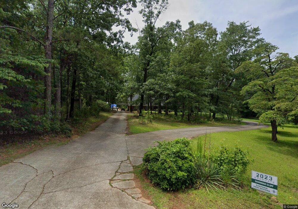
205 High Point Forest Dr Covington, GA 30016
Estimated Value: $549,069 - $680,000
5
Beds
3
Baths
4,302
Sq Ft
$146/Sq Ft
Est. Value
About This Home
This home is located at 205 High Point Forest Dr, Covington, GA 30016 and is currently estimated at $626,267, approximately $145 per square foot. 205 High Point Forest Dr is a home located in Newton County with nearby schools including Heard-Mixon Elementary School, Indian Creek Middle School, and Alcovy High School.
Ownership History
Date
Name
Owned For
Owner Type
Purchase Details
Closed on
Jul 3, 2017
Sold by
Cluff Nathan
Bought by
Cluff Nathan and Cluff Mickie
Current Estimated Value
Home Financials for this Owner
Home Financials are based on the most recent Mortgage that was taken out on this home.
Original Mortgage
$323,921
Outstanding Balance
$268,884
Interest Rate
4.12%
Mortgage Type
FHA
Estimated Equity
$357,383
Create a Home Valuation Report for This Property
The Home Valuation Report is an in-depth analysis detailing your home's value as well as a comparison with similar homes in the area
Home Values in the Area
Average Home Value in this Area
Purchase History
| Date | Buyer | Sale Price | Title Company |
|---|---|---|---|
| Cluff Nathan | -- | -- | |
| Cluff Nathan | $329,900 | -- |
Source: Public Records
Mortgage History
| Date | Status | Borrower | Loan Amount |
|---|---|---|---|
| Open | Cluff Nathan | $323,921 | |
| Closed | Cluff Nathan | $323,921 |
Source: Public Records
Tax History
| Year | Tax Paid | Tax Assessment Tax Assessment Total Assessment is a certain percentage of the fair market value that is determined by local assessors to be the total taxable value of land and additions on the property. | Land | Improvement |
|---|---|---|---|---|
| 2025 | $6,064 | $243,680 | $14,000 | $229,680 |
| 2024 | $5,642 | $222,720 | $14,000 | $208,720 |
| 2023 | $5,187 | $191,160 | $8,800 | $182,360 |
| 2022 | $4,633 | $170,760 | $8,800 | $161,960 |
| 2021 | $4,949 | $163,200 | $8,800 | $154,400 |
| 2020 | $4,748 | $141,320 | $7,680 | $133,640 |
| 2019 | $4,516 | $132,400 | $7,680 | $124,720 |
| 2018 | $4,353 | $126,800 | $7,680 | $119,120 |
| 2017 | $3,479 | $105,240 | $7,680 | $97,560 |
| 2016 | $3,331 | $100,920 | $7,680 | $93,240 |
| 2015 | $3,405 | $103,080 | $7,680 | $95,400 |
| 2014 | $3,396 | $103,080 | $0 | $0 |
Source: Public Records
Map
Nearby Homes
- 12510 Highway 36
- 230 Myrtle Grove Ln
- 219 Channing Cope Rd
- 12895 Highway 36
- 0 Highway 36 Unit 10671092
- 0 Highway 36 Unit 10632443
- 440 Varner St
- 0 Rocky Plains Rd Unit 18248418
- 550 Anderson Creek Rd
- 0 White Laurel Ln Unit 16
- 230 Alcovy Reserve Way
- 60 Laurie Ln
- 30 Laurie Ln
- 0 River Shoals Ct Unit 10620666
- 90 Alcovy Reserve Way
- 70 Alcovy Reserve Way
- 645 5th Ave
- 000 Lower River Rd
- 674 Lower River Rd
- 1599 Lower River Rd
- N High Point Forest Dr
- 0 High Point Forest Dr Unit 8829255
- 215 High Point Forest Dr
- 185 High Point Forest Dr
- 200 Oak Ridge Rd
- 180 High Point Forest Dr
- 255 High Point Forest Dr
- 155 High Point Forest Dr
- 80 Dogwood Terrace
- 60 Dogwood Terrace
- 165 Holly Cir
- 265 High Point Forest Dr
- 270 High Point Forest Dr
- 90 Dogwood Terrace
- 35 Dogwood Terrace
- 210 Oak Ridge Rd
- 160 Holly Cir
- 25 Dogwood Terrace
- 125 High Point Forest Dr
- 145 Holly Cir
Your Personal Tour Guide
Ask me questions while you tour the home.