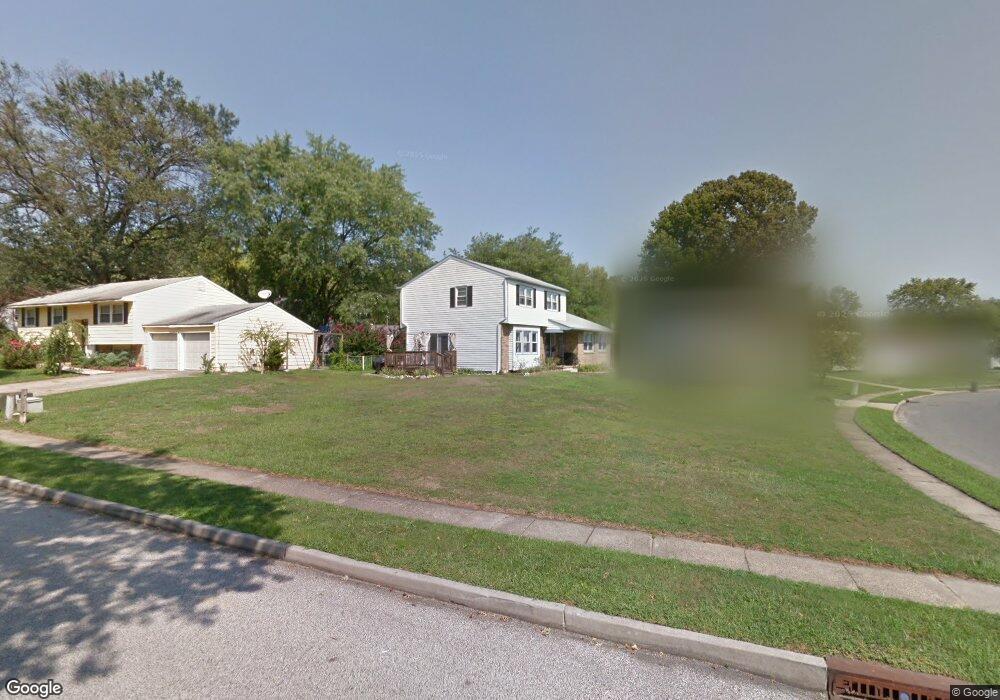
205 Independence Blvd Lawnside, NJ 08045
Estimated Value: $290,000 - $343,000
--
Bed
--
Bath
2,144
Sq Ft
$146/Sq Ft
Est. Value
About This Home
This home is located at 205 Independence Blvd, Lawnside, NJ 08045 and is currently estimated at $313,748, approximately $146 per square foot. 205 Independence Blvd is a home located in Camden County with nearby schools including Lawnside Public Elementary School.
Ownership History
Date
Name
Owned For
Owner Type
Purchase Details
Closed on
Feb 5, 2020
Sold by
Price Tawanda J and Price Lamar P
Bought by
Price Tawanda J and Price Lamar P
Current Estimated Value
Purchase Details
Closed on
Nov 16, 2018
Sold by
Price Miranda P and The Estate Of Joseph Eric Pric
Bought by
Price Tawanda J and Price Lamar P
Purchase Details
Closed on
Nov 30, 1999
Sold by
Geyer Laura E
Bought by
Price Joseph E
Home Financials for this Owner
Home Financials are based on the most recent Mortgage that was taken out on this home.
Original Mortgage
$114,500
Outstanding Balance
$35,952
Interest Rate
7.9%
Mortgage Type
VA
Estimated Equity
$277,796
Create a Home Valuation Report for This Property
The Home Valuation Report is an in-depth analysis detailing your home's value as well as a comparison with similar homes in the area
Home Values in the Area
Average Home Value in this Area
Purchase History
| Date | Buyer | Sale Price | Title Company |
|---|---|---|---|
| Price Tawanda J | -- | None Available | |
| Price Tawanda J | -- | None Available | |
| Price Joseph E | $114,500 | -- |
Source: Public Records
Mortgage History
| Date | Status | Borrower | Loan Amount |
|---|---|---|---|
| Open | Price Joseph E | $114,500 |
Source: Public Records
Tax History Compared to Growth
Tax History
| Year | Tax Paid | Tax Assessment Tax Assessment Total Assessment is a certain percentage of the fair market value that is determined by local assessors to be the total taxable value of land and additions on the property. | Land | Improvement |
|---|---|---|---|---|
| 2025 | $7,608 | $161,500 | $40,500 | $121,000 |
| 2024 | $7,290 | $161,500 | $40,600 | $120,900 |
| 2023 | $7,290 | $161,500 | $40,600 | $120,900 |
| 2022 | $7,090 | $161,500 | $40,600 | $120,900 |
| 2021 | $7,142 | $161,500 | $40,600 | $120,900 |
| 2020 | $6,841 | $161,500 | $40,600 | $120,900 |
| 2019 | $6,730 | $161,500 | $40,600 | $120,900 |
| 2018 | $6,596 | $161,500 | $40,600 | $120,900 |
| 2017 | $6,486 | $161,500 | $40,600 | $120,900 |
| 2016 | $6,329 | $161,500 | $40,600 | $120,900 |
| 2015 | $6,310 | $161,500 | $40,600 | $120,900 |
| 2014 | $6,205 | $161,500 | $40,600 | $120,900 |
Source: Public Records
Map
Nearby Homes
- 523 Carver Ct
- 518 Carver Ct
- 1201 Wayne Rd
- 358 Quaker Rd
- 27 E Phoenix Ave
- 26 E Phoenix Ave
- 95 Lane of Acres
- 425 Peltoma Rd
- 104 Bell Ave
- 0 Thomas Ave S
- 315 Hutchinson Ave
- 35 Colonial Ridge Dr
- 22 Center Oak Ave
- 59 E Oak Ave
- 26 Center Oak Ave
- 134 Kent Rd
- 303 Highland Ave
- 128 E Oak Ave
- 351 Bellevue Ave
- 301 Bradshaw Ave
- 509 Hemmings Way
- 209 Independence Blvd
- 214 John F. Kennedy Blvd
- 220 John F. Kennedy Blvd
- 200 Independence Blvd
- 204 John F. Kennedy Blvd
- 504 Hemmings Way
- 215 Independence Blvd
- 208 Independence Blvd
- 510 Hemmings Way
- 226 John F. Kennedy Blvd
- 120 Independence Blvd
- 516 Hemmings Way
- 221 Independence Blvd
- 114 Independence Blvd
- 505 Carver Ct
- 230 John F. Kennedy Blvd
- 520 Hemmings Way
- 511 Carver Ct
- 408 Independence West Ct