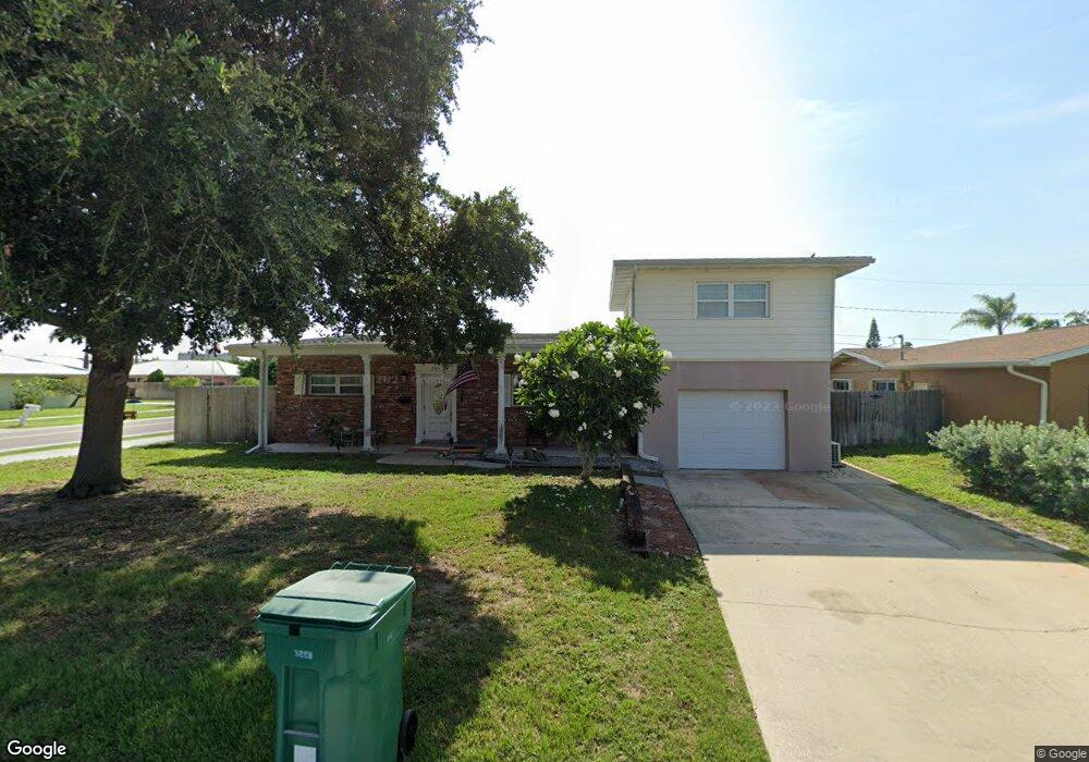
205 Jason Ct Satellite Beach, FL 32937
Estimated Value: $409,000 - $561,000
3
Beds
2
Baths
1,963
Sq Ft
$247/Sq Ft
Est. Value
About This Home
This home is located at 205 Jason Ct, Satellite Beach, FL 32937 and is currently estimated at $485,330, approximately $247 per square foot. 205 Jason Ct is a home located in Brevard County with nearby schools including Satellite Senior High School, Surfside Elementary School, and DeLaura Middle School.
Ownership History
Date
Name
Owned For
Owner Type
Purchase Details
Closed on
Jul 6, 2010
Sold by
Fauchier Todd and Fauchier Todd T
Bought by
Fauchier Todd T and Todd T Fauchier Trust
Current Estimated Value
Purchase Details
Closed on
Jun 26, 1997
Sold by
Wanless Josette
Bought by
Fauchier Todd
Home Financials for this Owner
Home Financials are based on the most recent Mortgage that was taken out on this home.
Original Mortgage
$29,550
Interest Rate
7.93%
Create a Home Valuation Report for This Property
The Home Valuation Report is an in-depth analysis detailing your home's value as well as a comparison with similar homes in the area
Home Values in the Area
Average Home Value in this Area
Purchase History
| Date | Buyer | Sale Price | Title Company |
|---|---|---|---|
| Fauchier Todd T | -- | Attorney | |
| Fauchier Todd | $96,000 | -- |
Source: Public Records
Mortgage History
| Date | Status | Borrower | Loan Amount |
|---|---|---|---|
| Previous Owner | Fauchier Todd | $29,550 |
Source: Public Records
Tax History
| Year | Tax Paid | Tax Assessment Tax Assessment Total Assessment is a certain percentage of the fair market value that is determined by local assessors to be the total taxable value of land and additions on the property. | Land | Improvement |
|---|---|---|---|---|
| 2025 | $2,364 | $160,980 | -- | -- |
| 2024 | $2,320 | $156,450 | -- | -- |
| 2023 | $2,320 | $151,900 | $0 | $0 |
| 2022 | $2,167 | $147,480 | $0 | $0 |
| 2021 | $2,222 | $143,190 | $0 | $0 |
| 2020 | $2,212 | $141,220 | $0 | $0 |
| 2019 | $2,192 | $138,050 | $0 | $0 |
| 2018 | $2,189 | $135,480 | $0 | $0 |
| 2017 | $2,031 | $132,700 | $0 | $0 |
| 2016 | $2,033 | $129,980 | $80,000 | $49,980 |
| 2015 | $2,080 | $129,080 | $70,000 | $59,080 |
| 2014 | $2,081 | $128,060 | $65,000 | $63,060 |
Source: Public Records
Map
Nearby Homes
- 200 Jason Ct
- 348 Sherwood Ave
- 255 Magnolia St
- 325 Park Ave
- 335 Wilson Ave
- 365 Sheridan Ave
- 149 Seawind Dr Unit 21
- 220 Debra Ct
- 150 Roosevelt Ave Unit B
- 280 Grant Ave
- 310 Glenwood Ave
- 1230 Highway A1a Unit 406
- 1230 Highway A1a Unit 507
- 1230 Highway A1a Unit 606
- 1230 Highway A1a Unit 408
- 1230 Highway A1a Unit 404
- 1230 Highway A1a Unit 410
- 1230 Highway A1a Unit 701
- 1230 Highway A1a Unit 405
- 1230 Highway A1a Unit 703
- 215 Jason Ct
- 200 Carole Ct
- 210 Carole Ct
- 225 Jason Ct
- 290 Roosevelt Ave
- 280 Roosevelt Ave
- 210 Jason Ct
- 220 Carole Ct
- 270 Roosevelt Ave
- 298 Roosevelt Ave
- 220 Jason Ct
- 235 Jason Ct
- 260 Roosevelt Ave
- 205 Carole Ct
- 230 Carole Ct
- 205 Orange Street Satellite Beach
- 205 Orange St
- 275 Sheridan Ave
- 285 Sheridan Ave
- 215 Carole Ct
Your Personal Tour Guide
Ask me questions while you tour the home.