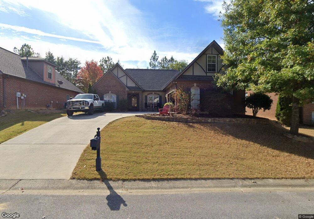
205 Kenniston Dale Pelham, AL 35124
Estimated Value: $359,000 - $422,000
4
Beds
2
Baths
1,899
Sq Ft
$208/Sq Ft
Est. Value
About This Home
This home is located at 205 Kenniston Dale, Pelham, AL 35124 and is currently estimated at $394,179, approximately $207 per square foot. 205 Kenniston Dale is a home located in Shelby County with nearby schools including Pelham Ridge Elementary School, Pelham Park Middle School, and Pelham High School.
Ownership History
Date
Name
Owned For
Owner Type
Purchase Details
Closed on
Aug 29, 2022
Sold by
Ruth Mills Jessica
Bought by
Mills Thomas
Current Estimated Value
Purchase Details
Closed on
Feb 28, 2011
Sold by
Buck Creek Construction Inc
Bought by
Mills Christopher T and Mills Jessica
Home Financials for this Owner
Home Financials are based on the most recent Mortgage that was taken out on this home.
Original Mortgage
$220,685
Interest Rate
3.25%
Mortgage Type
FHA
Purchase Details
Closed on
Jan 15, 2007
Sold by
Mobley Development Inc
Bought by
Buck Creek Construction Inc
Home Financials for this Owner
Home Financials are based on the most recent Mortgage that was taken out on this home.
Original Mortgage
$314,300
Interest Rate
6.12%
Mortgage Type
Unknown
Create a Home Valuation Report for This Property
The Home Valuation Report is an in-depth analysis detailing your home's value as well as a comparison with similar homes in the area
Home Values in the Area
Average Home Value in this Area
Purchase History
| Date | Buyer | Sale Price | Title Company |
|---|---|---|---|
| Mills Thomas | -- | Gregory Fann Law Llc | |
| Mills Christopher T | $226,500 | None Available | |
| Buck Creek Construction Inc | $314,300 | None Available |
Source: Public Records
Mortgage History
| Date | Status | Borrower | Loan Amount |
|---|---|---|---|
| Previous Owner | Mills Christopher T | $220,685 | |
| Previous Owner | Buck Creek Construction Inc | $314,300 |
Source: Public Records
Tax History Compared to Growth
Tax History
| Year | Tax Paid | Tax Assessment Tax Assessment Total Assessment is a certain percentage of the fair market value that is determined by local assessors to be the total taxable value of land and additions on the property. | Land | Improvement |
|---|---|---|---|---|
| 2024 | $2,049 | $35,320 | $0 | $0 |
| 2023 | $2,009 | $35,340 | $0 | $0 |
| 2022 | $1,754 | $30,940 | $0 | $0 |
| 2021 | $1,510 | $26,740 | $0 | $0 |
| 2020 | $1,468 | $26,020 | $0 | $0 |
| 2019 | $1,425 | $25,280 | $0 | $0 |
| 2017 | $1,343 | $23,860 | $0 | $0 |
| 2015 | $1,293 | $23,000 | $0 | $0 |
| 2014 | $1,262 | $22,460 | $0 | $0 |
Source: Public Records
Map
Nearby Homes
- 0 Ballantrae Rd Unit 24141998
- 400 Ballantrae Rd
- 418 Ballantrae Rd
- 425 Ballantrae Rd
- 446 Ballantrae Rd
- 309 MacAllan Dr
- 609 Kirkwall Ln
- 417 Glen Iris Cir
- 205 Perthshire Cove
- 471 Ballantrae Rd
- 213 Perthshire Cove
- 487 Ballantrae Rd
- 114 Gleneagles Ln
- 110 Gleneagles Ln
- 100 Kilkerran Ln
- 1113 Weybridge Cir
- 125 Mcalpin Cir
- 1117 Weybridge Rd
- 116 Mcalpin Cir
- 109 Mcalpin Cir
- 205 Kenniston Dale Unit 1512
- 207 Kenniston Dale
- 203 Kenniston Dale
- 203 Kenniston Dale Unit LOT 1513
- 209 Kenniston Dale
- 201 Kenniston Dale
- 204 Kenniston Dale
- 206 Kenniston Dale
- 211 Kenniston Dale
- 211 Kenniston Dale Unit 1509
- 202 Kenniston Dale
- 208 Kenniston Dale
- 200 Kenniston Dale
- 213 Kenniston Dale
- 213 Kenniston Dale Unit 1508
- 212 Kenniston Dale
- 212 Kenniston Dale Unit LOT 1521
- 215 Kenniston Dale
- 331 Strathaven Cir
- 333 Strathaven Cir