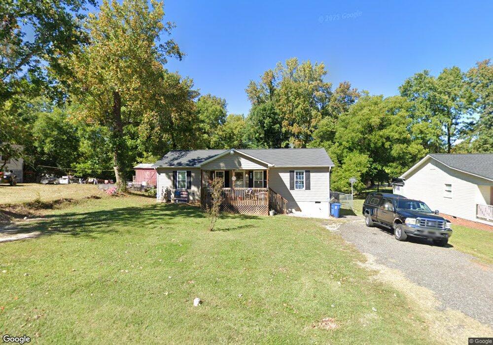
205 Kersey Dr Archdale, NC 27263
Estimated Value: $160,000 - $231,000
--
Bed
--
Bath
1,104
Sq Ft
$184/Sq Ft
Est. Value
About This Home
This home is located at 205 Kersey Dr, Archdale, NC 27263 and is currently estimated at $203,338, approximately $184 per square foot. 205 Kersey Dr is a home with nearby schools including Archdale Elementary School, Wheatmore Middle School, and Trinity High School.
Ownership History
Date
Name
Owned For
Owner Type
Purchase Details
Closed on
Aug 29, 2014
Sold by
Liner Thomas Michael
Bought by
Austin Misty Lynn and Austin Curtis Wayne
Current Estimated Value
Purchase Details
Closed on
Jul 20, 2012
Sold by
Frye Edward Roy
Bought by
Liner Thomas Michael and Liner Brenda K
Purchase Details
Closed on
Jan 21, 2007
Sold by
Ingram Diane and Ingram Kenneth
Bought by
Frye Edward Roy
Create a Home Valuation Report for This Property
The Home Valuation Report is an in-depth analysis detailing your home's value as well as a comparison with similar homes in the area
Home Values in the Area
Average Home Value in this Area
Purchase History
| Date | Buyer | Sale Price | Title Company |
|---|---|---|---|
| Austin Misty Lynn | -- | None Available | |
| Liner Thomas Michael | $8,000 | None Available | |
| Frye Edward Roy | -- | None Available |
Source: Public Records
Tax History Compared to Growth
Tax History
| Year | Tax Paid | Tax Assessment Tax Assessment Total Assessment is a certain percentage of the fair market value that is determined by local assessors to be the total taxable value of land and additions on the property. | Land | Improvement |
|---|---|---|---|---|
| 2025 | $1,742 | $167,480 | $20,260 | $147,220 |
| 2024 | $1,726 | $167,480 | $20,260 | $147,220 |
| 2023 | $1,726 | $167,480 | $20,260 | $147,220 |
| 2022 | $1,451 | $122,470 | $16,340 | $106,130 |
| 2021 | $1,451 | $122,470 | $16,340 | $106,130 |
| 2020 | $1,418 | $122,470 | $16,340 | $106,130 |
| 2019 | $1,418 | $122,470 | $16,340 | $106,130 |
| 2018 | $1,153 | $97,050 | $15,680 | $81,370 |
| 2016 | $1,130 | $97,047 | $15,680 | $81,367 |
| 2015 | $1,132 | $97,047 | $15,680 | $81,367 |
Source: Public Records
Map
Nearby Homes
- 10844 N Main St
- 706 E Fairfield Rd
- 600 E Fairfield Rd
- 327 Wynnewood Dr
- 1020 Westbrook Ct
- 10812, 10822, 10828 N Main St
- 112 Havenwood Dr
- 3820 David St
- 512 Dale St
- 3813 Salisbury St
- 302 Brittany Way
- 1009 Harb Dr
- 102 Quakerwood Dr
- 1011 Harb Dr
- 1010 Harb Dr
- 1103 Pegram Ave
- 926 Norton St
- 1027 Harb Dr
- 2708 Ernest St
- 2716 Allen Jay Rd
- 207 Kersey Dr
- 203 Kersey Dr
- 0 Kersey Dr
- 301 Hayworth St
- 201 Kersey Dr
- 309 Hayworth St
- 206 Kersey Dr
- 214 Kersey Dr
- 104 Northview Place
- 111 Kersey Dr
- 311 Hayworth St
- 102 Northview Place
- 301 Kersey Dr
- 313 Hayworth St
- 306 Hayworth St
- 109 Kersey Dr
- 216 Kersey Dr
- 310 Hayworth St
- 315 Hayworth St
- 207 Liberty Rd