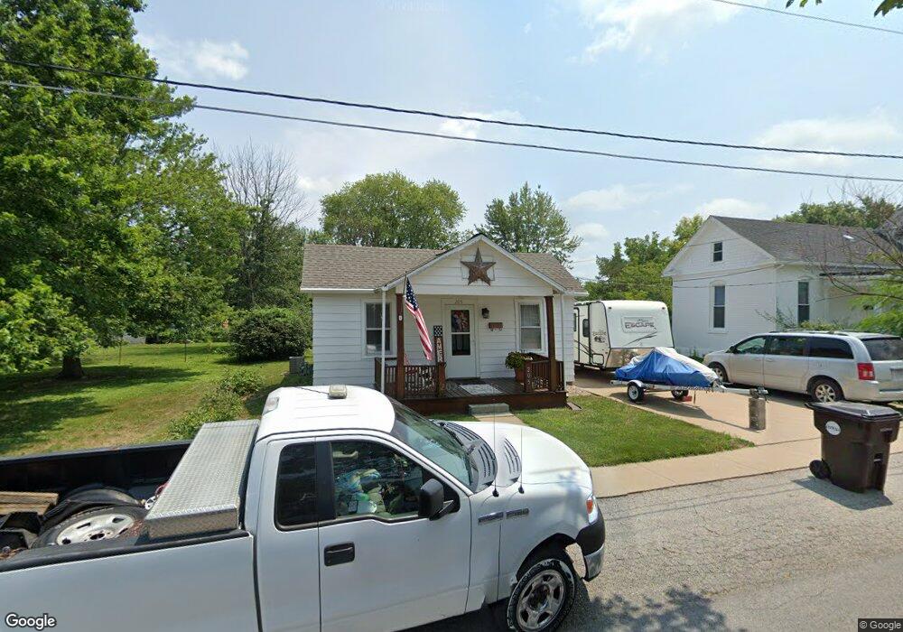
205 Logan St Palmyra, MO 63461
Estimated Value: $107,090 - $168,000
1
Bed
1
Bath
702
Sq Ft
$206/Sq Ft
Est. Value
About This Home
This home is located at 205 Logan St, Palmyra, MO 63461 and is currently estimated at $144,273, approximately $205 per square foot. 205 Logan St is a home with nearby schools including Palmyra Elementary School, Palmyra Middle School, and Palmyra High School.
Ownership History
Date
Name
Owned For
Owner Type
Purchase Details
Closed on
Jan 9, 2008
Sold by
Peters Brandy D and Spicknall Travis K
Bought by
Peters Belinda S
Current Estimated Value
Home Financials for this Owner
Home Financials are based on the most recent Mortgage that was taken out on this home.
Original Mortgage
$48,000
Outstanding Balance
$29,321
Interest Rate
6.07%
Mortgage Type
New Conventional
Estimated Equity
$114,952
Purchase Details
Closed on
Apr 14, 2005
Sold by
Herold Ryan and Herold Angela J
Bought by
Peters Brandy D and Spicknall Travis K
Home Financials for this Owner
Home Financials are based on the most recent Mortgage that was taken out on this home.
Original Mortgage
$28,400
Interest Rate
5.78%
Mortgage Type
New Conventional
Create a Home Valuation Report for This Property
The Home Valuation Report is an in-depth analysis detailing your home's value as well as a comparison with similar homes in the area
Home Values in the Area
Average Home Value in this Area
Purchase History
| Date | Buyer | Sale Price | Title Company |
|---|---|---|---|
| Peters Belinda S | -- | None Available | |
| Peters Brandy D | -- | None Available |
Source: Public Records
Mortgage History
| Date | Status | Borrower | Loan Amount |
|---|---|---|---|
| Open | Peters Belinda S | $48,000 | |
| Closed | Peters Brandy D | $28,400 |
Source: Public Records
Tax History
| Year | Tax Paid | Tax Assessment Tax Assessment Total Assessment is a certain percentage of the fair market value that is determined by local assessors to be the total taxable value of land and additions on the property. | Land | Improvement |
|---|---|---|---|---|
| 2025 | $424 | $7,770 | $1,610 | $6,160 |
| 2024 | $421 | $7,060 | $1,460 | $5,600 |
| 2023 | $422 | $7,060 | $1,460 | $5,600 |
| 2022 | $421 | $7,060 | $1,460 | $5,600 |
| 2021 | $421 | $7,060 | $1,460 | $5,600 |
| 2020 | $390 | $6,420 | $1,330 | $5,090 |
| 2019 | $391 | $6,420 | $1,330 | $5,090 |
| 2018 | $390 | $6,420 | $1,330 | $5,090 |
| 2017 | $319 | $6,420 | $1,330 | $5,090 |
| 2015 | $338 | $6,420 | $1,330 | $5,090 |
| 2014 | $338 | $6,420 | $1,330 | $5,090 |
| 2012 | -- | $6,420 | $0 | $0 |
Source: Public Records
Map
Nearby Homes
- 302 Logan St
- 218 Dingle Ave
- 624 W New St
- 222 W New St
- 222 W Jefferson St
- 323 W Ross St
- 320 W Elm St
- 201 W Massie St
- 222 E Church St
- 116 E Ross St
- 920 S Spring St
- 118 E Elm St
- 815 N Dickerson St
- 1309 Martha St
- 315 Janet Trail
- 4335 Weatherstone
- 4727 Walnut Creek Dr
- 3393 County Road 333
- 3721 Hawk Point
- 9019 Idell Creek Ln
- 121 Logan St
- 721 W Main Cross St
- 717 W Main Cross St
- 118 Logan St
- 122 Logan St
- 803 W Main Cross St Unit CROSS
- 711 W Main Cross St
- 202 Logan St
- 122 S Ashland Ave
- 116 S Ashland Ave
- 703 W Main Cross St
- 703 W Main Cross St Unit CROSS
- 813 W Main Cross St Unit CROSS
- 206 Logan St
- 209 Logan St
- 722 W Main Cross St
- 718 W Main Cross St
- 804 W Main Cross St
- 712 W Main Cross St
- 212 Logan St
Your Personal Tour Guide
Ask me questions while you tour the home.