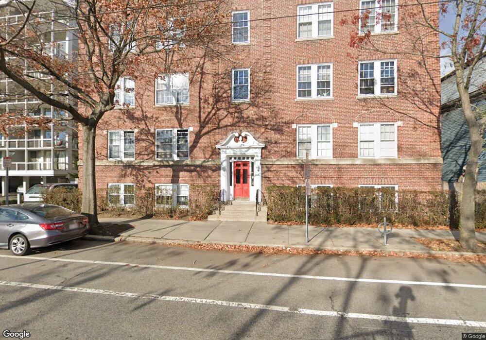
205 Mt Auburn Unit 4B Cambridge, MA 02138
West Cambridge NeighborhoodEstimated Value: $807,000 - $900,000
2
Beds
1
Bath
915
Sq Ft
$929/Sq Ft
Est. Value
About This Home
This home is located at 205 Mt Auburn Unit 4B, Cambridge, MA 02138 and is currently estimated at $850,491, approximately $929 per square foot. 205 Mt Auburn Unit 4B is a home located in Middlesex County with nearby schools including St Peter School, Shady Hill School, and Buckingham Browne & Nichols School.
Ownership History
Date
Name
Owned For
Owner Type
Purchase Details
Closed on
Dec 6, 2007
Sold by
Barth T Fredrik
Bought by
Wikan Unni
Current Estimated Value
Purchase Details
Closed on
Jun 14, 1999
Sold by
Mcginn Jeannette
Bought by
Barth T Fredric and Wikan Unni
Home Financials for this Owner
Home Financials are based on the most recent Mortgage that was taken out on this home.
Original Mortgage
$200,000
Interest Rate
6.9%
Mortgage Type
Purchase Money Mortgage
Purchase Details
Closed on
Jun 3, 1988
Sold by
Baker Lawrence B
Bought by
Darling Jeannette C
Create a Home Valuation Report for This Property
The Home Valuation Report is an in-depth analysis detailing your home's value as well as a comparison with similar homes in the area
Home Values in the Area
Average Home Value in this Area
Purchase History
| Date | Buyer | Sale Price | Title Company |
|---|---|---|---|
| Wikan Unni | -- | -- | |
| Barth T Fredric | $265,000 | -- | |
| Darling Jeannette C | $227,000 | -- |
Source: Public Records
Mortgage History
| Date | Status | Borrower | Loan Amount |
|---|---|---|---|
| Previous Owner | Darling Jeannette C | $200,000 |
Source: Public Records
Tax History Compared to Growth
Tax History
| Year | Tax Paid | Tax Assessment Tax Assessment Total Assessment is a certain percentage of the fair market value that is determined by local assessors to be the total taxable value of land and additions on the property. | Land | Improvement |
|---|---|---|---|---|
| 2025 | $5,009 | $788,800 | $0 | $788,800 |
| 2024 | $4,718 | $797,000 | $0 | $797,000 |
| 2023 | $4,519 | $771,100 | $0 | $771,100 |
| 2022 | $4,481 | $756,900 | $0 | $756,900 |
| 2021 | $4,494 | $768,200 | $0 | $768,200 |
| 2020 | $4,252 | $739,500 | $0 | $739,500 |
| 2019 | $4,070 | $685,200 | $0 | $685,200 |
| 2018 | $3,927 | $624,400 | $0 | $624,400 |
| 2017 | $3,825 | $589,400 | $0 | $589,400 |
| 2016 | $3,737 | $534,600 | $0 | $534,600 |
| 2015 | $3,695 | $472,500 | $0 | $472,500 |
| 2014 | $3,633 | $433,500 | $0 | $433,500 |
Source: Public Records
Map
Nearby Homes
- 20 Maynard Place
- 32 Hawthorn St
- 1010 Memorial Dr Unit 6G
- 988 Memorial Dr Unit 386
- 5 Brewer St Unit 5
- 15 Hubbard Park Rd
- 986 Memorial Dr Unit 404
- 984 Memorial Dr Unit 984-503
- 983 Memorial Dr Unit 502
- 48 Hubbard Park Rd
- 3 Berkeley Place
- 130 Mount Auburn St Unit 108
- 153 Brattle St
- 12 Berkeley St
- 158 Brattle St
- 22 Concord Ave Unit 10
- 975 Memorial Dr Unit 209
- 975 Memorial Dr Unit 211
- 172 Brattle St
- 44 Garden St
- 205 Mount Auburn St Unit 4D
- 205 Mount Auburn St Unit 4C
- 205 Mount Auburn St Unit 4B
- 205 Mount Auburn St Unit 4A
- 205 Mount Auburn St Unit 3D
- 205 Mount Auburn St Unit 3C
- 205 Mount Auburn St Unit 3B
- 205 Mount Auburn St Unit 3A
- 205 Mount Auburn St Unit 2D
- 205 Mount Auburn St Unit 2C
- 205 Mount Auburn St Unit 2B
- 205 Mount Auburn St Unit 2A
- 205 Mount Auburn St Unit 1D
- 205 Mount Auburn St Unit 1C
- 205 Mount Auburn St Unit 1B
- 205 Mount Auburn St Unit 1A
- 205 Mount Auburn St
- 205 Mount Auburn St Unit 2
- 205 Mount Auburn St Unit ask
- 205 Mount Auburn St Unit 20A