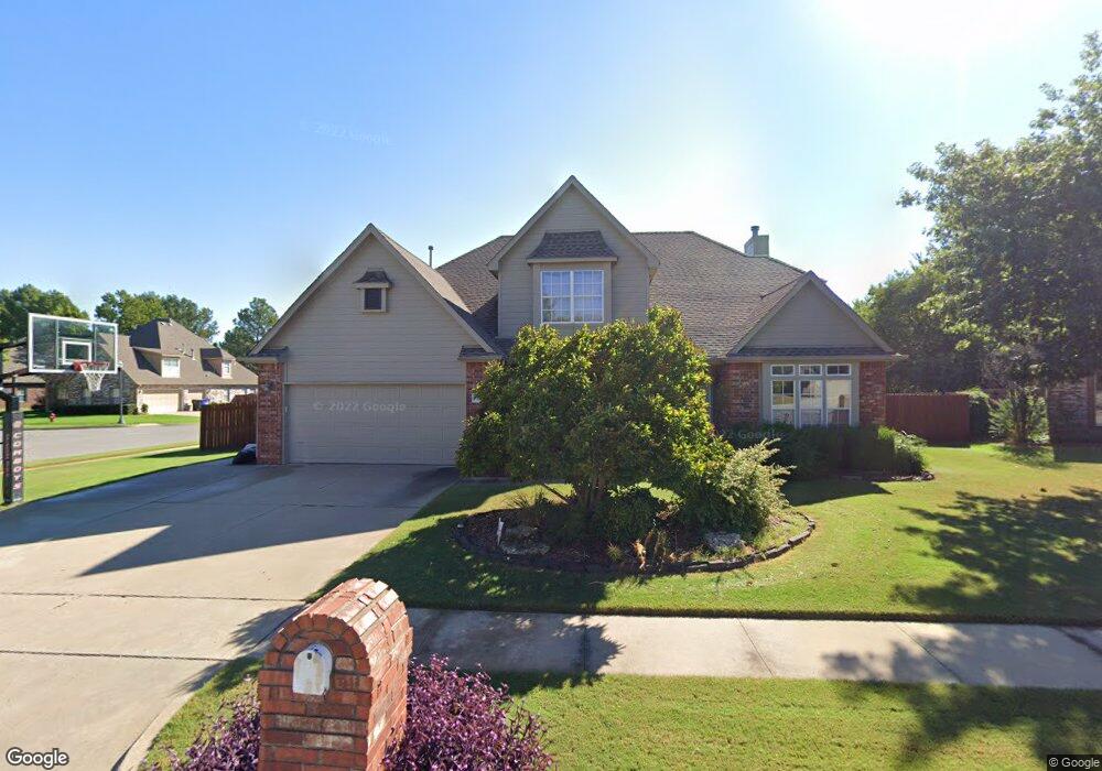
205 N Butternut Cir Broken Arrow, OK 74012
Country Aire Estates NeighborhoodEstimated Value: $381,000 - $414,000
--
Bed
4
Baths
3,113
Sq Ft
$129/Sq Ft
Est. Value
About This Home
This home is located at 205 N Butternut Cir, Broken Arrow, OK 74012 and is currently estimated at $401,851, approximately $129 per square foot. 205 N Butternut Cir is a home located in Tulsa County with nearby schools including Marshall T. Moore Elementary School, Union 8th Grade Center, and Union 6th-7th Grade Center.
Ownership History
Date
Name
Owned For
Owner Type
Purchase Details
Closed on
Jun 1, 1999
Sold by
Green Eric A and Green Gail Kenney
Bought by
Livingston John O and Livingston Lori L
Current Estimated Value
Purchase Details
Closed on
Aug 3, 1998
Sold by
Decuir Jerome J and Decuir Mary M
Bought by
Green Eric A and Green Gail Kenney
Purchase Details
Closed on
Jul 1, 1996
Create a Home Valuation Report for This Property
The Home Valuation Report is an in-depth analysis detailing your home's value as well as a comparison with similar homes in the area
Home Values in the Area
Average Home Value in this Area
Purchase History
| Date | Buyer | Sale Price | Title Company |
|---|---|---|---|
| Livingston John O | $207,000 | -- | |
| Green Eric A | $180,000 | Guaranty Abstract Company | |
| -- | $172,000 | -- |
Source: Public Records
Tax History Compared to Growth
Tax History
| Year | Tax Paid | Tax Assessment Tax Assessment Total Assessment is a certain percentage of the fair market value that is determined by local assessors to be the total taxable value of land and additions on the property. | Land | Improvement |
|---|---|---|---|---|
| 2024 | $3,332 | $26,622 | $2,683 | $23,939 |
| 2023 | $3,332 | $26,818 | $2,871 | $23,947 |
| 2022 | $3,258 | $25,037 | $3,814 | $21,223 |
| 2021 | $3,169 | $24,278 | $3,698 | $20,580 |
| 2020 | $3,190 | $24,278 | $3,698 | $20,580 |
| 2019 | $3,185 | $24,278 | $3,698 | $20,580 |
| 2018 | $3,176 | $24,278 | $3,698 | $20,580 |
| 2017 | $3,218 | $25,278 | $3,850 | $21,428 |
| 2016 | $3,176 | $25,278 | $3,850 | $21,428 |
| 2015 | $3,177 | $25,278 | $3,850 | $21,428 |
| 2014 | $3,159 | $25,278 | $3,850 | $21,428 |
Source: Public Records
Map
Nearby Homes
- 4408 W Elgin St
- 4400 W Freeport Cir
- 4201 W Detroit St
- 4501 W Hartford St
- 708 N Aster Ave
- 418 S Butternut Ave
- 4932 W Commercial St
- 905 N Butternut Ave
- 910 N Butternut Ct
- 10942 E 76th St
- 0 W Houston St Unit 2538461
- 3812 W El Paso St
- 4416 W Indianola St
- 1109 N Cypress Ave
- 2416 W Lansing Place
- 409 N Palm Ave
- 3843 W Galveston Place
- 208 N Nyssa Ave
- 808 S Butternut Ave
- 4419 W Madison St
- 201 N Butternut Cir
- 4409 W Detroit St
- 301 N Aster Place
- 4408 W Detroit St
- 200 N Butternut Cir
- 4412 W Detroit St
- 204 N Butternut Cir
- 305 N Aster Place
- 208 N Butternut Cir
- 4404 W College Ct
- 4405 W Detroit St
- 4500 W Detroit St
- 4400 W College Ct
- 4403 W Detroit Place
- 300 N Aster Ave
- 309 N Aster Place
- 4407 W Detroit Place
- 4408 W College Ct
- 4504 W Detroit St
- 4401 W Detroit St
