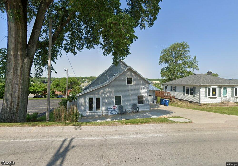
205 N High St Port Byron, IL 61275
Estimated Value: $187,847 - $287,000
2
Beds
1
Bath
1,334
Sq Ft
$165/Sq Ft
Est. Value
About This Home
This home is located at 205 N High St, Port Byron, IL 61275 and is currently estimated at $220,212, approximately $165 per square foot. 205 N High St is a home located in Rock Island County with nearby schools including Riverdale Elementary School, Riverdale Middle School, and Riverdale Senior High School.
Ownership History
Date
Name
Owned For
Owner Type
Purchase Details
Closed on
Feb 20, 2018
Sold by
Creech Teresa G
Bought by
Dennison Melvin E
Current Estimated Value
Create a Home Valuation Report for This Property
The Home Valuation Report is an in-depth analysis detailing your home's value as well as a comparison with similar homes in the area
Home Values in the Area
Average Home Value in this Area
Purchase History
| Date | Buyer | Sale Price | Title Company |
|---|---|---|---|
| Dennison Melvin E | -- | Fisher Kelly |
Source: Public Records
Tax History
| Year | Tax Paid | Tax Assessment Tax Assessment Total Assessment is a certain percentage of the fair market value that is determined by local assessors to be the total taxable value of land and additions on the property. | Land | Improvement |
|---|---|---|---|---|
| 2024 | $4,200 | $61,371 | $8,567 | $52,804 |
| 2023 | $4,200 | $56,304 | $7,860 | $48,444 |
| 2022 | $3,358 | $48,669 | $7,496 | $41,173 |
| 2021 | $3,259 | $46,132 | $7,105 | $39,027 |
| 2020 | $3,203 | $45,450 | $7,000 | $38,450 |
| 2019 | $1,177 | $45,450 | $7,000 | $38,450 |
| 2018 | $1,319 | $47,477 | $5,355 | $42,122 |
| 2017 | $1,299 | $47,477 | $5,355 | $42,122 |
| 2016 | $1,254 | $46,821 | $5,281 | $41,540 |
| 2015 | $1,163 | $20,546 | $5,137 | $15,409 |
| 2014 | $250 | $20,143 | $5,036 | $15,107 |
| 2013 | $250 | $20,143 | $5,036 | $15,107 |
Source: Public Records
Map
Nearby Homes
- 207 N High St
- 107 Hickory St
- 202 Walnut St
- 208 N Main St
- 210 N High St
- 236 N Main St
- 236 N Main St Unit 2
- 204 Walnut St
- 110 N High St
- 103 Hickory St
- 212 N High St
- 301 N High St
- 104 Hickory St
- 108 N High St
- 215 N Main St
- 215 N Main St Unit 215
- 215 N Main St Unit 219
- 215 N Main St Unit 201-2
- 215 N Main St Unit 201-1
- 215 N Main St Unit 1-2
Your Personal Tour Guide
Ask me questions while you tour the home.