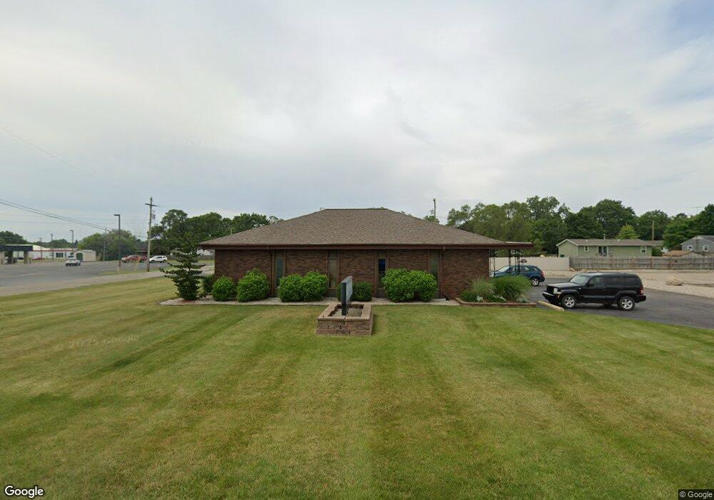
205 N Hintz Rd Owosso, MI 48867
Estimated Value: $273,905
--
Bed
--
Bath
1,800
Sq Ft
$152/Sq Ft
Est. Value
About This Home
This home is located at 205 N Hintz Rd, Owosso, MI 48867 and is currently estimated at $273,905, approximately $152 per square foot. 205 N Hintz Rd is a home located in Shiawassee County with nearby schools including Owosso High School, St. Paul Catholic School, and St. Joseph School.
Ownership History
Date
Name
Owned For
Owner Type
Purchase Details
Closed on
Mar 30, 2015
Sold by
Planned Parenthood
Bought by
Stowell Kirk W and Stowell Coleen A
Current Estimated Value
Home Financials for this Owner
Home Financials are based on the most recent Mortgage that was taken out on this home.
Original Mortgage
$104,000
Outstanding Balance
$80,148
Interest Rate
3.77%
Mortgage Type
Commercial
Estimated Equity
$193,757
Purchase Details
Closed on
Oct 1, 2009
Sold by
Ppecm Properties Inc
Bought by
Planned Parenthood Mid And South Mi
Create a Home Valuation Report for This Property
The Home Valuation Report is an in-depth analysis detailing your home's value as well as a comparison with similar homes in the area
Home Values in the Area
Average Home Value in this Area
Purchase History
| Date | Buyer | Sale Price | Title Company |
|---|---|---|---|
| Stowell Kirk W | -- | None Available | |
| Planned Parenthood | $120,000 | Midstate Title | |
| Planned Parenthood Mid And South Mi | -- | -- |
Source: Public Records
Mortgage History
| Date | Status | Borrower | Loan Amount |
|---|---|---|---|
| Open | Planned Parenthood | $104,000 | |
| Closed | Stowell Kirk W | $104,000 |
Source: Public Records
Tax History Compared to Growth
Tax History
| Year | Tax Paid | Tax Assessment Tax Assessment Total Assessment is a certain percentage of the fair market value that is determined by local assessors to be the total taxable value of land and additions on the property. | Land | Improvement |
|---|---|---|---|---|
| 2025 | $3,773 | $100,400 | $0 | $0 |
| 2024 | $3,773 | $95,300 | $0 | $0 |
| 2023 | $920 | $91,000 | $0 | $0 |
| 2022 | $2,675 | $84,100 | $0 | $0 |
| 2021 | $3,383 | $79,100 | $0 | $0 |
| 2020 | $2,503 | $75,400 | $0 | $0 |
| 2019 | $3,052 | $69,500 | $0 | $0 |
| 2018 | $3,277 | $69,300 | $0 | $0 |
| 2017 | $2,884 | $70,300 | $0 | $0 |
| 2016 | -- | $70,300 | $0 | $0 |
| 2015 | -- | $74,200 | $0 | $0 |
| 2014 | -- | $0 | $0 | $0 |
Source: Public Records
Map
Nearby Homes
- V/L Short St
- Vacant Copas Rd
- 1701 Copas Rd
- 628 Aiken St
- 611 Beck Ave
- 415 Dimmick St
- 624 E Comstock St
- 332 N Dewey St
- 721 Wright Ave
- 1605 Corunna Ave
- 703 Queen St
- 1856 Owosso Ave
- 813 Wiltshire Dr
- 520 E Comstock St
- 915 Corunna Ave
- 724 N Dewey St
- 2010 Kilbourn Ave
- 418 E Oliver St
- 412 N Hickory St
- 1430 Mallard Cir
- 1287 E Exchange St
- 290 Venice Ave
- VACANT N M-52
- 300 Venice Ave
- 1132 Dowling Place
- 1139 E Exchange St
- 305 N Hintz Rd
- 1201 E M 21
- 1208 E Exchange St
- 1128 Dowling Place
- 315 N Hintz Rd
- 1129 E Exchange St
- 1124 Dowling Place
- 307 Venice Ave
- 1200 E Exchange St
- 1120 Dowling Place
- 315 Venice Ave
- 1312 E M 21
- 1125 E Exchange St
- 1312 E Main St