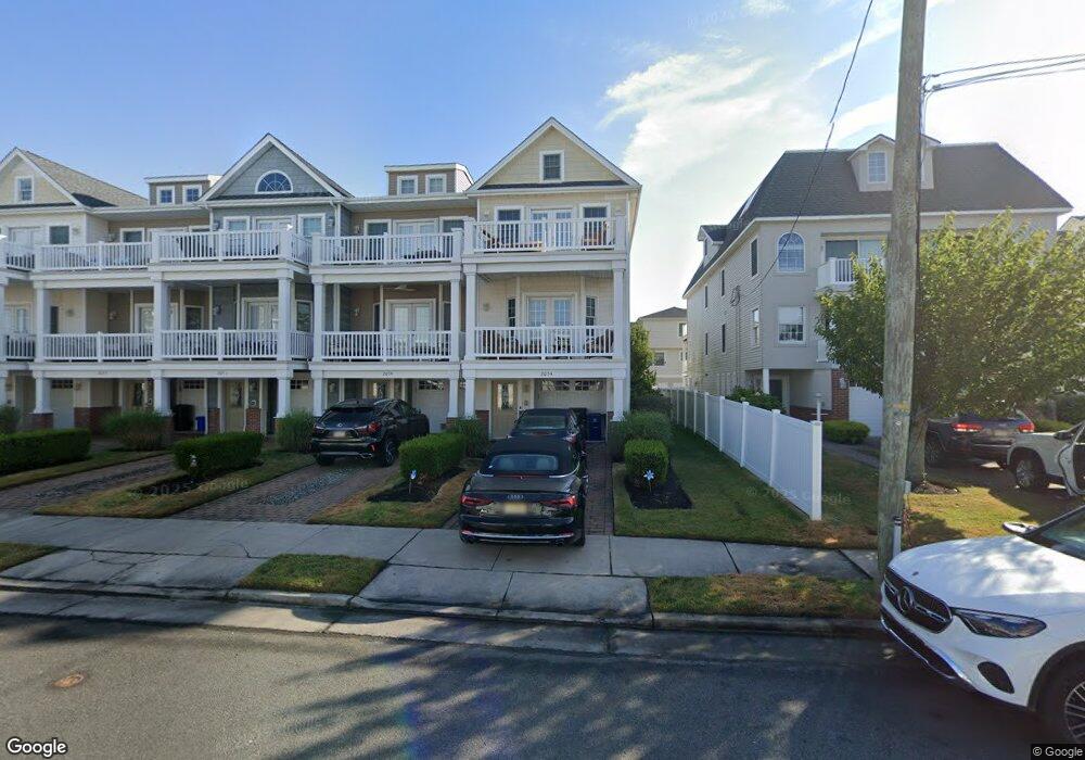
205 N Jefferson Unit B Ave Unit B Margate, NJ 08402
Estimated Value: $1,185,995 - $1,486,000
4
Beds
5
Baths
2,208
Sq Ft
$584/Sq Ft
Est. Value
About This Home
This home is located at 205 N Jefferson Unit B Ave Unit B, Margate, NJ 08402 and is currently estimated at $1,288,499, approximately $583 per square foot. 205 N Jefferson Unit B Ave Unit B is a home located in Atlantic County with nearby schools including William H. Ross III Intermediate School, Eugene A. Tighe Middle School, and Blessed Sacrament Regional School.
Ownership History
Date
Name
Owned For
Owner Type
Purchase Details
Closed on
Nov 10, 2009
Sold by
Jefferson Ventures Llc
Bought by
Leib Stephen and Leib Sharon
Current Estimated Value
Home Financials for this Owner
Home Financials are based on the most recent Mortgage that was taken out on this home.
Original Mortgage
$340,000
Outstanding Balance
$222,120
Interest Rate
5.01%
Mortgage Type
New Conventional
Estimated Equity
$1,066,379
Create a Home Valuation Report for This Property
The Home Valuation Report is an in-depth analysis detailing your home's value as well as a comparison with similar homes in the area
Home Values in the Area
Average Home Value in this Area
Purchase History
| Date | Buyer | Sale Price | Title Company |
|---|---|---|---|
| Leib Stephen | $590,000 | North American Title Agency |
Source: Public Records
Mortgage History
| Date | Status | Borrower | Loan Amount |
|---|---|---|---|
| Open | Leib Stephen | $340,000 |
Source: Public Records
Tax History Compared to Growth
Tax History
| Year | Tax Paid | Tax Assessment Tax Assessment Total Assessment is a certain percentage of the fair market value that is determined by local assessors to be the total taxable value of land and additions on the property. | Land | Improvement |
|---|---|---|---|---|
| 2025 | $8,373 | $490,200 | $158,600 | $331,600 |
| 2024 | $8,373 | $490,200 | $158,600 | $331,600 |
| 2023 | $7,735 | $490,200 | $158,600 | $331,600 |
| 2022 | $7,735 | $490,200 | $158,600 | $331,600 |
| 2021 | $7,628 | $490,200 | $158,600 | $331,600 |
| 2020 | $7,588 | $490,200 | $158,600 | $331,600 |
| 2019 | $7,559 | $490,200 | $158,600 | $331,600 |
| 2018 | $7,662 | $490,200 | $158,600 | $331,600 |
| 2017 | $7,672 | $490,200 | $158,600 | $331,600 |
| 2016 | $7,412 | $490,200 | $158,600 | $331,600 |
| 2015 | $7,294 | $490,200 | $158,600 | $331,600 |
| 2014 | $7,157 | $490,200 | $158,600 | $331,600 |
Source: Public Records
Map
Nearby Homes
- 9411 Monmouth Ave Unit 9
- 9411 Monmouth Ave
- 9500 Amherst Ave Unit 10 aka 9
- 201 N Washington Ave Unit 1
- 201 N Washington Ave Unit 3
- 201 N Washington Ave Unit 5
- 201 N Washington Ave Unit 2
- 201 N Washington Ave Unit 6
- 201 N Washington Ave Unit 4
- 119 N Madison Ave Unit A
- 119 N Madison #B Ave Unit B
- 111 N Madison Ave Unit 2
- 206 N Madison Ave
- 9600 Amherst Ave Unit 7
- 24 N Adams Ave Unit B
- 215 N Decatur Ave
- 107 N Monroe Ave
- 20 N Washington Ave
- 100 N Monroe #2 Ave
- 202 N Harding Ave
- 205 N Jefferson Unit D Ave Unit D
- 205 N Jefferson Unit C Ave Unit C
- 205 N Jefferson Unit A Ave Unit A
- 205 N Jefferson Unit D Ave
- 205 N Jefferson Ave Unit A
- 205 N Jefferson Ave
- 205 N Jefferson Ave Unit D
- 205 N Jefferson Ave Unit E
- 205 N Jefferson Ave
- 205 N Jefferson Ave Unit C
- 205 N Jefferson Ave
- 205 N Jefferson Ave
- 205 N Jefferson Ave Unit 205-C
- 203 N Jefferson Ave
- 203 N Jefferson Ave Unit B
- 203 N Jefferson Ave Unit A
- 203 -B N Jefferson Ave
- 211 N Jefferson Ave
- 211 N Jefferson Ave Unit E
- 201 N Jefferson Ave