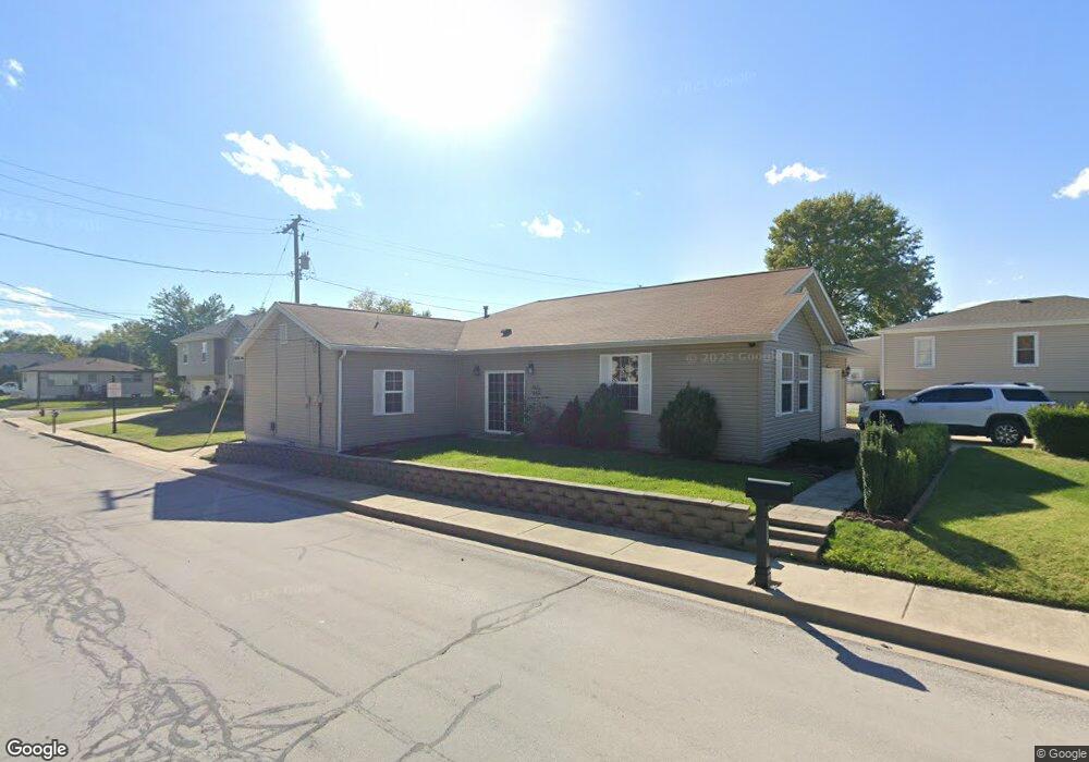
205 N Lange Ave Maryville, IL 62062
Estimated Value: $180,000 - $248,192
4
Beds
3
Baths
1,967
Sq Ft
$106/Sq Ft
Est. Value
About This Home
This home is located at 205 N Lange Ave, Maryville, IL 62062 and is currently estimated at $207,548, approximately $105 per square foot. 205 N Lange Ave is a home located in Madison County with nearby schools including Maryville Elementary School, Dorris Intermediate School, and Collinsville Middle School.
Ownership History
Date
Name
Owned For
Owner Type
Purchase Details
Closed on
Oct 28, 2019
Sold by
Alimi Bafi
Bought by
Dzeladini Muhamed
Current Estimated Value
Purchase Details
Closed on
Dec 17, 2004
Sold by
Thull Harold
Bought by
Alimi Nafi
Home Financials for this Owner
Home Financials are based on the most recent Mortgage that was taken out on this home.
Original Mortgage
$67,200
Interest Rate
6.3%
Mortgage Type
Purchase Money Mortgage
Create a Home Valuation Report for This Property
The Home Valuation Report is an in-depth analysis detailing your home's value as well as a comparison with similar homes in the area
Home Values in the Area
Average Home Value in this Area
Purchase History
| Date | Buyer | Sale Price | Title Company |
|---|---|---|---|
| Dzeladini Muhamed | -- | None Available | |
| Alimi Nafi | $85,000 | Chicago Title Insurance Comp |
Source: Public Records
Mortgage History
| Date | Status | Borrower | Loan Amount |
|---|---|---|---|
| Previous Owner | Alimi Nafi | $67,200 |
Source: Public Records
Tax History Compared to Growth
Tax History
| Year | Tax Paid | Tax Assessment Tax Assessment Total Assessment is a certain percentage of the fair market value that is determined by local assessors to be the total taxable value of land and additions on the property. | Land | Improvement |
|---|---|---|---|---|
| 2024 | $4,499 | $74,720 | $5,510 | $69,210 |
| 2023 | $4,499 | $68,340 | $5,020 | $63,320 |
| 2022 | $4,161 | $63,190 | $4,640 | $58,550 |
| 2021 | $3,715 | $59,370 | $4,360 | $55,010 |
| 2020 | $3,570 | $56,650 | $4,160 | $52,490 |
| 2019 | $2,582 | $42,360 | $4,020 | $38,340 |
| 2018 | $2,511 | $40,130 | $3,810 | $36,320 |
| 2017 | $2,451 | $39,330 | $3,730 | $35,600 |
| 2016 | $2,488 | $39,330 | $3,730 | $35,600 |
| 2015 | $624 | $38,300 | $3,630 | $34,670 |
| 2014 | $624 | $14,530 | $3,630 | $10,900 |
| 2013 | $624 | $38,300 | $3,630 | $34,670 |
Source: Public Records
Map
Nearby Homes
- 201 S Lange Ave
- 419 N Donk Ave
- 137 W Zupan St
- 501 Drost St
- 1005 Daniel Dr
- 1014 Daniel Dr
- 1029 Andra Dr
- 912 Oakridge Dr
- 1313 Jacquelyn Ct
- 130 Hilltop Place
- 1 Heather Green
- 1831 Crimson Oak Dr
- 226 Woodridge Ct
- 1844 Crimson Oak Dr
- 1819 Robin Mills Ct
- 1815 Robins Mill Ct
- 1830 Robin Mills Ct
- 1826 Robin Mills Ct
- 189 Meyer Dr
- 2301 Preswyck Ct
- 209 E Union St
- 207 E Union St
- 207 East Union
- 201 N Lange Ave
- 208 E Zupan St
- 201 E Union St
- 200 N Donk Ave
- 211 E Zupan St
- 115 E Union St
- 205 E Zupan St
- 108 N Donk Ave
- 105 E Union St
- 6216 E Main St
- 109 N Donk Ave
- 6208 E Main St
- 210 E Perry St
- 400 N Lange Ave
- 6316 E Main St
- 101 E Union St
- 400 N Donk Ave