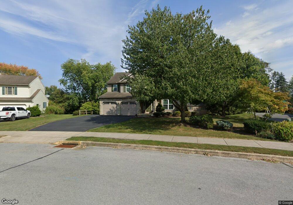
205 N Point Dr Manheim, PA 17545
Estimated Value: $469,000 - $527,000
4
Beds
3
Baths
2,308
Sq Ft
$218/Sq Ft
Est. Value
About This Home
This home is located at 205 N Point Dr, Manheim, PA 17545 and is currently estimated at $502,791, approximately $217 per square foot. 205 N Point Dr is a home located in Lancaster County with nearby schools including Manheim Central Senior High School, Manheim Christian Day School, and Sporting Hill Christian School.
Ownership History
Date
Name
Owned For
Owner Type
Purchase Details
Closed on
Apr 12, 2024
Sold by
Greenwald James P and Greenwald Denine M
Bought by
Greenwald James P
Current Estimated Value
Purchase Details
Closed on
Oct 5, 2007
Sold by
Costello Joseph and Costello Dana E
Bought by
Greenwald James P and Greenwald Denine M
Home Financials for this Owner
Home Financials are based on the most recent Mortgage that was taken out on this home.
Original Mortgage
$160,000
Interest Rate
6.59%
Mortgage Type
Purchase Money Mortgage
Create a Home Valuation Report for This Property
The Home Valuation Report is an in-depth analysis detailing your home's value as well as a comparison with similar homes in the area
Home Values in the Area
Average Home Value in this Area
Purchase History
| Date | Buyer | Sale Price | Title Company |
|---|---|---|---|
| Greenwald James P | -- | None Listed On Document | |
| Greenwald James P | $276,000 | First American Title Ins Co |
Source: Public Records
Mortgage History
| Date | Status | Borrower | Loan Amount |
|---|---|---|---|
| Previous Owner | Greenwald James P | $160,000 |
Source: Public Records
Tax History Compared to Growth
Tax History
| Year | Tax Paid | Tax Assessment Tax Assessment Total Assessment is a certain percentage of the fair market value that is determined by local assessors to be the total taxable value of land and additions on the property. | Land | Improvement |
|---|---|---|---|---|
| 2025 | $6,412 | $266,100 | $69,700 | $196,400 |
| 2024 | $6,412 | $266,100 | $69,700 | $196,400 |
| 2023 | $6,297 | $266,100 | $69,700 | $196,400 |
| 2022 | $6,094 | $266,100 | $69,700 | $196,400 |
| 2021 | $5,911 | $266,100 | $69,700 | $196,400 |
| 2020 | $5,911 | $266,100 | $69,700 | $196,400 |
| 2019 | $5,823 | $266,100 | $69,700 | $196,400 |
| 2018 | $3,698 | $266,100 | $69,700 | $196,400 |
| 2017 | $5,231 | $191,200 | $45,800 | $145,400 |
| 2016 | $5,078 | $191,200 | $45,800 | $145,400 |
| 2015 | $1,680 | $191,200 | $45,800 | $145,400 |
| 2014 | $3,165 | $191,200 | $45,800 | $145,400 |
Source: Public Records
Map
Nearby Homes
- 188 N Main St
- 162 N Charlotte St
- 239 E High St
- 2 S Charlotte St
- 108 110 S Main St
- 27 W Ferdinand St
- 121 Mill St
- 33 W Ferdinand St
- 123 S Main St
- 37 W Ferdinand St
- 55 S Grant St
- 125 S Main St
- 43 W Ferdinand St
- 609 Hamaker Rd
- 218 W Ferdinand St
- 113 S Grant St
- 140 S Charlotte St
- 32 S Fulton St
- 554 Mallard Dr
- 51 S Snyder St
- 201 N Point Dr
- 209 N Point Dr
- 204 N Point Dr
- 213 N Point Dr
- 196 N Laurel St
- 212 N Point Dr
- 204 N Laurel St
- 175 N Linden St
- 190 N Laurel St
- 210 N Laurel St
- 217 N Point Dr
- 204 N Linden St
- 186 N Laurel St
- 216 N Laurel St
- 202 N Linden St
- 206 N Linden St
- 220 N Point Dr
- 173 N Linden St
- 221 N Point Dr
- 174 N Linden St