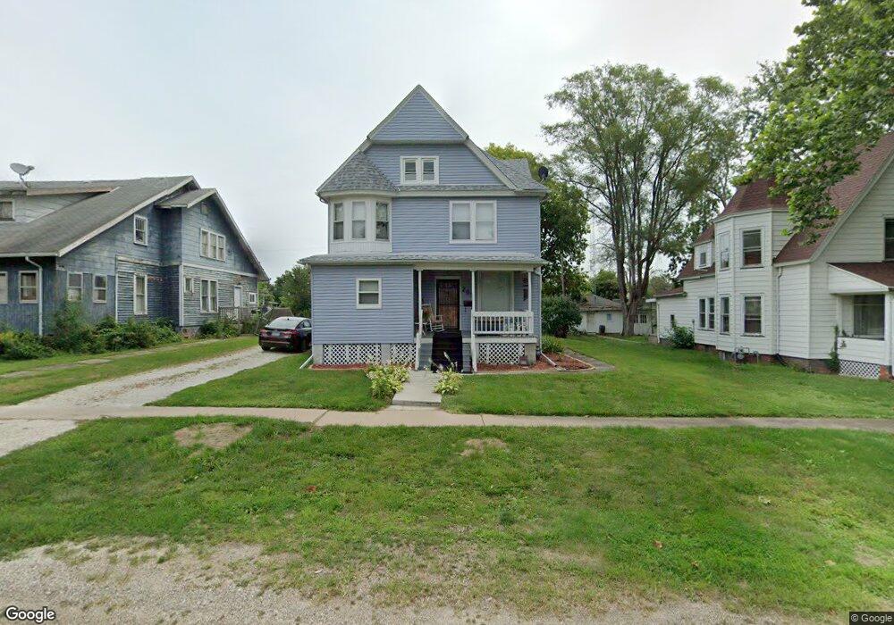
205 N Swarts Ave Abingdon, IL 61410
Estimated Value: $80,367 - $107,000
--
Bed
--
Bath
1,216
Sq Ft
$77/Sq Ft
Est. Value
About This Home
This home is located at 205 N Swarts Ave, Abingdon, IL 61410 and is currently estimated at $93,592, approximately $76 per square foot. 205 N Swarts Ave is a home located in Knox County with nearby schools including Hedding Grade School, Avon Elementary School, and Abingdon-Avon Middle School.
Ownership History
Date
Name
Owned For
Owner Type
Purchase Details
Closed on
Jun 2, 2025
Sold by
Sandoval Marlyn E
Bought by
Cannon Darrell D and Combs Brenna D
Current Estimated Value
Home Financials for this Owner
Home Financials are based on the most recent Mortgage that was taken out on this home.
Original Mortgage
$88,000
Outstanding Balance
$85,526
Interest Rate
6.83%
Mortgage Type
Construction
Estimated Equity
$8,066
Create a Home Valuation Report for This Property
The Home Valuation Report is an in-depth analysis detailing your home's value as well as a comparison with similar homes in the area
Home Values in the Area
Average Home Value in this Area
Purchase History
| Date | Buyer | Sale Price | Title Company |
|---|---|---|---|
| Cannon Darrell D | $90,000 | Attorney Only |
Source: Public Records
Mortgage History
| Date | Status | Borrower | Loan Amount |
|---|---|---|---|
| Open | Cannon Darrell D | $88,000 |
Source: Public Records
Tax History Compared to Growth
Tax History
| Year | Tax Paid | Tax Assessment Tax Assessment Total Assessment is a certain percentage of the fair market value that is determined by local assessors to be the total taxable value of land and additions on the property. | Land | Improvement |
|---|---|---|---|---|
| 2024 | $2,443 | $29,970 | $2,560 | $27,410 |
| 2023 | $2,443 | $27,050 | $2,310 | $24,740 |
| 2022 | $1,293 | $25,710 | $2,200 | $23,510 |
| 2021 | $1,232 | $24,730 | $2,120 | $22,610 |
| 2020 | $1,153 | $23,780 | $2,040 | $21,740 |
| 2019 | $1,174 | $23,540 | $2,020 | $21,520 |
| 2018 | $1,112 | $22,850 | $1,960 | $20,890 |
| 2017 | $1,081 | $22,400 | $1,920 | $20,480 |
| 2015 | -- | $21,960 | $1,880 | $20,080 |
| 2013 | $1,097 | $21,740 | $1,860 | $19,880 |
Source: Public Records
Map
Nearby Homes
- 103 N Swarts St
- 407 W Martin St
- 108 W Jackson St
- 500 N Monroe St
- 204 S Washington St
- 106 E Jackson St
- 214 S Main St
- 206 W Lower St
- 211 S Froelich Ln
- 204 E Adams St
- 306 N Harshbarger St
- 704 N Cherry St
- 405 W Memorial Dr
- 205 N Austin Ave
- 103 W Givens St
- 403 1/2 E Jared St
- 369 Knox Highway 23
- 1196 160th St
- 1077 Knox Road 500 E
- 572 Knox Highway 26
- 207 N Swarts Ave
- 203 N Swarts Ave
- 305 W Jackson St
- 204 N Monroe St
- 202 N Monroe St
- 303 W Jackson St
- 307 W Pearl St
- 206 N Swarts St
- 309 W Pearl St
- 204 N Swarts Ave
- 206 N Swarts Ave
- 202 N Swarts St
- 202 N Swarts Ave
- 200 N Monroe St
- 200 N Swarts Ave
- 300 N Monroe St
- 303 N Swarts Ave
- 308 W Jackson St
- 300 N Swarts Ave
- 309 W Jackson St