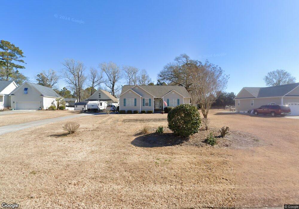
205 Neptune Ct Swansboro, NC 28584
Estimated Value: $430,460 - $499,000
3
Beds
2
Baths
1,669
Sq Ft
$280/Sq Ft
Est. Value
About This Home
This home is located at 205 Neptune Ct, Swansboro, NC 28584 and is currently estimated at $467,365, approximately $280 per square foot. 205 Neptune Ct is a home located in Carteret County with nearby schools including White Oak Elementary School, Broad Creek Middle School, and Croatan High School.
Ownership History
Date
Name
Owned For
Owner Type
Purchase Details
Closed on
Nov 16, 2007
Sold by
Mclamb Katherine P
Bought by
Vogue Sandra M and Vogue Michael D
Current Estimated Value
Purchase Details
Closed on
May 25, 2007
Sold by
Klatt Andrew M and Klatt Jill A
Bought by
Mclamb Katherine P
Purchase Details
Closed on
Jun 21, 2002
Purchase Details
Closed on
Mar 8, 2002
Purchase Details
Closed on
Sep 17, 2001
Purchase Details
Closed on
Mar 22, 2001
Purchase Details
Closed on
Mar 2, 1994
Create a Home Valuation Report for This Property
The Home Valuation Report is an in-depth analysis detailing your home's value as well as a comparison with similar homes in the area
Home Values in the Area
Average Home Value in this Area
Purchase History
| Date | Buyer | Sale Price | Title Company |
|---|---|---|---|
| Vogue Sandra M | -- | None Available | |
| Mclamb Katherine P | $265,000 | None Available | |
| -- | -- | -- | |
| -- | $133,000 | -- | |
| -- | $35,000 | -- | |
| -- | -- | -- | |
| -- | -- | -- |
Source: Public Records
Tax History Compared to Growth
Tax History
| Year | Tax Paid | Tax Assessment Tax Assessment Total Assessment is a certain percentage of the fair market value that is determined by local assessors to be the total taxable value of land and additions on the property. | Land | Improvement |
|---|---|---|---|---|
| 2025 | $2,273 | $467,728 | $132,563 | $335,165 |
| 2024 | $2,048 | $286,758 | $93,420 | $193,338 |
| 2023 | $1,965 | $286,758 | $93,420 | $193,338 |
| 2022 | $1,886 | $286,758 | $93,420 | $193,338 |
| 2021 | $1,886 | $286,758 | $93,420 | $193,338 |
| 2020 | $1,886 | $286,758 | $93,420 | $193,338 |
| 2019 | $1,899 | $297,870 | $93,420 | $204,450 |
| 2017 | $1,735 | $297,870 | $93,420 | $204,450 |
| 2016 | $1,735 | $297,870 | $93,420 | $204,450 |
| 2015 | $1,571 | $297,870 | $93,420 | $204,450 |
| 2014 | $1,130 | $301,283 | $88,740 | $212,543 |
Source: Public Records
Map
Nearby Homes
- 209 Bayside Dr
- 200 Bayside Dr
- 119 Cape Point Blvd
- 111 Cape Point
- 1204 Cedar Point Blvd Unit 50
- 1204 Cedar Point Blvd Unit 14
- 1204 Cedar Point Blvd Unit 73
- 1204 Cedar Point Blvd Unit 119
- 1204 Cedar Point Blvd Unit 6
- 113 Cape Point
- 109 Firefly Cir
- 211 Club Point Dr
- 207 Club Point Dr
- 206 Channel Dr
- 150 Coastline Cir
- 110 Bridge Point Cir
- 226 Royal Oaks Ct
- 107 Magens Way
- 122 Fawn Creek Ct
- 105 Deerfield Ct
- 207 Neptune Ct
- 203 Neptune Ct
- 208 Yaupon Dr
- 206 Yaupon Dr
- 201 Neptune Ct
- 209 Neptune Ct
- 210 Yaupon Dr
- 204 Neptune Ct
- 204 Yaupon Dr
- 206 Neptune Ct
- 200 Neptune Ct
- 202 Neptune Ct
- 105 Yaupon Dr
- 211 Neptune Ct
- 202 Yaupon Dr
- 208 Neptune Ct
- 408 Loma Linda Dr
- 410 Loma Linda Dr
- 406 Loma Linda Dr
- 214 Yaupon Dr