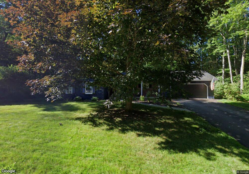
205 Nottingham Rd Auburn, ME 04210
Estimated Value: $368,000 - $407,000
3
Beds
2
Baths
1,392
Sq Ft
$283/Sq Ft
Est. Value
About This Home
This home is located at 205 Nottingham Rd, Auburn, ME 04210 and is currently estimated at $393,986, approximately $283 per square foot. 205 Nottingham Rd is a home located in Androscoggin County with nearby schools including Washburn School, Auburn Middle School, and Edward Little High School.
Ownership History
Date
Name
Owned For
Owner Type
Purchase Details
Closed on
Aug 19, 2021
Sold by
Camp Eugene D
Bought by
Camp Tina M and Camp Eugene D
Current Estimated Value
Purchase Details
Closed on
Jun 19, 2020
Sold by
Mailloux Barbra
Bought by
Camp Eugene D
Home Financials for this Owner
Home Financials are based on the most recent Mortgage that was taken out on this home.
Original Mortgage
$230,000
Interest Rate
3.1%
Mortgage Type
VA
Purchase Details
Closed on
Nov 7, 2014
Sold by
Camp Barbara K
Bought by
Camp Eugene D
Create a Home Valuation Report for This Property
The Home Valuation Report is an in-depth analysis detailing your home's value as well as a comparison with similar homes in the area
Home Values in the Area
Average Home Value in this Area
Purchase History
| Date | Buyer | Sale Price | Title Company |
|---|---|---|---|
| Camp Tina M | -- | None Available | |
| Camp Eugene D | -- | None Available | |
| Camp Eugene D | -- | -- |
Source: Public Records
Mortgage History
| Date | Status | Borrower | Loan Amount |
|---|---|---|---|
| Previous Owner | Camp Eugene D | $230,000 |
Source: Public Records
Tax History Compared to Growth
Tax History
| Year | Tax Paid | Tax Assessment Tax Assessment Total Assessment is a certain percentage of the fair market value that is determined by local assessors to be the total taxable value of land and additions on the property. | Land | Improvement |
|---|---|---|---|---|
| 2024 | $5,972 | $268,400 | $55,900 | $212,500 |
| 2023 | $5,437 | $239,000 | $49,700 | $189,300 |
| 2022 | $5,437 | $239,000 | $49,700 | $189,300 |
| 2021 | $4,759 | $199,800 | $41,400 | $158,400 |
| 2020 | $4,152 | $199,800 | $41,400 | $158,400 |
| 2019 | $4,270 | $199,800 | $41,400 | $158,400 |
| 2018 | $4,258 | $199,800 | $41,400 | $158,400 |
| 2017 | $4,134 | $199,800 | $41,400 | $158,400 |
| 2016 | $4,146 | $200,500 | $41,400 | $159,100 |
| 2015 | $4,048 | $200,500 | $41,400 | $159,100 |
| 2013 | -- | $200,000 | $41,400 | $158,600 |
Source: Public Records
Map
Nearby Homes
- 0 Nottingham Rd
- 200 Nottingham Rd
- 155 Nottingham Rd
- 208 Nottingham Rd
- 87 Locksley Rd
- 71 Locksley Rd
- 197 Nottingham Rd
- 68 Locksley Rd
- 216 Nottingham Rd
- 22 Robin Rd
- 100 Locksley Rd
- 14 Robin Rd
- 95 Locksley Rd
- 61 Nottingham Rd
- 145 Nottingham Rd
- 152 Nottingham Rd
- 75 Nottingham Rd
- 2 Robin Rd
- 85 Nottingham Rd
- 135 Nottingham Rd