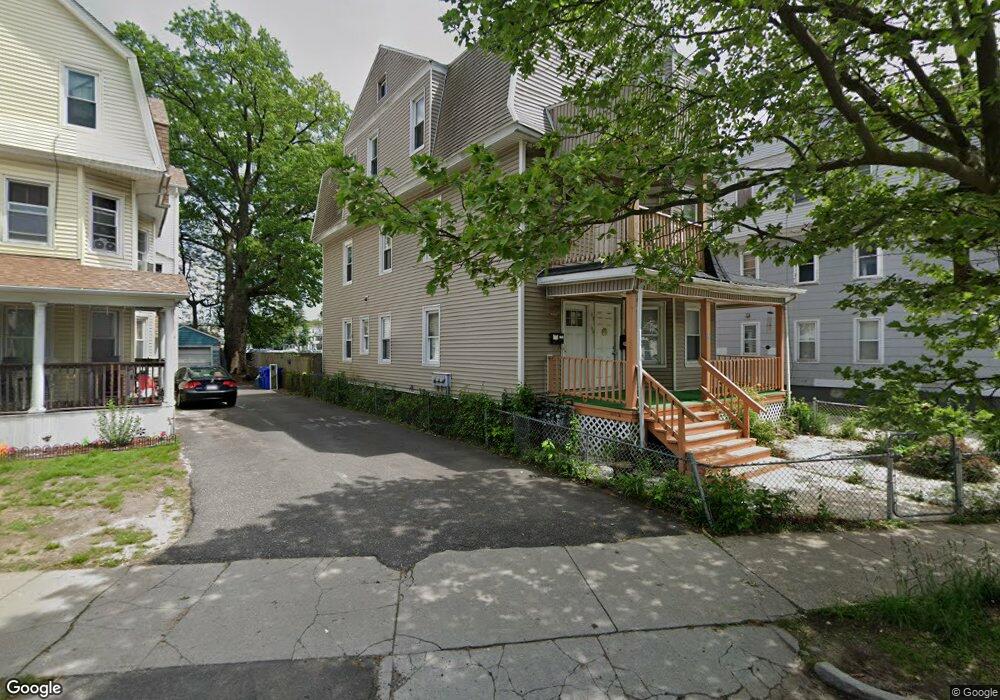
205 Oakland St Unit 207 Springfield, MA 01108
Forest Park NeighborhoodEstimated Value: $271,000 - $403,000
6
Beds
3
Baths
3,117
Sq Ft
$113/Sq Ft
Est. Value
About This Home
This home is located at 205 Oakland St Unit 207, Springfield, MA 01108 and is currently estimated at $353,667, approximately $113 per square foot. 205 Oakland St Unit 207 is a home located in Hampden County with nearby schools including Kensington International School, Forest Park Middle School, and High School Of Commerce.
Ownership History
Date
Name
Owned For
Owner Type
Purchase Details
Closed on
Feb 23, 2009
Sold by
Us Bk
Bought by
Le Lyle T
Current Estimated Value
Purchase Details
Closed on
Jan 21, 2009
Sold by
Gomez Addys P
Bought by
Us Bk
Purchase Details
Closed on
Dec 2, 2004
Sold by
Calo Edwin R and Calo Madeline
Bought by
Gomez Addys P
Home Financials for this Owner
Home Financials are based on the most recent Mortgage that was taken out on this home.
Original Mortgage
$156,600
Interest Rate
5.69%
Mortgage Type
Purchase Money Mortgage
Purchase Details
Closed on
Dec 30, 1993
Sold by
Dymon Mary C
Bought by
Calo Edwin R
Home Financials for this Owner
Home Financials are based on the most recent Mortgage that was taken out on this home.
Original Mortgage
$67,457
Interest Rate
7%
Mortgage Type
Purchase Money Mortgage
Create a Home Valuation Report for This Property
The Home Valuation Report is an in-depth analysis detailing your home's value as well as a comparison with similar homes in the area
Home Values in the Area
Average Home Value in this Area
Purchase History
| Date | Buyer | Sale Price | Title Company |
|---|---|---|---|
| Le Lyle T | $51,000 | -- | |
| Us Bk | $51,300 | -- | |
| Gomez Addys P | $174,000 | -- | |
| Calo Edwin R | $67,000 | -- |
Source: Public Records
Mortgage History
| Date | Status | Borrower | Loan Amount |
|---|---|---|---|
| Previous Owner | Gomez Addys P | $156,600 | |
| Previous Owner | Calo Edwin R | $34,981 | |
| Previous Owner | Calo Edwin R | $6,400 | |
| Previous Owner | Calo Edwin R | $67,457 |
Source: Public Records
Tax History
| Year | Tax Paid | Tax Assessment Tax Assessment Total Assessment is a certain percentage of the fair market value that is determined by local assessors to be the total taxable value of land and additions on the property. | Land | Improvement |
|---|---|---|---|---|
| 2025 | $3,915 | $249,700 | $29,400 | $220,300 |
| 2024 | $3,544 | $220,700 | $29,400 | $191,300 |
| 2023 | $2,794 | $163,900 | $26,700 | $137,200 |
| 2022 | $3,502 | $186,100 | $25,000 | $161,100 |
| 2021 | $3,457 | $182,900 | $22,700 | $160,200 |
| 2020 | $2,806 | $143,700 | $22,700 | $121,000 |
| 2019 | $2,722 | $138,300 | $22,700 | $115,600 |
| 2018 | $2,609 | $136,700 | $22,700 | $114,000 |
| 2017 | $2,609 | $132,700 | $21,300 | $111,400 |
| 2016 | $2,202 | $112,000 | $21,300 | $90,700 |
| 2015 | $2,215 | $112,600 | $21,300 | $91,300 |
Source: Public Records
Map
Nearby Homes
- 202 Oakland St
- 21 Bloomfield St
- 8 Wilmont St
- 195 Orange St
- 7-9 Glendell Terrace
- 172-174 Euclid Ave
- 33 Lansing Place
- 243 Orange St
- 88-90 Beaumont St
- 320 Oakland St
- 106 Malden St
- 99 Wilmont St
- 15-19 Litchfield St
- 49 Euclid Ave
- 55 Malden St
- 122 Bellevue Ave
- 327 Orange St
- 192 White St
- 228 Belmont Ave
- 15 Malden St
- 205-207 Oakland St
- 213 Oakland St
- 201 Oakland St Unit 203
- 211 Oakland St
- 20 Bloomfield St
- 210 Oakland St
- 219 Oakland St
- 217-219 Oakland St
- 217 Oakland St
- 212 Oakland St
- 208 Oakland St
- 218 Oakland St
- 218 Oakland St Unit 1
- 9 Bloomfield St
- 15 Bloomfield St Unit 17
- 17 Bloomfield St
- 15 Bloomfield St Unit 1
- 202/230-32 Oakland St
- 191 Oakland St
- 222 Oakland St
Your Personal Tour Guide
Ask me questions while you tour the home.