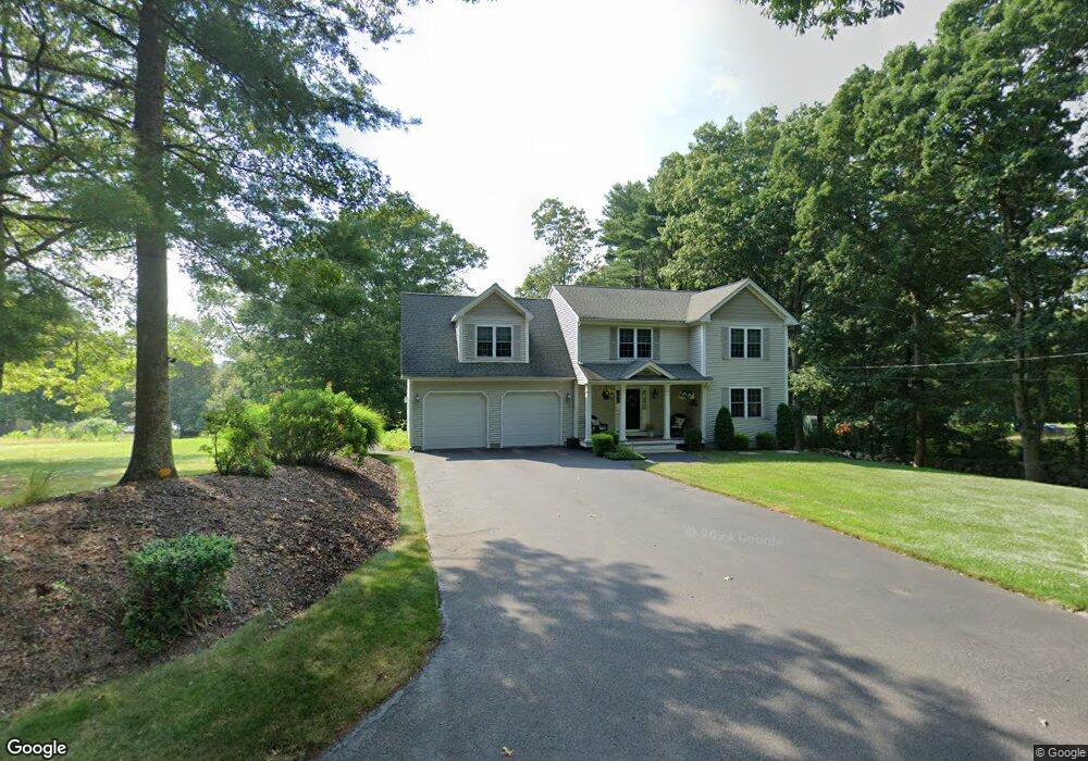
205 Phillips Hill Rd Coventry, RI 02816
Estimated Value: $639,058 - $711,000
3
Beds
3
Baths
2,100
Sq Ft
$316/Sq Ft
Est. Value
About This Home
This home is located at 205 Phillips Hill Rd, Coventry, RI 02816 and is currently estimated at $662,765, approximately $315 per square foot. 205 Phillips Hill Rd is a home located in Kent County with nearby schools including Alan Shawn Feinstein Ms Of Cov and Coventry High School.
Ownership History
Date
Name
Owned For
Owner Type
Purchase Details
Closed on
Feb 3, 2006
Sold by
Contr J and Contr R
Bought by
Varrecchione David B and Varrecchione Diane M
Current Estimated Value
Home Financials for this Owner
Home Financials are based on the most recent Mortgage that was taken out on this home.
Original Mortgage
$260,000
Outstanding Balance
$143,096
Interest Rate
6.31%
Mortgage Type
Purchase Money Mortgage
Estimated Equity
$519,669
Create a Home Valuation Report for This Property
The Home Valuation Report is an in-depth analysis detailing your home's value as well as a comparison with similar homes in the area
Purchase History
| Date | Buyer | Sale Price | Title Company |
|---|---|---|---|
| Varrecchione David B | $435,000 | -- |
Source: Public Records
Mortgage History
| Date | Status | Borrower | Loan Amount |
|---|---|---|---|
| Open | Varrecchione David B | $155,000 | |
| Closed | Varrecchione David B | $160,000 | |
| Open | Varrecchione David B | $260,000 |
Source: Public Records
Tax History
| Year | Tax Paid | Tax Assessment Tax Assessment Total Assessment is a certain percentage of the fair market value that is determined by local assessors to be the total taxable value of land and additions on the property. | Land | Improvement |
|---|---|---|---|---|
| 2025 | $7,393 | $459,500 | $141,600 | $317,900 |
| 2024 | $7,369 | $465,200 | $141,600 | $323,600 |
| 2023 | $7,132 | $465,200 | $141,600 | $323,600 |
| 2022 | $6,983 | $356,800 | $122,700 | $234,100 |
| 2021 | $6,922 | $356,800 | $122,700 | $234,100 |
| 2020 | $7,935 | $356,800 | $122,700 | $234,100 |
| 2019 | $7,035 | $316,300 | $106,300 | $210,000 |
| 2018 | $6,835 | $316,300 | $106,300 | $210,000 |
| 2017 | $6,636 | $316,300 | $106,300 | $210,000 |
| 2016 | $6,806 | $317,900 | $100,500 | $217,400 |
| 2015 | $6,622 | $317,900 | $100,500 | $217,400 |
| 2014 | $6,484 | $317,900 | $100,500 | $217,400 |
| 2013 | $6,391 | $342,500 | $112,300 | $230,200 |
Source: Public Records
Map
Nearby Homes
- 54 Acres of Pine Rd
- 0 Poor Farm Lot 67 Rd
- 380 Ledge Rd
- 630 Whaley Hollow Rd
- 290 Mile Rd
- 0 Hollywood Ave
- 10 Sherwood Valley Ln
- 9 Sherwood Valley Ln
- 25 Hill Farm Camp Rd
- 24 Sherwood Valley Ln
- 15 Friar Tuck Ln
- 33 Sunset Lake Cir
- 65 Sunset Lake Cir
- 7 June Ct
- 9 June Ct
- 2 June Ct
- 5 June Ct
- 5 Tamarack Trail
- 30 Pine Tree Rd
- 14 Audubon Ln
- 187 Phillips Hill Rd
- 241 Phillips Hill Rd
- 236 Phillips Hill Rd
- 246 Phillips Hill Rd
- 208 Phillips Hill Rd
- 261 Phillips Hill Rd
- 256 Phillips Hill Rd
- 184 Phillips Hill Rd
- 228 Phillips Hill Rd
- 168 Phillips Hill Rd
- 161 Phillips Hill Rd
- 282 Phillips Hill Rd Unit 284
- 277 Phillips Hill Rd
- 36 Audubon Ln
- 40 Audubon Ln
- 24 April Ct
- 9 Aster Ln
- 7 Audubon Ln
- 21 Audubon Ln
- 154 Phillips Hill Rd
Your Personal Tour Guide
Ask me questions while you tour the home.