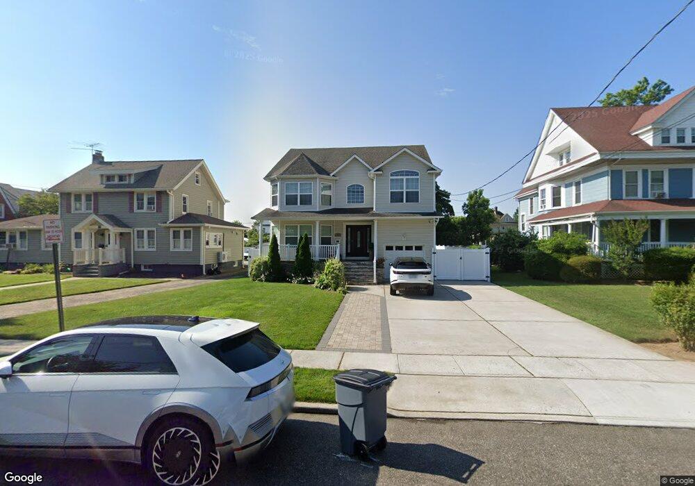
205 Pine St Freeport, NY 11520
Estimated Value: $841,000 - $930,803
Studio
1
Bath
2,752
Sq Ft
$322/Sq Ft
Est. Value
About This Home
This home is located at 205 Pine St, Freeport, NY 11520 and is currently estimated at $885,902, approximately $321 per square foot. 205 Pine St is a home with nearby schools including Columbus Avenue School, Caroline G. Atkinson Intermediate School, and John W Dodd Middle School.
Ownership History
Date
Name
Owned For
Owner Type
Purchase Details
Closed on
Jun 18, 2018
Sold by
Brant Corp
Bought by
Crespo B Inc
Current Estimated Value
Home Financials for this Owner
Home Financials are based on the most recent Mortgage that was taken out on this home.
Original Mortgage
$305,400
Outstanding Balance
$264,711
Interest Rate
4.6%
Mortgage Type
Commercial
Estimated Equity
$621,191
Create a Home Valuation Report for This Property
The Home Valuation Report is an in-depth analysis detailing your home's value as well as a comparison with similar homes in the area
Home Values in the Area
Average Home Value in this Area
Purchase History
| Date | Buyer | Sale Price | Title Company |
|---|---|---|---|
| Crespo B Inc | $509,000 | Fidelity National Title |
Source: Public Records
Mortgage History
| Date | Status | Borrower | Loan Amount |
|---|---|---|---|
| Open | Crespo B Inc | $305,400 |
Source: Public Records
Tax History Compared to Growth
Tax History
| Year | Tax Paid | Tax Assessment Tax Assessment Total Assessment is a certain percentage of the fair market value that is determined by local assessors to be the total taxable value of land and additions on the property. | Land | Improvement |
|---|---|---|---|---|
| 2025 | $7,892 | $544 | $165 | $379 |
| 2024 | $798 | $556 | $169 | $387 |
Source: Public Records
Map
Nearby Homes
- 235 Pine St
- 28 Lexington Ave
- 250 W Merrick Rd Unit 2R
- 250 W Merrick Rd Unit 2 L
- 250 W Merrick Rd Unit 2F
- 190 W Merrick Rd Unit 4E
- 55 S Bergen Place Unit 3F
- 100 S Ocean Ave Unit 3U
- 100 S Ocean Ave Unit 3m
- 222 Smith St Unit 3C
- 222 Smith St Unit 1B
- 194 Smith St Unit 1K
- 194 Smith St Unit 1B
- 194 Smith St Unit 3P
- 187 S Long Beach Ave
- 100 Brooklyn Ave Unit 3S
- 99 Randall Ave Unit 1Q
- 103 Rose St
- 100 Randall Ave Unit 1E
- 124 Smith St Unit 3B
- 211 Pine St
- 211 Pine St
- 209 Pine St
- 219 Pine St
- 20 Porterfield Place
- 204 Pine St
- 24 Porterfield Place
- 24 Porterfield Place
- 30 Porterfield Place
- 210 Pine St
- 200 Pine St
- 18 Porterfield Place
- 225 Pine St
- 216 Pine St
- 36 Porterfield Place
- 220 Pine St
- 86 S Long Beach Ave
- 40 Porterfield Place
- 229 Pine St
- 226 Pine St