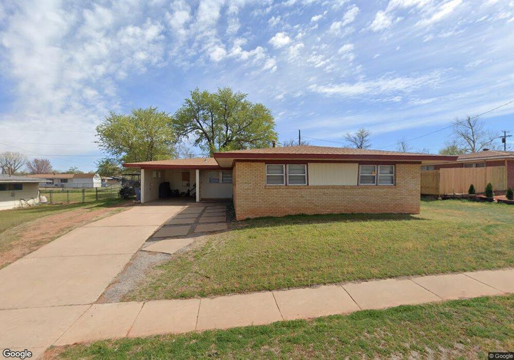
205 Potomac Rd Burns Flat, OK 73647
Estimated Value: $88,000 - $99,000
3
Beds
2
Baths
1,772
Sq Ft
$53/Sq Ft
Est. Value
About This Home
This home is located at 205 Potomac Rd, Burns Flat, OK 73647 and is currently estimated at $94,758, approximately $53 per square foot. 205 Potomac Rd is a home with nearby schools including Will Rogers Elementary School and Burns Flat-Dill City High School.
Ownership History
Date
Name
Owned For
Owner Type
Purchase Details
Closed on
Feb 3, 2021
Sold by
Caves George Thomas and Caves Family Trust
Bought by
Yates Shelton
Current Estimated Value
Home Financials for this Owner
Home Financials are based on the most recent Mortgage that was taken out on this home.
Original Mortgage
$62,403
Outstanding Balance
$55,557
Interest Rate
2.7%
Mortgage Type
Purchase Money Mortgage
Estimated Equity
$39,201
Purchase Details
Closed on
Jun 11, 2020
Sold by
Deenile Revocable Living Trust
Bought by
Yates Shelton
Purchase Details
Closed on
Mar 18, 1997
Sold by
Caves Family Tru
Bought by
Daughtrey D
Create a Home Valuation Report for This Property
The Home Valuation Report is an in-depth analysis detailing your home's value as well as a comparison with similar homes in the area
Purchase History
| Date | Buyer | Sale Price | Title Company |
|---|---|---|---|
| Yates Shelton | -- | Smith Title | |
| Yates Shelton | -- | None Available | |
| Daughtrey D | $20,000 | -- |
Source: Public Records
Mortgage History
| Date | Status | Borrower | Loan Amount |
|---|---|---|---|
| Open | Yates Shelton | $62,403 |
Source: Public Records
Tax History
| Year | Tax Paid | Tax Assessment Tax Assessment Total Assessment is a certain percentage of the fair market value that is determined by local assessors to be the total taxable value of land and additions on the property. | Land | Improvement |
|---|---|---|---|---|
| 2025 | $342 | $4,573 | $110 | $4,463 |
| 2024 | $325 | $4,355 | $110 | $4,245 |
| 2023 | $309 | $4,148 | $110 | $4,038 |
| 2022 | $320 | $3,951 | $110 | $3,841 |
| 2021 | $299 | $3,762 | $110 | $3,652 |
| 2020 | $299 | $3,762 | $110 | $3,652 |
| 2019 | $296 | $3,762 | $110 | $3,652 |
| 2018 | $299 | $3,762 | $110 | $3,652 |
| 2017 | $301 | $3,762 | $110 | $3,652 |
| 2016 | $303 | $3,762 | $110 | $3,652 |
| 2015 | $292 | $3,678 | $110 | $3,568 |
| 2014 | $292 | $3,678 | $110 | $3,568 |
Source: Public Records
Map
Nearby Homes
- 207 Pioneer Way
- 212 Iroquois Trail
- 214 Pawnee Rd
- 107 Cimarron Rd
- 21303 E 990 Rd
- 21238 Highway 73
- 204 Elaine Dr
- 0 I-40 Frontage Road 26 Acres
- 101 Claude St
- 409 S McDonald St
- 12004 N 2110 Rd
- 409 W 5th St
- 112 E Main
- 21508 S Frontage Rd
- 705 S 6th St
- 11117 N 2073 Rd
- 105 E Walk
- 0 E 1220 Rd
- 11747 N 2240 Rd
- 17 E 1040 & Hwy 73 Rd
- 203 Potomac Rd
- 201 Potomac Rd
- 206 Potomac Rd
- 204 Potomac Rd
- 200 Potomac Rd
- 200 Suwannee Rd
- 107 Potomac Rd
- 202 Potomac Rd
- 202 Suwannee Rd
- 201 Pioneer Way
- 111 Pioneer Way
- 204 Suwannee Rd
- 207 Potomac Rd
- 203 Pioneer Way
- 201 Suwannee Rd
- 203 Suwannee Rd
- 109 Pioneer Way
- 107 Suwannee Rd
- 205 Suwannee Rd
- 206 Suwannee Rd
Your Personal Tour Guide
Ask me questions while you tour the home.