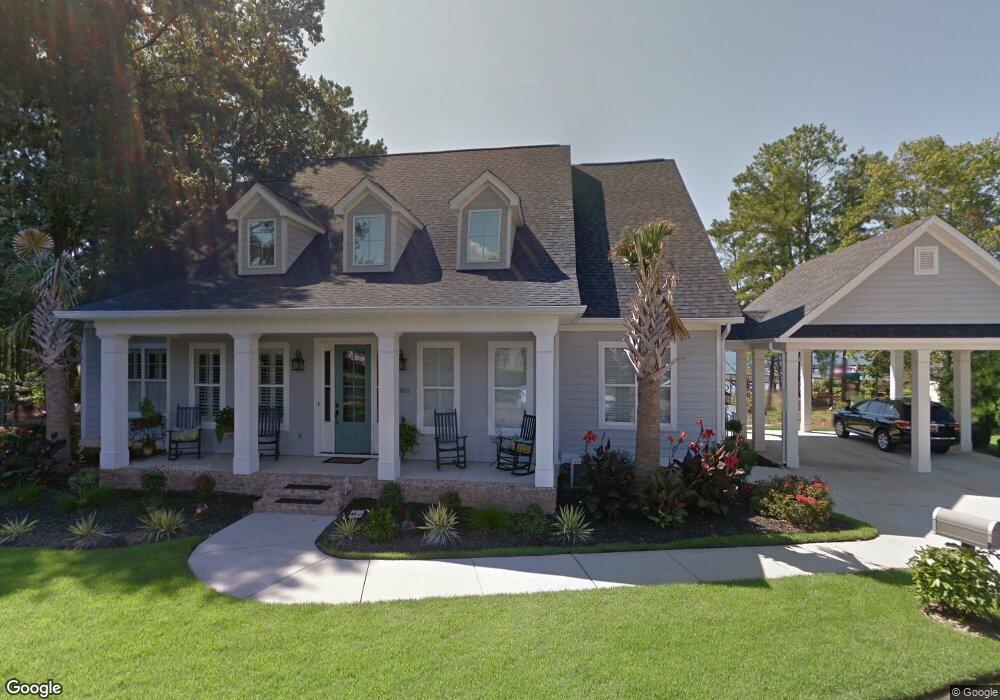
205 Power Point Ln Lexington, SC 29072
Estimated Value: $1,228,000 - $1,661,986
5
Beds
5
Baths
4,157
Sq Ft
$333/Sq Ft
Est. Value
About This Home
This home is located at 205 Power Point Ln, Lexington, SC 29072 and is currently estimated at $1,383,662, approximately $332 per square foot. 205 Power Point Ln is a home with nearby schools including New Providence Elementary School, River Bluff High School, and Lake Murray Montessori School.
Ownership History
Date
Name
Owned For
Owner Type
Purchase Details
Closed on
Sep 8, 2014
Sold by
Dean Tyeler and Dean Kristen
Bought by
Holt Russell L and Holt Patricia A
Current Estimated Value
Purchase Details
Closed on
Apr 4, 2014
Sold by
Dean Tyeler and Dean Kristen
Bought by
Dean Tyeler and Dean Kristen
Purchase Details
Closed on
Oct 4, 2010
Sold by
Caughman Brent Hampton and Caughman Brent H
Bought by
Dean Tyeler and Dean Kristen
Purchase Details
Closed on
Feb 8, 2010
Sold by
Caughman Stephen Todd
Bought by
Caughman Brent Hampton and Caughman Brent H
Purchase Details
Closed on
Dec 1, 2008
Sold by
Caughman Stephen Todd and Caughman Brent Hampton
Bought by
Mason Robert J and Mason Theresa S
Create a Home Valuation Report for This Property
The Home Valuation Report is an in-depth analysis detailing your home's value as well as a comparison with similar homes in the area
Home Values in the Area
Average Home Value in this Area
Purchase History
| Date | Buyer | Sale Price | Title Company |
|---|---|---|---|
| Holt Russell L | $715,000 | -- | |
| Dean Tyeler | -- | -- | |
| Dean Tyeler | $281,300 | -- | |
| Caughman Brent Hampton | -- | -- | |
| Mason Robert J | $365,000 | -- |
Source: Public Records
Tax History Compared to Growth
Tax History
| Year | Tax Paid | Tax Assessment Tax Assessment Total Assessment is a certain percentage of the fair market value that is determined by local assessors to be the total taxable value of land and additions on the property. | Land | Improvement |
|---|---|---|---|---|
| 2024 | $4,995 | $33,084 | $13,600 | $19,484 |
| 2023 | $4,939 | $29,096 | $13,600 | $15,496 |
| 2022 | $4,333 | $29,096 | $13,600 | $15,496 |
| 2020 | $4,399 | $28,813 | $13,600 | $15,213 |
| 2019 | $4,446 | $28,600 | $12,000 | $16,600 |
| 2018 | $4,364 | $28,600 | $12,000 | $16,600 |
| 2017 | $4,233 | $28,600 | $12,000 | $16,600 |
| 2016 | $4,194 | $28,600 | $12,000 | $16,600 |
| 2014 | $3,141 | $22,390 | $10,800 | $11,590 |
| 2013 | -- | $22,390 | $10,800 | $11,590 |
Source: Public Records
Map
Nearby Homes
- 102 Longford Ct
- 420 Plymouth Pass Dr
- 206 Portsmouth Dr
- 704 Old Cherokee Rd
- 312 Settlers Trail
- 561 Plymouth Pass Dr
- 413 Settlers Trail
- 2225 Old Cherokee Rd Unit LOT 3
- 2235 Old Cherokee Rd Unit LOT 5
- 2229 Old Cherokee Rd Unit LOT 4
- 2247 Old Cherokee Rd Unit LOT 6
- 2221 Old Cherokee Rd Unit LOT 2
- 154 Pilgrim Church Rd
- 113 Cherokee Pond Ct
- 221 Yachting Rd
- 145 Cherokee Pond Ct
- 159 Maritime Trail
- 1415 N Lake Dr
- 101 York Commons
- 246 Cobbleview Dr
- 208 Power Point Ln
- 212 Power Point Ln
- 212 State Road S-956
- 211 Power Point Ln
- 216 Power Point Ln
- 183 Power Point Ln
- 190 Power Point Ln
- 215 Power Point Ln
- 173 State Road S-956
- 173 Power Point Ln
- 167 Power Point Ln
- 184 Power Point Ln
- 184 State Road S-956
- 180 Power Point Ln
- 182 Power Point Ln
- 186 Power Point Ln
- 221 Power Point Ln
- 163 Power Point Ln
- 225 Power Point Ln
- 244 Power Point Ln