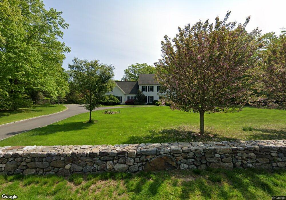
205 Redding Rd Easton, CT 06612
Estimated Value: $1,325,870 - $1,763,000
4
Beds
3
Baths
4,108
Sq Ft
$378/Sq Ft
Est. Value
About This Home
This home is located at 205 Redding Rd, Easton, CT 06612 and is currently estimated at $1,551,718, approximately $377 per square foot. 205 Redding Rd is a home located in Fairfield County with nearby schools including Samuel Staples Elementary School, Helen Keller Middle School, and Joel Barlow High School.
Ownership History
Date
Name
Owned For
Owner Type
Purchase Details
Closed on
Jun 23, 2010
Sold by
Kerin Andrea
Bought by
Park Christina
Current Estimated Value
Home Financials for this Owner
Home Financials are based on the most recent Mortgage that was taken out on this home.
Original Mortgage
$750,000
Interest Rate
4.8%
Purchase Details
Closed on
May 23, 2003
Sold by
Hoyt Janet L and Lindquist Robert C
Bought by
Kerin Andrea
Create a Home Valuation Report for This Property
The Home Valuation Report is an in-depth analysis detailing your home's value as well as a comparison with similar homes in the area
Home Values in the Area
Average Home Value in this Area
Purchase History
| Date | Buyer | Sale Price | Title Company |
|---|---|---|---|
| Park Christina | $1,000,000 | -- | |
| Park Christina | $1,000,000 | -- | |
| Kerin Andrea | $490,000 | -- | |
| Kerin Andrea | $490,000 | -- |
Source: Public Records
Mortgage History
| Date | Status | Borrower | Loan Amount |
|---|---|---|---|
| Open | Kerin Andrea | $595,000 | |
| Closed | Kerin Andrea | $715,000 | |
| Closed | Kerin Andrea | $750,000 |
Source: Public Records
Tax History
| Year | Tax Paid | Tax Assessment Tax Assessment Total Assessment is a certain percentage of the fair market value that is determined by local assessors to be the total taxable value of land and additions on the property. | Land | Improvement |
|---|---|---|---|---|
| 2025 | $21,251 | $685,510 | $210,210 | $475,300 |
| 2024 | $20,250 | $685,510 | $210,210 | $475,300 |
| 2023 | $19,852 | $685,510 | $210,210 | $475,300 |
| 2022 | $19,496 | $685,510 | $210,210 | $475,300 |
| 2021 | $20,591 | $636,520 | $262,690 | $373,830 |
| 2020 | $19,732 | $636,520 | $262,690 | $373,830 |
| 2019 | $19,942 | $636,520 | $262,690 | $373,830 |
| 2018 | $19,974 | $636,520 | $262,690 | $373,830 |
| 2017 | $21,247 | $636,520 | $262,690 | $373,830 |
| 2016 | $21,949 | $712,410 | $332,680 | $379,730 |
| 2015 | $20,804 | $684,800 | $332,690 | $352,110 |
| 2014 | $20,476 | $684,800 | $332,690 | $352,110 |
Source: Public Records
Map
Nearby Homes
- 140 Mile Common Rd
- 14 Codfish Ln
- 85-95 Old Easton Turnpike
- 11 Judges Hollow Rd
- 200 Long Meadow Rd
- 1375 Westport Turnpike
- 10 Pheasant Hill Rd
- 4 Colony Rd
- 274 Lyons Plain Rd
- 180 Catamount Rd
- 51 Wilson Rd
- 158 Coventry Ln
- 4800 Congress St
- 22 Brett Rd
- 198 Steep Hill Rd
- 103 Davis Hill Rd
- 39 Tannery Ln S
- 475 Fence Row Dr
- 214 Good Hill Rd
- 1 Greenlea Ln
- 200 Redding Rd Unit A
- 200 Redding Rd
- 200 Redding Rd
- 195 Redding Rd
- 215 Redding Rd
- 215 Redding Rd
- 116 Mile Common Rd
- 180 Redding Rd
- 7 Old Redding Rd
- 226 Redding Rd
- 169 Redding Rd
- 169 Redding Rd
- 124 Mile Common Rd
- 104 Mile Common Rd
- 19 Old Redding Rd
- 15 Old Redding Rd
- 15 Old Redding Rd Unit 19
- 232 Redding Rd
- 22 Mills Ln
- 130 Mile Common Rd
Your Personal Tour Guide
Ask me questions while you tour the home.