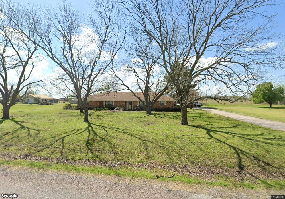
205 Roland Rd Whitesboro, TX 76273
Estimated Value: $256,165 - $318,000
--
Bed
--
Bath
2,244
Sq Ft
$128/Sq Ft
Est. Value
About This Home
This home is located at 205 Roland Rd, Whitesboro, TX 76273 and is currently estimated at $287,083, approximately $127 per square foot. 205 Roland Rd is a home located in Grayson County with nearby schools including J.W. Hayes Primary School, Whitesboro Intermediate School, and Whitesboro Middle School.
Ownership History
Date
Name
Owned For
Owner Type
Purchase Details
Closed on
May 2, 2022
Sold by
Kirk Gwendolyn June
Bought by
Yeargan Amy and Anders Michael
Current Estimated Value
Home Financials for this Owner
Home Financials are based on the most recent Mortgage that was taken out on this home.
Original Mortgage
$204,250
Outstanding Balance
$192,002
Interest Rate
4.16%
Mortgage Type
New Conventional
Estimated Equity
$95,081
Create a Home Valuation Report for This Property
The Home Valuation Report is an in-depth analysis detailing your home's value as well as a comparison with similar homes in the area
Home Values in the Area
Average Home Value in this Area
Purchase History
| Date | Buyer | Sale Price | Title Company |
|---|---|---|---|
| Yeargan Amy | -- | Red River Title |
Source: Public Records
Mortgage History
| Date | Status | Borrower | Loan Amount |
|---|---|---|---|
| Open | Yeargan Amy | $204,250 |
Source: Public Records
Tax History Compared to Growth
Tax History
| Year | Tax Paid | Tax Assessment Tax Assessment Total Assessment is a certain percentage of the fair market value that is determined by local assessors to be the total taxable value of land and additions on the property. | Land | Improvement |
|---|---|---|---|---|
| 2025 | $1,971 | $173,274 | $51,088 | $122,186 |
| 2024 | $2,638 | $166,715 | $52,017 | $114,698 |
| 2023 | $1,727 | $164,076 | $50,367 | $113,709 |
| 2022 | $4,309 | $271,075 | $52,284 | $218,791 |
| 2021 | $3,667 | $204,030 | $38,569 | $165,461 |
| 2020 | $4,437 | $239,650 | $35,888 | $203,762 |
| 2019 | $4,742 | $238,994 | $38,569 | $200,425 |
| 2018 | $4,499 | $222,020 | $23,678 | $198,342 |
| 2017 | $4,298 | $211,414 | $23,678 | $187,736 |
| 2016 | $3,907 | $205,032 | $22,605 | $182,427 |
| 2015 | $2,068 | $184,918 | $22,605 | $162,313 |
| 2014 | $2,158 | $157,135 | $22,605 | $134,530 |
Source: Public Records
Map
Nearby Homes
- 703 W Main St
- 706 Abney St
- 313 Texoma Dr
- 605 Abney St
- 103 Tipton St
- 649 Anderson Rd
- 508 N Jordan St
- 3285 Roland Rd
- 309 Elm St
- 115 D St
- 103 Chestnut St
- 400 Wild Wood Ln
- 203 Red River Dr
- 34673 Us-82
- 34673 Us Highway 82
- 216 Red River Rd
- 707 N Union St
- 993 County Line Rd
- 53 ac U S Highway 82
- US U S Highway 82
- 27 E Fox Creek Ln
- 236 Roland Rd
- 257 Roland Rd
- 125 Roland Rd
- 268 Roland Rd
- 106 Roland Rd
- 49 E Fox Creek Ln
- 115 E Fox Creek Ln
- 95 E Fox Creek Ln
- 20 W Fox Creek Ln
- 86 W Fox Creek Ln
- 37 W Fox Creek Ln
- 33912 U S 82
- 124 W Fox Creek Ln
- 189 E Fox Creek Ln
- 95 W Fox Creek Ln
- 33912 Highway 82 W
- 33912 Highway 82 W
- 164 W Fox Creek Ln
- 422 Roland Rd