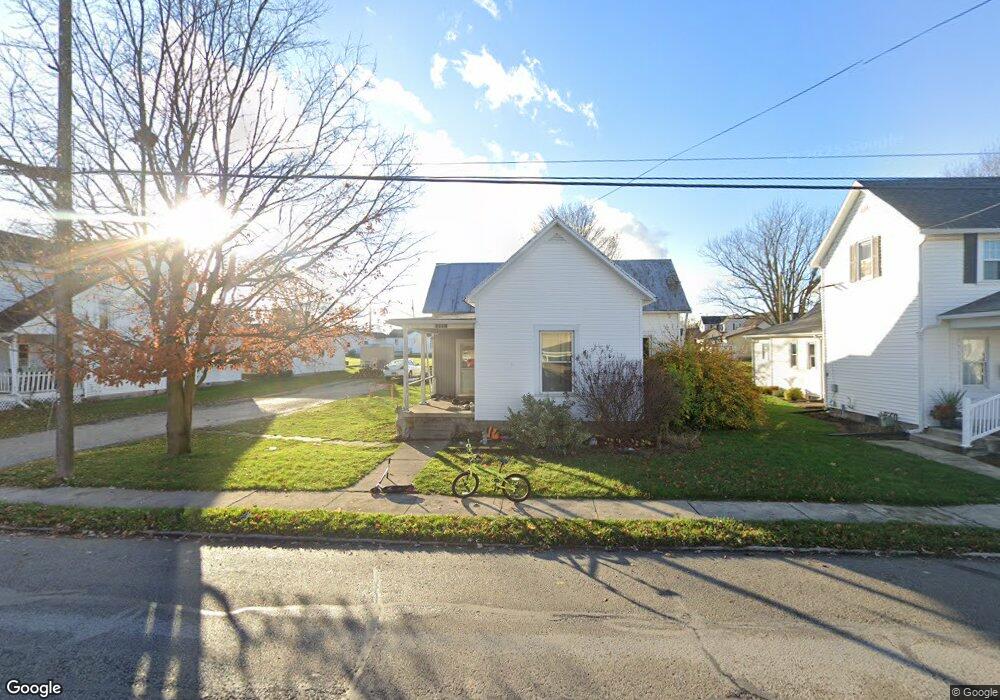
205 S Main St Botkins, OH 45306
Estimated Value: $184,581 - $241,000
3
Beds
1
Bath
1,510
Sq Ft
$144/Sq Ft
Est. Value
About This Home
This home is located at 205 S Main St, Botkins, OH 45306 and is currently estimated at $218,145, approximately $144 per square foot. 205 S Main St is a home located in Shelby County with nearby schools including Botkins Elementary School and Botkins High School.
Ownership History
Date
Name
Owned For
Owner Type
Purchase Details
Closed on
Jul 28, 2020
Sold by
Wells Fargo Bank Na
Bought by
Community Revitaliozation Llc
Current Estimated Value
Purchase Details
Closed on
Dec 17, 2019
Sold by
Wallace Helena A
Bought by
Wells Fargo Bank and One Mortgage Loan Trust 2006 1
Purchase Details
Closed on
May 4, 2011
Sold by
Wallace Amber A
Bought by
Wallace Helena A
Purchase Details
Closed on
Oct 19, 2005
Sold by
Smock Phillip K and Smock Mary Lee
Bought by
Wallace Helena A and Wallace Amber A
Home Financials for this Owner
Home Financials are based on the most recent Mortgage that was taken out on this home.
Original Mortgage
$69,960
Interest Rate
5.82%
Mortgage Type
Purchase Money Mortgage
Create a Home Valuation Report for This Property
The Home Valuation Report is an in-depth analysis detailing your home's value as well as a comparison with similar homes in the area
Purchase History
We collect this data history from publicly available records. To have your information removed, we recommend requesting removal directly through your county’s website.
| Date | Buyer | Sale Price | Title Company |
|---|---|---|---|
| Community Revitaliozation Llc | $25,450 | None Available | |
| Wells Fargo Bank | $48,000 | None Available | |
| Wallace Helena A | -- | Attorney | |
| Wallace Helena A | $87,375 | Upland Title Agency |
Source: Public Records
Mortgage History
We collect this data history from publicly available records. To have your information removed, we recommend requesting removal directly through your county’s website.
| Date | Status | Borrower | Loan Amount |
|---|---|---|---|
| Previous Owner | Wallace Helena A | $69,960 |
Source: Public Records
Tax History
| Year | Tax Paid | Tax Assessment Tax Assessment Total Assessment is a certain percentage of the fair market value that is determined by local assessors to be the total taxable value of land and additions on the property. | Land | Improvement |
|---|---|---|---|---|
| 2025 | $1,456 | $43,440 | $10,950 | $32,490 |
| 2024 | $1,456 | $43,440 | $10,950 | $32,490 |
| 2023 | $8,507 | $43,440 | $10,950 | $32,490 |
| 2022 | $753 | $19,250 | $8,370 | $10,880 |
| 2021 | $750 | $19,250 | $8,370 | $10,880 |
| 2020 | $1,293 | $32,720 | $8,370 | $24,350 |
| 2019 | $1,110 | $28,590 | $7,080 | $21,510 |
| 2018 | $1,067 | $28,590 | $7,080 | $21,510 |
| 2017 | $1,073 | $28,590 | $7,080 | $21,510 |
| 2016 | $840 | $22,520 | $7,080 | $15,440 |
| 2015 | $833 | $22,520 | $7,080 | $15,440 |
| 2014 | $833 | $22,520 | $7,080 | $15,440 |
| 2013 | $834 | $21,780 | $7,080 | $14,700 |
Source: Public Records
Map
Nearby Homes
- 14846 Lock 2 Rd
- 17300 Lock 2 Rd
- 401 Risha Ave
- 401 Risha St
- 210 N Pike St
- 15031 Ohio 119
- 102 E Main St
- 205 S 2nd St
- 17516 Montra Rd
- 200 Camdyn Trail
- 103 Camdyn Trail
- 14333 Meranda Rd
- 13401 Ailes Rd
- 10104 Cook Rd
- 10 Summerplace Dr
- 15124 Wones Rd
- 706 Buchanan St
- 408 W Plum St
- 409 Gibbs Ave
- 616 E Benton St
Your Personal Tour Guide
Ask me questions while you tour the home.