Estimated Value: $273,000 - $293,000
3
Beds
2
Baths
1,352
Sq Ft
$209/Sq Ft
Est. Value
About This Home
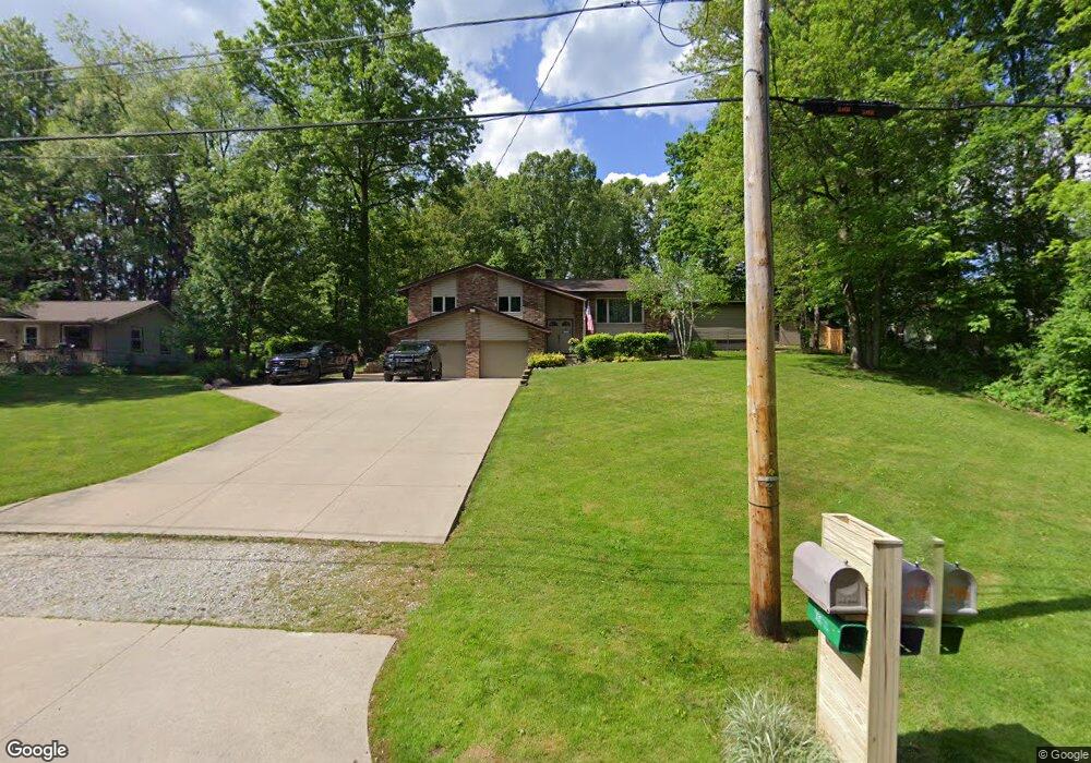
This home is located at 205 S Messner Rd, Akron, OH 44319 and is currently estimated at $282,969, approximately $209 per square foot. 205 S Messner Rd is a home located in Summit County.
Ownership History
Date
Name
Owned For
Owner Type
Purchase Details
Closed on
Jul 9, 2007
Sold by
Porter Christine S
Bought by
Porter Christine S and Porter Kenneth
Current Estimated Value
Home Financials for this Owner
Home Financials are based on the most recent Mortgage that was taken out on this home.
Original Mortgage
$174,529
Outstanding Balance
$108,630
Interest Rate
6.42%
Mortgage Type
New Conventional
Estimated Equity
$174,339
Purchase Details
Closed on
Jan 21, 2004
Sold by
Wheeler Kathy L
Bought by
Porter Christine S
Home Financials for this Owner
Home Financials are based on the most recent Mortgage that was taken out on this home.
Original Mortgage
$139,806
Interest Rate
5.91%
Mortgage Type
FHA
Purchase Details
Closed on
Jan 28, 1998
Sold by
Douglas Jeanette
Bought by
Wheeler Kathy C
Home Financials for this Owner
Home Financials are based on the most recent Mortgage that was taken out on this home.
Original Mortgage
$86,000
Interest Rate
7.16%
Mortgage Type
New Conventional
Create a Home Valuation Report for This Property
The Home Valuation Report is an in-depth analysis detailing your home's value as well as a comparison with similar homes in the area
Home Values in the Area
Average Home Value in this Area
Purchase History
| Date | Buyer | Sale Price | Title Company |
|---|---|---|---|
| Porter Christine S | -- | Oldstone Title Agency | |
| Porter Christine S | $142,000 | -- | |
| Wheeler Kathy C | $112,000 | -- |
Source: Public Records
Mortgage History
| Date | Status | Borrower | Loan Amount |
|---|---|---|---|
| Open | Porter Christine S | $174,529 | |
| Closed | Porter Christine S | $139,806 | |
| Previous Owner | Wheeler Kathy C | $86,000 |
Source: Public Records
Tax History Compared to Growth
Tax History
| Year | Tax Paid | Tax Assessment Tax Assessment Total Assessment is a certain percentage of the fair market value that is determined by local assessors to be the total taxable value of land and additions on the property. | Land | Improvement |
|---|---|---|---|---|
| 2025 | $3,984 | $79,829 | $16,972 | $62,857 |
| 2024 | $3,984 | $79,829 | $16,972 | $62,857 |
| 2023 | $3,984 | $79,829 | $16,972 | $62,857 |
| 2022 | $3,626 | $56,617 | $12,037 | $44,580 |
| 2021 | $3,639 | $56,617 | $12,037 | $44,580 |
| 2020 | $3,576 | $56,620 | $12,040 | $44,580 |
| 2019 | $3,614 | $51,280 | $9,830 | $41,450 |
| 2018 | $3,118 | $51,280 | $9,830 | $41,450 |
| 2017 | $2,990 | $51,280 | $9,830 | $41,450 |
| 2016 | $2,954 | $44,550 | $9,830 | $34,720 |
| 2015 | $2,990 | $44,550 | $9,830 | $34,720 |
| 2014 | $2,967 | $44,550 | $9,830 | $34,720 |
| 2013 | $2,952 | $44,600 | $9,830 | $34,770 |
Source: Public Records
Map
Nearby Homes
- 451 Yager Rd
- 427 Center Rd
- 6407 Southview Dr
- 5776 Harter Home Dr
- 715 Highland Park Dr
- 781 Leeman Dr
- 899 Loway Dr
- 6090 Manchester Rd Unit 6096
- S/L 14,15 Shakes Hotel Dr
- 4 Shrakes Hotel Dr
- 6 Shrakes Hotel Dr
- 5892 Woodward Dr
- 7 Shrakes Hotel Dr
- 5 Shrakes Hotel Dr
- 3 Shrakes Hotel Dr
- 4881 S Main St
- 4831 Christman Rd
- 1062 Stump Rd
- 4944 Coleman Dr
- 0 W Comet Rd Unit 5079117
- 217 S Messner Rd
- 190 N Messner Rd
- 210 N Messner Rd
- 227 S Messner Rd
- 218 N Messner Rd
- 237 S Messner Rd
- 206 S Messner Rd
- 232 N Messner Rd
- 197 N Messner Rd
- 222 S Messner Rd
- 247 S Messner Rd
- 236 N Messner Rd Unit 238
- 236 N Messner Rd
- 236 S Messner Rd
- 5673 Dailey Rd
- 185 N Messner Rd
- 5661 Dailey Rd
- 209 N Messner Rd
- 257 S Messner Rd
- 5645 Dailey Rd