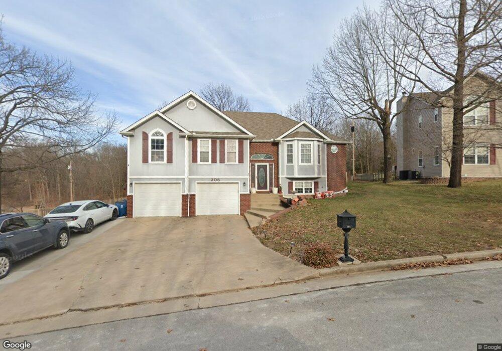
205 Sherri Ln Carl Junction, MO 64834
Estimated Value: $349,859 - $404,000
5
Beds
3
Baths
2,909
Sq Ft
$133/Sq Ft
Est. Value
About This Home
This home is located at 205 Sherri Ln, Carl Junction, MO 64834 and is currently estimated at $386,215, approximately $132 per square foot. 205 Sherri Ln is a home located in Jasper County with nearby schools including Carl Junction Primary School (K-1), Carl Junction Intermediate School, and Carl Junction Primary School (2-3).
Ownership History
Date
Name
Owned For
Owner Type
Purchase Details
Closed on
May 23, 2017
Sold by
Lowe Dennis and Lowe Loretta
Bought by
Perkins Amanda M and Perkins Joseph G
Current Estimated Value
Home Financials for this Owner
Home Financials are based on the most recent Mortgage that was taken out on this home.
Original Mortgage
$193,922
Outstanding Balance
$160,571
Interest Rate
4.03%
Mortgage Type
FHA
Estimated Equity
$225,644
Purchase Details
Closed on
Jun 9, 2011
Sold by
Gipson William L and Gipson Tracy L
Bought by
Lowe Dennis and Lowe Loretta
Create a Home Valuation Report for This Property
The Home Valuation Report is an in-depth analysis detailing your home's value as well as a comparison with similar homes in the area
Purchase History
| Date | Buyer | Sale Price | Title Company |
|---|---|---|---|
| Perkins Amanda M | -- | None Available | |
| Lowe Dennis | -- | Fatco |
Source: Public Records
Mortgage History
| Date | Status | Borrower | Loan Amount |
|---|---|---|---|
| Open | Perkins Amanda M | $193,922 |
Source: Public Records
Tax History
| Year | Tax Paid | Tax Assessment Tax Assessment Total Assessment is a certain percentage of the fair market value that is determined by local assessors to be the total taxable value of land and additions on the property. | Land | Improvement |
|---|---|---|---|---|
| 2025 | $2,188 | $42,210 | $4,230 | $37,980 |
| 2024 | $2,201 | $37,390 | $4,230 | $33,160 |
| 2023 | $2,201 | $37,390 | $4,230 | $33,160 |
| 2022 | $2,217 | $37,550 | $4,230 | $33,320 |
| 2021 | $1,902 | $37,550 | $4,230 | $33,320 |
| 2020 | $1,786 | $34,670 | $4,230 | $30,440 |
| 2019 | $1,696 | $34,670 | $4,230 | $30,440 |
| 2018 | $1,675 | $34,330 | $0 | $0 |
| 2016 | $1,751 | $36,130 | $0 | $0 |
Source: Public Records
Map
Nearby Homes
- 112 Red Oak Dr
- 121 Forest Dr
- 401 Dogwood Trails Loop
- 6548 Mo-171
- 123 Rocky Ln
- 128 Par Ln
- 25122 Gum Rd
- 306 Lakeview Ln
- XXX Lone Elm
- 710 Briarbrook Dr
- 107 Foursome Ln
- 232 Hickory Place
- 328 Briarbrook Dr
- 9130 Missouri 171
- 106 Victoria Ln
- Lot 1B Hwy 171 & Fir Rd
- Lot 1A Hwy 171 & Fir Rd
- LOT 4C Hwy 171 & Fir Rd Unit 4C
- 501 Anita Dr
- Lot 1 Hwy 171 & Fir Rd
Your Personal Tour Guide
Ask me questions while you tour the home.