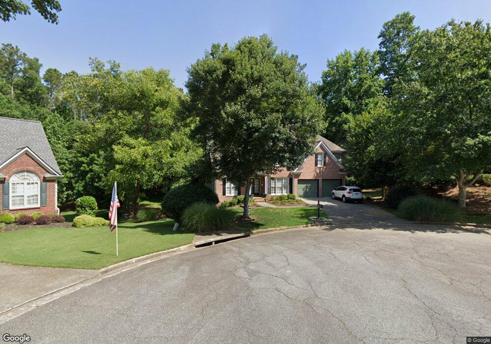
205 Springshade Ct Canton, GA 30114
Sutallee NeighborhoodEstimated Value: $605,582 - $642,000
5
Beds
4
Baths
3,918
Sq Ft
$159/Sq Ft
Est. Value
About This Home
This home is located at 205 Springshade Ct, Canton, GA 30114 and is currently estimated at $623,791, approximately $159 per square foot. 205 Springshade Ct is a home located in Cherokee County with nearby schools including Sixes Elementary School, Freedom Middle School, and Woodstock High School.
Ownership History
Date
Name
Owned For
Owner Type
Purchase Details
Closed on
Dec 9, 2003
Sold by
Velentin Didier
Bought by
Atkins Kathleen L
Current Estimated Value
Home Financials for this Owner
Home Financials are based on the most recent Mortgage that was taken out on this home.
Original Mortgage
$47,600
Outstanding Balance
$10,335
Interest Rate
5.98%
Mortgage Type
Unknown
Estimated Equity
$613,456
Purchase Details
Closed on
Aug 21, 1998
Sold by
Ogilvie Custom Home Builders Inc
Bought by
Valentin Didier
Home Financials for this Owner
Home Financials are based on the most recent Mortgage that was taken out on this home.
Original Mortgage
$172,800
Interest Rate
6.92%
Mortgage Type
New Conventional
Create a Home Valuation Report for This Property
The Home Valuation Report is an in-depth analysis detailing your home's value as well as a comparison with similar homes in the area
Home Values in the Area
Average Home Value in this Area
Purchase History
| Date | Buyer | Sale Price | Title Company |
|---|---|---|---|
| Atkins Kathleen L | $238,000 | -- | |
| Valentin Didier | $192,000 | -- |
Source: Public Records
Mortgage History
| Date | Status | Borrower | Loan Amount |
|---|---|---|---|
| Open | Atkins Kathleen L | $47,600 | |
| Open | Atkins Kathleen L | $190,400 | |
| Previous Owner | Valentin Didier | $172,800 |
Source: Public Records
Tax History Compared to Growth
Tax History
| Year | Tax Paid | Tax Assessment Tax Assessment Total Assessment is a certain percentage of the fair market value that is determined by local assessors to be the total taxable value of land and additions on the property. | Land | Improvement |
|---|---|---|---|---|
| 2025 | $5,152 | $221,520 | $41,600 | $179,920 |
| 2024 | $4,867 | $207,880 | $38,000 | $169,880 |
| 2023 | $4,310 | $202,120 | $38,000 | $164,120 |
| 2022 | $4,276 | $177,436 | $35,200 | $142,236 |
| 2021 | $3,994 | $149,956 | $25,600 | $124,356 |
| 2020 | $3,613 | $133,400 | $25,600 | $107,800 |
| 2019 | $3,456 | $126,640 | $25,600 | $101,040 |
| 2018 | $3,236 | $116,400 | $24,000 | $92,400 |
| 2017 | $3,203 | $284,800 | $20,400 | $93,520 |
| 2016 | $2,937 | $258,000 | $20,400 | $82,800 |
| 2015 | $2,744 | $239,100 | $18,000 | $77,640 |
| 2014 | $2,667 | $232,100 | $18,000 | $74,840 |
Source: Public Records
Map
Nearby Homes
- 711 Tall Oaks Dr
- 829 Valley Dr
- 834 Valley Dr Unit 1K
- 164 Henley St
- 160 Henley St Unit 15
- 160 Henley St
- Jasper II Plan at Cambridge at Steels Bridge
- Newton II Plan at Cambridge at Steels Bridge
- Fulton II Plan at Cambridge at Steels Bridge
- Brookwood Plan at Cambridge at Steels Bridge
- Tifton II Plan at Cambridge at Steels Bridge
- 601 Redwood Ln
- 3008 Heatherbrook Trace Unit 2B
- 302 Magnolia Trace
- 3018 Heatherbrook Trace
- 3021 Heatherbrook Trace
- 552 Steels Bridge Rd
- 414 Dogwood Way
- 106 Birchwood Pass
- 203 Springshade Ct
- 206 Springshade Ct
- 603 Woodbrook Trail
- 601 Woodbrook Trail
- 605 Woodbrook Trail
- 112 Springshade Ln
- 327 Woodbrook Crest
- 204 Springshade Ct
- 0 Springshade Ln Unit 7261653
- 0 Springshade Ln Unit 7153597
- 0 Springshade Ln Unit 8548964
- 0 Springshade Ln Unit 8153596
- 0 Springshade Ln Unit 7145164
- 114 Springshade Ln
- 325 Woodbrook Crest
- 325 Woodbrook Crest Unit 325
- 202 Springshade Ct Unit 202
- 202 Springshade Ct
- 200 Springshade Ct
- 604 Woodbrook Trail