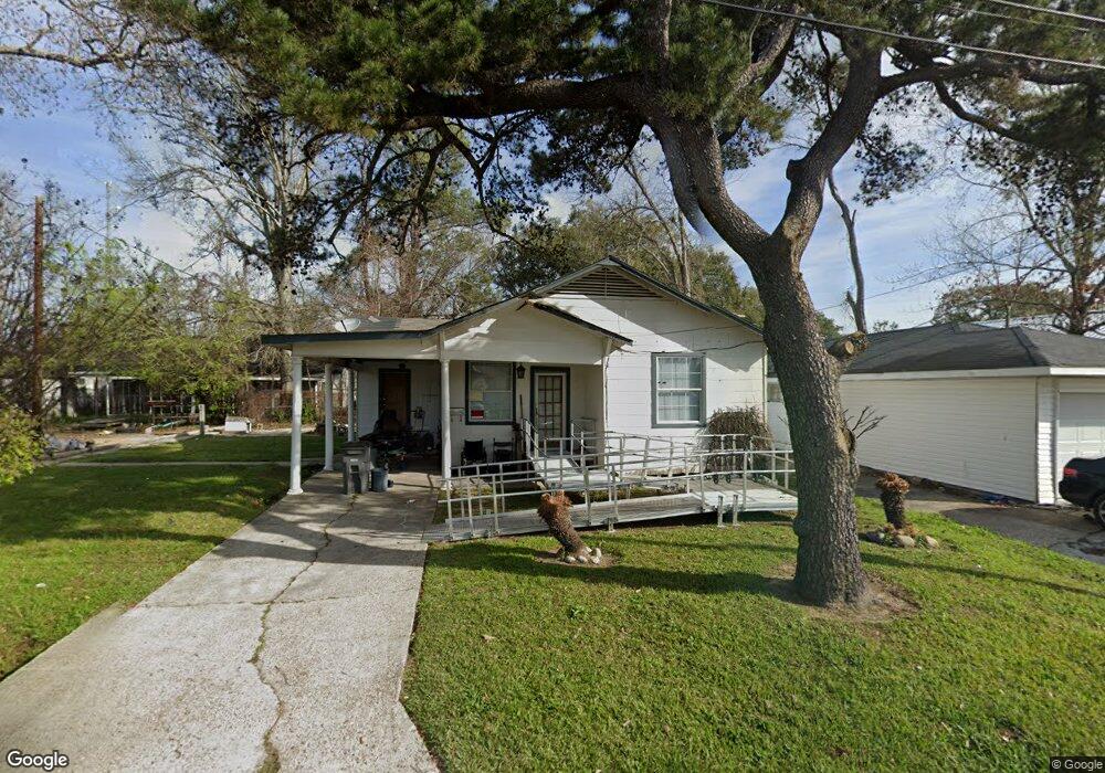
205 Taft St Baton Rouge, LA 70802
Highlands/Perkins NeighborhoodEstimated Value: $36,000 - $67,000
--
Bed
--
Bath
--
Sq Ft
2
Acres
About This Home
This home is located at 205 Taft St, Baton Rouge, LA 70802 and is currently estimated at $53,534. 205 Taft St is a home located in East Baton Rouge Parish with nearby schools including Buchanan Elementary School, Glasgow Middle School, and Mckinley Senior High School.
Ownership History
Date
Name
Owned For
Owner Type
Purchase Details
Closed on
Oct 14, 2023
Sold by
Kimble Artisha
Bought by
Department Of Transportation And Development
Current Estimated Value
Purchase Details
Closed on
Sep 5, 2023
Sold by
Kimble Aaron and Kimble Helen
Bought by
Department Of Transportation And Development
Purchase Details
Closed on
Aug 31, 2023
Sold by
Varnell Willie Mae and Thomas Vernell Sr
Bought by
Department Of Transportation And Develop
Create a Home Valuation Report for This Property
The Home Valuation Report is an in-depth analysis detailing your home's value as well as a comparison with similar homes in the area
Home Values in the Area
Average Home Value in this Area
Purchase History
| Date | Buyer | Sale Price | Title Company |
|---|---|---|---|
| Department Of Transportation And Development | -- | None Listed On Document | |
| Department Of Transportation And Development | $11,483 | None Listed On Document | |
| Department Of Transportation And Development | $11,483 | None Listed On Document | |
| Department Of Transportation And Develop | $11,483 | None Listed On Document |
Source: Public Records
Mortgage History
| Date | Status | Borrower | Loan Amount |
|---|---|---|---|
| Open | Scion Br Apartments | $424,800,000 |
Source: Public Records
Tax History Compared to Growth
Tax History
| Year | Tax Paid | Tax Assessment Tax Assessment Total Assessment is a certain percentage of the fair market value that is determined by local assessors to be the total taxable value of land and additions on the property. | Land | Improvement |
|---|---|---|---|---|
| 2024 | $12 | $986 | $370 | $616 |
| 2023 | $11 | $880 | $330 | $550 |
| 2022 | $105 | $880 | $330 | $550 |
| 2021 | $103 | $880 | $330 | $550 |
| 2020 | $102 | $880 | $330 | $550 |
| 2019 | $97 | $800 | $300 | $500 |
| 2018 | $96 | $800 | $300 | $500 |
| 2017 | $96 | $800 | $300 | $500 |
| 2016 | $8 | $625 | $300 | $325 |
| 2015 | $10 | $800 | $300 | $500 |
| 2014 | $11 | $800 | $300 | $500 |
| 2013 | -- | $800 | $300 | $500 |
Source: Public Records
Map
Nearby Homes
- 478 W Johnson St
- 210 W Polk St
- 262 E Grant St
- 2138 Minnesota St
- 230 Taylor St
- 2389 Tennessee St
- 1820 Nebraska St
- 1965 Kansas St
- Lot 23 W Johnson St
- 824 E Polk St
- 1952 Thomas H Delpit Dr
- 126 W Harrison St Unit 3
- 126 W Harrison St
- 1907 Kansas St
- 180 W Harrison St
- 2227 Kentucky St
- 272 W Harrison St
- 280 W Harrison St
- 3005 Highland Rd Unit 27
- 1915 Tennessee St
- 209 Taft St
- 241 Taft St
- 260 E Harding St
- 220 E Harding St
- 212 E Harding St
- 253 Taft St
- 229 E Buchanan St
- 270 E Harding St
- 253 E Buchanan St
- 108 E Harding St
- 301 Taft St
- 305 E Buchanan St
- 321 Taft St
- 344 E Harding St
- 0 E Harding St
- 2437 Highland Rd
- 1800 & 1814 Highland Rd
- Lot 55 Highland Rd
- 2110 Highland Rd
- 362 E Harding St