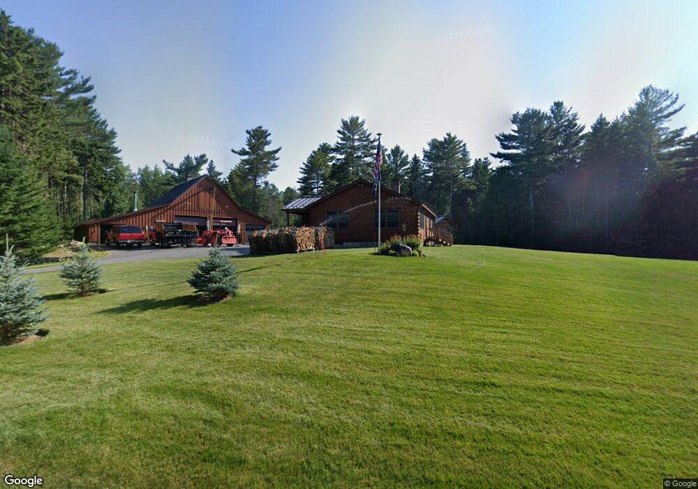
205 Varnumville Rd Brooksville, ME 04617
Estimated Value: $347,000 - $380,945
--
Bed
--
Bath
--
Sq Ft
8.35
Acres
About This Home
This home is located at 205 Varnumville Rd, Brooksville, ME 04617 and is currently estimated at $364,236. 205 Varnumville Rd is a home with nearby schools including Brooksville Elementary School.
Ownership History
Date
Name
Owned For
Owner Type
Purchase Details
Closed on
Nov 22, 2013
Sold by
Austin David B and Devlin Joseph M
Bought by
Austin David B and Devlin Joseph M
Current Estimated Value
Purchase Details
Closed on
Feb 22, 2011
Sold by
Devlin Joseph M and Moyer Catherine E
Bought by
Varnumville Road Rt
Purchase Details
Closed on
Apr 8, 2005
Sold by
Devlin Joseph M and Moyer Catherine E
Bought by
Varnumville Rd Rt
Create a Home Valuation Report for This Property
The Home Valuation Report is an in-depth analysis detailing your home's value as well as a comparison with similar homes in the area
Home Values in the Area
Average Home Value in this Area
Purchase History
| Date | Buyer | Sale Price | Title Company |
|---|---|---|---|
| Austin David B | -- | -- | |
| Varnumville Road Rt | -- | -- | |
| Varnumville Rd Rt | -- | -- | |
| Devlin Joseph M | -- | -- |
Source: Public Records
Tax History Compared to Growth
Tax History
| Year | Tax Paid | Tax Assessment Tax Assessment Total Assessment is a certain percentage of the fair market value that is determined by local assessors to be the total taxable value of land and additions on the property. | Land | Improvement |
|---|---|---|---|---|
| 2024 | $1,887 | $349,400 | $83,200 | $266,200 |
| 2023 | $1,749 | $269,100 | $64,000 | $205,100 |
| 2022 | $1,653 | $242,400 | $57,600 | $184,800 |
| 2021 | $1,624 | $242,400 | $57,600 | $184,800 |
| 2020 | $3,743 | $242,400 | $57,600 | $184,800 |
| 2019 | $3,792 | $242,400 | $57,600 | $184,800 |
| 2018 | $3,593 | $242,400 | $57,600 | $184,800 |
| 2017 | $3,412 | $242,400 | $57,600 | $184,800 |
| 2016 | $3,351 | $212,200 | $57,600 | $154,600 |
| 2015 | $1,186 | $212,200 | $57,600 | $154,600 |
| 2013 | $1,123 | $234,000 | $64,000 | $170,000 |
Source: Public Records
Map
Nearby Homes
- M15 L23 Varnum Rd
- 111 Franks Flat Rd
- 565 Bagaduce Rd
- 2 Camp Stream Point Ln
- 118 Wescott Battery
- 0 Route 175 Unit 1622156
- 37 Water St
- 144 Bagaduce Rd
- 10 Green St
- 0 Kingdom Rd
- 26 Tidal Creek Rd
- Map4 Lot26 Graytown Rd
- 435 Parcel 4 Herrick Rd
- M17 L15 Perkins St
- M17 L15 Battle Ave
- 79 Perkins St
- Lot #3 Blueberry Ridge Way
- 113 Wardwell Point Rd
- 00 Dunbar
- 107 Acadian Oak Ln
- 202 Varnumville Rd
- 186 Varnumville Rd
- 189 Varnumville Rd
- 173 Varnumville Rd
- 165 Varnumville Rd
- 276 Varnumville Rd
- 246 Varnumville Rd
- 39 Coastal Rd
- 108 Varnumville Rd
- 304 Varnumville Rd
- 358 Varnumville Rd
- 455 Varnum Rd
- 351 Varnumville Rd
- 371 Varnumville Rd
- 1395 Coastal Rd
- 0 Varnumvill Rd
- 0 Varnumville
- 365 Coastal Rd
- 1390 Coastal Rd
- 402 Varnumville Rd