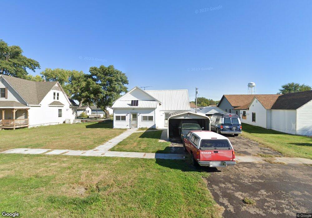
205 W 1st St Maxwell, NE 69151
Estimated Value: $114,526 - $169,000
3
Beds
1
Bath
962
Sq Ft
$137/Sq Ft
Est. Value
About This Home
This home is located at 205 W 1st St, Maxwell, NE 69151 and is currently estimated at $131,382, approximately $136 per square foot. 205 W 1st St is a home located in Lincoln County with nearby schools including Maxwell Elementary School and Maxwell High School.
Create a Home Valuation Report for This Property
The Home Valuation Report is an in-depth analysis detailing your home's value as well as a comparison with similar homes in the area
Home Values in the Area
Average Home Value in this Area
Tax History Compared to Growth
Tax History
| Year | Tax Paid | Tax Assessment Tax Assessment Total Assessment is a certain percentage of the fair market value that is determined by local assessors to be the total taxable value of land and additions on the property. | Land | Improvement |
|---|---|---|---|---|
| 2024 | $1,052 | $89,552 | $7,293 | $82,259 |
| 2023 | $1,003 | $62,848 | $7,293 | $55,555 |
| 2022 | $1,039 | $60,528 | $7,293 | $53,235 |
| 2021 | $1,030 | $60,528 | $7,293 | $53,235 |
| 2020 | $952 | $51,285 | $2,575 | $48,710 |
| 2019 | $936 | $51,285 | $2,575 | $48,710 |
| 2018 | $921 | $51,285 | $2,575 | $48,710 |
| 2017 | $945 | $51,285 | $2,575 | $48,710 |
| 2016 | $1,007 | $51,285 | $2,575 | $48,710 |
| 2014 | $843 | $42,950 | $2,575 | $40,375 |
Source: Public Records
Map
Nearby Homes
- 103 W 2nd St
- 109 W Highway 30
- 21611 E Slant Rd
- 20292 E Fort McPherson Rd
- 00 Miriam Rd
- 116 N Vine St
- Pt 5 & Pt. Lot NW 1 4 & Pt Laacre 14-12-27
- 6568 E Trail Ridge Rd Unit North Platte NE 6910
- 6568 E Trail Ridge Rd
- 4306 Twin Rivers Rd
- 2600 E Philip Ave
- 2111 Iron Eagle Ct
- 1909 Iron Eagle Ct
- LOT 12 Crow Brothers Sub
- 2209 E D St
- 114 N Welch Ave
- 0 Creekside Subdivision Unit 11328758
- 5449 N Horizon Dr
- 1113 E B St
- 9421 S Sierra Dr